 |
|
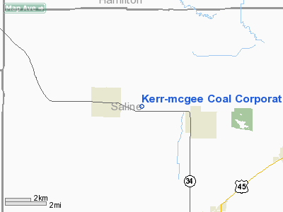
Kerr-Mcgee Coal Corporation Heliport |
Location
& QuickFacts
|
FAA
Information Effective: |
2007-12-20 |
|
Airport
Identifier: |
6IL1 |
|
Airport
Status: |
Operational |
|
Longitude/Latitude: |
088-34-58.1930W/37-50-18.1720N
-88.582831/37.838381 (Estimated) |
|
Elevation: |
439 ft / 133.81 m (Estimated) |
|
Land: |
0 acres |
|
From
nearest city: |
3 nautical miles SE of Galatia, IL |
|
Location: |
Saline County, IL |
|
Magnetic Variation: |
01W (1985) |
Owner
& Manager
|
Ownership: |
Privately
owned |
|
Owner: |
Kerr-mcgee Coal Corporation |
|
Address: |
P.o. Box 727
Harrisburg, IL 62946 |
|
Phone
number: |
618-268-6311 |
|
Manager: |
Steve S. Rowland |
|
Address: |
P.o. Box 727
Harrisburg, IL 62946 |
|
Phone number: |
618-268-6311 |
Airport Operations and Facilities
|
Airport
Use: |
Private |
|
Wind
indicator: |
Yes |
|
Segmented Circle: |
No |
|
Control
Tower: |
No |
|
Lighting
Schedule: |
PHONE REQ
FOR PERIMETER LGTS CALL
618-268-6311. |
|
Sectional chart: |
St Louis |
|
Region: |
AGL - Great Lakes |
|
Boundary
ARTCC: |
ZKC - Kansas City |
|
Tie-in
FSS: |
COU - Columbia |
|
FSS
Toll Free: |
1-800-WX-BRIEF |
|
Runway Information
Helipad H1
|
Dimension: |
40
x 40 ft / 12.2 x 12.2 m |
|
Surface: |
CONC, |
|
|
Runway H1 |
Runway |
|
Traffic
Pattern: |
Left |
Left |
|
Radio Navigation
Aids
|
ID |
Type |
Name |
Ch |
Freq |
Var |
Dist |
|
HSB |
NDB |
Harrisburg-raleigh |
|
230.00 |
00E |
2.4
nm |
|
CUL |
NDB |
Carmi |
|
332.00 |
01W |
26.8
nm |
|
FWC |
NDB |
Wayne
County |
|
257.00 |
01E |
33.6
nm |
|
TWT |
NDB |
Tradewater |
|
276.00 |
00E |
37.6
nm |
|
PJY |
NDB |
Pinckneyville |
|
215.00 |
00E |
37.9
nm |
|
GVA |
NDB |
Geneva |
|
224.00 |
01W |
38.6
nm |
|
BDD |
NDB |
Bellgrade |
|
254.00 |
00E |
41.9
nm |
|
MWA |
VOR/DME |
Marion |
041X |
110.40 |
04E |
21.0
nm |
|
VNN |
VOR/DME |
Mount
Vernon |
085X |
113.80 |
02E |
33.2
nm |
|
SAM |
VOR/DME |
Samsville |
113X |
116.60 |
03E |
45.4
nm |
|
PXV |
VORTAC |
Pocket
City |
080X |
113.30 |
03E |
39.3
nm |
|
ENL |
VORTAC |
Centralia |
097X |
115.00 |
04E |
44.3
nm |
Remarks
- PROVDD
ALL APCH/DEP OPS 360-180 DEGS & FM 270 DEG; TAKEOFF/LDG AREA APPROPRIATELY
MKD; NON-OBSTRUCTING WIND INDICATOR MAINTAINED.
Kerr-mcgee Coal Corporation Heliport
Address:
Saline County, IL
Tel:
618-268-6311
Images
and information placed above are from
http://www.airport-data.com/airport/6IL1/
We
thank them for the data!
| General
Info |
| Country |
United
States |
| State |
ILLINOIS
|
| FAA ID |
6IL1 |
| Latitude |
37-50-18.172N
|
| Longitude |
088-34-58.193W
|
| Elevation |
439 feet
|
| Near City |
GALATIA
|
We don't guarantee the information is fresh and accurate. The data may
be wrong or outdated.
For more up-to-date information please refer to other sources.
|
|


