 |
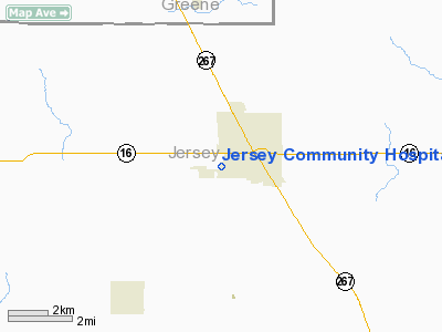
|
Jersey Community Hospital Heliport |
|
|
Location
& QuickFacts
|
FAA
Information Effective: |
2007-12-20 |
|
Airport
Identifier: |
27IL |
|
Airport
Status: |
Operational |
|
Longitude/Latitude: |
090-20-37.4130W/39-06-36.1700N
-90.343726/39.110047 (Estimated) |
|
Elevation: |
630 ft / 192.02 m (Estimated) |
|
Land: |
20 acres |
|
From
nearest city: |
0 nautical miles NE of Jerseyville, IL |
|
Location: |
Jersey County, IL |
|
Magnetic Variation: |
02E (1985) |
Owner
& Manager
|
Ownership: |
Publicly
owned |
|
Owner: |
Jersey Community Hospital |
|
Address: |
Po Box 426, 400 Maple Summit
Jerseyville, IL 62052 |
|
Phone
number: |
618-498-6402 |
|
Manager: |
Lawrence P. Bear |
|
Address: |
Po Box 426, 400 Maple Summit
Jerseyville, IL 62052 |
|
Phone number: |
618-498-6402 |
Airport Operations and Facilities
|
Airport
Use: |
Private
MEDICAL USE. |
|
Wind
indicator: |
Yes |
|
Segmented Circle: |
No |
|
Control
Tower: |
No |
|
Lighting
Schedule: |
PHONE REQ
FOR PERIMETER LGTS & ROTG BCN CALL
618-498-6402. |
|
Beacon
Color: |
Clear-Green-Yellow (heliport) |
|
Sectional chart: |
St Louis |
|
Region: |
AGL - Great Lakes |
|
Boundary
ARTCC: |
ZKC - Kansas City |
|
Tie-in
FSS: |
STL - Saint Louis |
|
FSS
on Airport: |
No |
|
FSS
Toll Free: |
1-800-WX-BRIEF |
|
Runway Information
Helipad H1
|
Dimension: |
40
x 40 ft / 12.2 x 12.2 m |
|
Surface: |
CONC, |
|
|
Runway H1 |
Runway |
|
Traffic
Pattern: |
Left |
Left |
|
Radio Navigation
Aids
|
ID |
Type |
Name |
Ch |
Freq |
Var |
Dist |
|
CVM |
NDB |
Civic
Memorial |
|
263.00 |
02E |
18.8
nm |
|
LM |
NDB |
Oblio |
|
338.00 |
00E |
19.6
nm |
|
LTD |
NDB |
Litchfield |
|
371.00 |
01E |
31.3
nm |
|
PPQ |
NDB |
Pittsfield |
|
344.00 |
02E |
37.8
nm |
|
BL |
NDB |
Belleville |
|
362.00 |
02E |
47.6
nm |
|
SP |
NDB |
Huskk |
|
382.00 |
01W |
48.2
nm |
|
SKE |
TACAN |
Scott |
059X |
|
02E |
41.0
nm |
|
CSX |
VOR/DME |
Cardinal |
111Y |
116.45 |
00E |
21.5
nm |
|
IJX |
VOR/DME |
Jacksonville |
023X |
108.60 |
02E |
40.4
nm |
|
STL |
VORTAC |
St
Louis |
121X |
117.40 |
01E |
16.3
nm |
|
TOY |
VORTAC |
Troy |
107X |
116.00 |
04E |
29.9
nm |
|
FTZ |
VORTAC |
Foristell |
045X |
110.80 |
05E |
38.5
nm |
|
STL |
VOT |
St
Louis Lambert |
|
111.00 |
|
21.8
nm |
|
SUS |
VOT |
Spirit
Of St Louis |
|
112.20 |
|
30.5
nm |
Remarks
- OPNS
ARE CONDUCTED FROM 180-360 DEGREES; AREA IS MARKED, WIND INDICATOR IS
MAINTAINED; 8:1 APCH SLOPE IS MAINTAINED.
Jersey Community Hospital Heliport
Address:
Jersey County, IL
Tel:
618-498-6402
Images
and information placed above are from
http://www.airport-data.com/airport/27IL/
We
thank them for the data!
| General
Info |
| Country |
United
States |
| State |
ILLINOIS
|
| FAA ID |
27IL |
| Latitude |
39-06-36.170N
|
| Longitude |
090-20-37.413W
|
| Elevation |
630 feet
|
| Near City |
JERSEYVILLE
|
We don't guarantee the information is fresh and accurate. The data may
be wrong or outdated.
For more up-to-date information please refer to other sources.
|
|


