 |
|
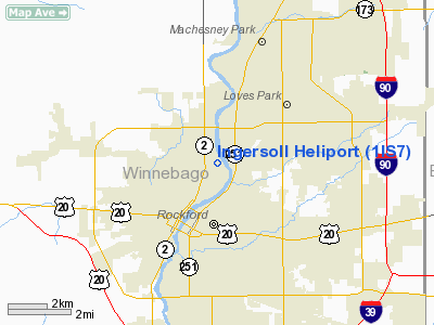
Ingersoll Winnebago Heliport |
Location
& QuickFacts
|
FAA
Information Effective: |
2007-12-20 |
|
Airport
Identifier: |
1IS7 |
|
Airport
Status: |
Operational |
|
Longitude/Latitude: |
089-04-09.3820W/42-17-58.0690N
-89.069273/42.299464 (Estimated) |
|
Elevation: |
745 ft / 227.08 m (Estimated) |
|
Land: |
0 acres |
|
From
nearest city: |
0 nautical miles N of Rockford, IL |
|
Location: |
Winnebago County, IL |
|
Magnetic Variation: |
00E (1985) |
Owner & Manager
|
Ownership: |
Privately owned |
|
Owner: |
Ingersoll Milling Machine Co |
|
Address: |
707 Fulton Avenue
Rockford, IL 61101 |
|
Phone number: |
815-987-6978 |
|
Manager: |
Robert W. Leach |
|
Address: |
707 Fulton Avenue
Rockford, IL 61101 |
|
Phone number: |
815-987-6978 |
Airport
Operations and Facilities
|
Airport
Use: |
Private |
|
Wind
indicator: |
Yes |
|
Segmented Circle: |
No |
|
Control
Tower: |
No |
|
Landing
fee charge: |
No |
|
Sectional chart: |
Chicago |
|
Region: |
AGL - Great Lakes |
|
Boundary
ARTCC: |
ZAU - Chicago |
|
Tie-in
FSS: |
IKK - Kankakee |
|
FSS
on Airport: |
No |
|
FSS
Toll Free: |
1-800-WX-BRIEF |
|
Runway Information
Helipad H1
|
Dimension: |
36
x 36 ft / 11.0 x 11.0 m |
|
Surface: |
CONC,
ROOFTOP. |
|
|
Runway H1 |
Runway |
|
Traffic
Pattern: |
Left |
Left |
|
Radio Navigation
Aids
|
ID |
Type |
Name |
Ch |
Freq |
Var |
Dist |
|
JVL |
NDB |
Janesville |
|
375.00 |
03E |
19.0
nm |
|
FEP |
NDB |
Freeport |
|
335.00 |
00E |
23.2
nm |
|
DKB |
NDB |
Dekalb |
|
209.00 |
02W |
27.3
nm |
|
LVV |
NDB |
Lake
Lawn |
|
404.00 |
00W |
32.0
nm |
|
MS |
NDB |
Monah |
|
400.00 |
00E |
47.5
nm |
|
BOZ |
NDB |
Whiteside |
|
254.00 |
01E |
47.7
nm |
|
RFD |
VOR/DME |
Rockford |
045X |
110.80 |
01E |
7.3
nm |
|
JVL |
VOR/DME |
Janesville |
090X |
114.30 |
03E |
15.6
nm |
|
PLL |
VOR/DME |
Polo |
049X |
111.20 |
03E |
28.5
nm |
|
DPA |
VOR/DME |
Dupage |
021X |
108.40 |
02E |
40.4
nm |
|
BUU |
VOR/DME |
Burbun |
092X |
114.50 |
01W |
41.3
nm |
|
OBK |
VOR/DME |
Northbrook |
077X |
113.00 |
02W |
49.9
nm |
Remarks
- APP/DEP
OPNS CONDUCTED IN AN AREA FROM 140-220 DEG & 290-070 DEG USING PAD
AS CNTR OF COMPASS POINT; AREA IS ADEQUATE TO ACCOMMODATE SMALL SNGL-TURBINE
HEL UP TO UH1 SIZE; WIND INDICATOR IS MAINTD.
Ingersoll Winnebago Heliport
Address:
Winnebago County, IL
Tel:
815-987-6978
Images
and information placed above are from
http://www.airport-data.com/airport/1IS7/
We
thank them for the data!
| General
Info |
| Country |
United
States |
| State |
ILLINOIS
|
| FAA ID |
1IS7 |
| Latitude |
42-17-58.069N
|
| Longitude |
089-04-09.382W
|
| Elevation |
745 feet
|
| Near City |
ROCKFORD
|
We don't guarantee the information is fresh and accurate. The data may
be wrong or outdated.
For more up-to-date information please refer to other sources.
|
|


