 |
|
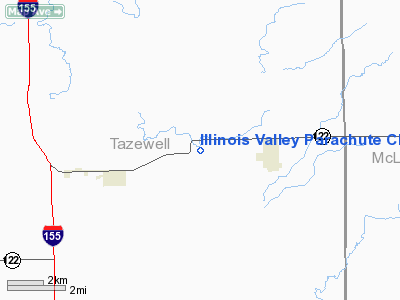
Illinois Valley Parachute Club Airport |
|
|
Location
& QuickFacts
|
FAA
Information Effective: |
2007-12-20 |
|
Airport
Identifier: |
81IL |
|
Airport
Status: |
Operational |
|
Longitude/Latitude: |
089-21-33.3350W/40-26-07.1420N
-89.359260/40.435317 (Estimated) |
|
Elevation: |
646 ft / 196.90 m (Surveyed) |
|
Land: |
0 acres |
|
From
nearest city: |
2 nautical miles W of Minier, IL |
|
Location: |
Tazewell County, IL |
|
Magnetic Variation: |
01E (1985) |
Owner
& Manager
|
Ownership: |
Privately
owned |
|
Owner: |
Il Valley Parachute Club |
|
Address: |
1114 So 8th St.
Pekin, IL 61554 |
|
Phone
number: |
309-346-0552 |
|
Manager: |
Jack Tillman
CHIEF PILOT |
|
Address: |
1114 So. 8th St.
Pekin, IL 61554 |
|
Phone number: |
309-346-0552 |
Airport Operations and Facilities
|
Airport Use: |
Private |
|
Wind indicator: |
No |
|
Segmented Circle: |
No |
|
Control Tower: |
No |
|
Landing fee charge: |
No |
|
Sectional chart: |
Chicago |
|
Region: |
AGL - Great Lakes |
|
Boundary ARTCC: |
ZAU - Chicago |
|
Tie-in FSS: |
IKK - Kankakee |
|
FSS on Airport: |
No |
|
FSS Toll Free: |
1-800-WX-BRIEF |
Airport Services
|
Airframe
Repair: |
NONE |
|
Power
Plant Repair: |
NONE |
|
Runway
Information
Runway E/W
|
Dimension: |
2640
x 70 ft / 804.7 x 21.3 m |
|
Surface: |
TURF, |
|
|
Runway E |
Runway W |
|
Traffic
Pattern: |
Left |
Left |
|
Radio Navigation
Aids
|
ID |
Type |
Name |
Ch |
Freq |
Var |
Dist |
|
PI |
NDB |
Tungg |
|
356.00 |
01E |
14.8
nm |
|
AAA |
NDB |
Abraham |
|
329.00 |
00E |
16.6
nm |
|
LQ |
NDB |
Licol |
|
375.00 |
01W |
33.4
nm |
|
CTK |
NDB |
Canton |
|
236.00 |
02E |
33.7
nm |
|
SP |
NDB |
Huskk |
|
382.00 |
01W |
43.9
nm |
|
BMI |
VOR/DME |
Bloomington |
019X |
108.20 |
03E |
19.8
nm |
|
PNT |
VOR/DME |
Pontiac |
033X |
109.60 |
03E |
36.8
nm |
|
PIA |
VORTAC |
Peoria |
099X |
115.20 |
04E |
24.7
nm |
|
CAP |
VORTAC |
Capital |
074X |
112.70 |
04E |
34.9
nm |
|
SPI |
VORTAC |
Spinner |
74X |
112.70 |
01W |
38.7
nm |
|
BDF |
VORTAC |
Bradford |
094X |
114.70 |
00E |
44.8
nm |
|
DEC |
VORTAC |
Decatur |
119X |
117.20 |
03E |
47.9
nm |
Based
Aircraft
|
Aircraft
based on field: |
3 |
|
Single
Engine Airplanes: |
3 |
Illinois Valley Parachute Club Airport
Address:
Tazewell County, IL
Tel:
309-346-0552
Images
and information placed above are from
http://www.airport-data.com/airport/81IL/
We
thank them for the data!
| General
Info |
| Country |
United
States |
| State |
ILLINOIS
|
| FAA ID |
81IL |
| Latitude |
40-26-07.142N
|
| Longitude |
089-21-33.335W
|
| Elevation |
646 feet
|
| Near City |
MINIER
|
We don't guarantee the information is fresh and accurate. The data may
be wrong or outdated.
For more up-to-date information please refer to other sources.
|
|


