 |
|
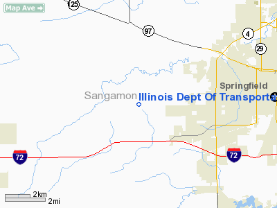
Illinois Dept Of Transportation Nr 6 Heliport |
Location
& QuickFacts
|
FAA
Information Effective: |
2007-12-20 |
|
Airport
Identifier: |
74LL |
|
Airport
Status: |
Operational |
|
Longitude/Latitude: |
089-46-42.3740W/39-46-44.1830N
-89.778437/39.778940 (Estimated) |
|
Elevation: |
630 ft / 192.02 m (Estimated) |
|
Land: |
0 acres |
|
From
nearest city: |
0 nautical miles N of Springfield, IL |
|
Location: |
Sangamon County, IL |
|
Magnetic Variation: |
01E (1985) |
Owner
& Manager
|
Ownership: |
Publicly
owned |
|
Owner: |
Ill Dept Of Transportation |
|
Address: |
126 East Ash Street
Springfield, IL 62704 |
|
Phone
number: |
217-782-7301 |
|
Manager: |
Roger W. Wright |
|
Address: |
126 East Ash Street
Springfield, IL 62704 |
|
Phone number: |
217-782-7301 |
Airport Operations and Facilities
|
Airport
Use: |
Private |
|
Segmented Circle: |
No |
|
Control
Tower: |
No |
|
Sectional chart: |
St Louis |
|
Region: |
AGL - Great Lakes |
|
Boundary
ARTCC: |
ZKC - Kansas City |
|
Tie-in
FSS: |
STL - Saint Louis |
|
FSS
on Airport: |
No |
|
FSS
Toll Free: |
1-800-WX-BRIEF |
|
Runway Information
Helipad H1
|
Dimension: |
16
x 16 ft / 4.9 x 4.9 m |
|
Surface: |
WOOD,
16 X 16'TD AREA WI A 75 X 75'ROOFTOP LNDG/TKOF AREA. |
|
|
Runway H1 |
Runway |
|
Traffic
Pattern: |
Left |
Left |
|
Radio Navigation
Aids
|
ID |
Type |
Name |
Ch |
Freq |
Var |
Dist |
|
SP |
NDB |
Huskk |
|
382.00 |
01W |
0.9
nm |
|
LQ |
NDB |
Licol |
|
375.00 |
01W |
11.4
nm |
|
TAZ |
NDB |
Taylorville |
|
395.00 |
00E |
25.6
nm |
|
AAA |
NDB |
Abraham |
|
329.00 |
00E |
30.6
nm |
|
LTD |
NDB |
Litchfield |
|
371.00 |
01E |
37.2
nm |
|
PPQ |
NDB |
Pittsfield |
|
344.00 |
02E |
47.2
nm |
|
SYZ |
NDB |
Shelbyville |
|
365.00 |
01E |
48.7
nm |
|
CTK |
NDB |
Canton |
|
236.00 |
02E |
49.2
nm |
|
IJX |
VOR/DME |
Jacksonville |
023X |
108.60 |
02E |
21.3
nm |
|
SPI |
VORTAC |
Spinner |
74X |
112.70 |
01W |
5.9
nm |
|
CAP |
VORTAC |
Capital |
074X |
112.70 |
04E |
9.8
nm |
|
DEC |
VORTAC |
Decatur |
119X |
117.20 |
03E |
42.7
nm |
Remarks
- PRVDD
INGRESS/EGRESS RTES ARE ESTBD ONLY FM 040 & 150 DEG USING PAD AS
CNTR OF COMPASS ROSE. HELI IS MKD/LGTD IN ACORDNC WITH AC150/5390-1
& A NON-OBSTG WIND INDCR IS MAINTD.
NO NGT OPNS CONDD TIL TKOF/LNDG AREA LGTD.
Illinois Dept Of Transportation Nr 6 Heliport
Address:
Sangamon County, IL
Tel:
217-782-7301
Images
and information placed above are from
http://www.airport-data.com/airport/74LL/
We
thank them for the data!
| General
Info |
| Country |
United
States |
| State |
ILLINOIS
|
| FAA ID |
74LL |
| Latitude |
39-46-44.183N
|
| Longitude |
089-46-42.374W
|
| Elevation |
630 feet
|
| Near City |
SPRINGFIELD
|
We don't guarantee the information is fresh and accurate. The data may
be wrong or outdated.
For more up-to-date information please refer to other sources.
|
|


