 |
|
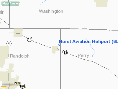
Location
& QuickFacts
|
FAA
Information Effective: |
2007-12-20 |
|
Airport
Identifier: |
6LL9 |
|
Airport
Status: |
Operational |
|
Longitude/Latitude: |
089-35-43.3390W/38-11-32.1800N
-89.595372/38.192272 (Estimated) |
|
Elevation: |
529 ft / 161.24 m (Estimated) |
|
Land: |
40 acres |
|
From
nearest city: |
0 nautical miles N of Coulterville, IL |
|
Location: |
Randolph County, IL |
|
Magnetic Variation: |
01E (1985) |
Owner
& Manager
|
Ownership: |
Privately
owned |
|
Owner: |
Durwood Q. Hurst |
|
Address: |
D. Q. Ranch
Coulterville, IL 62237 |
|
Phone
number: |
618-758-2500 |
|
Manager: |
Durwood Q. Hurst |
|
Address: |
D.. Q. Ranch
Coulterville, IL 62237 |
|
Phone number: |
618-758-2500 |
Airport Operations and Facilities
|
Airport Use: |
Private |
|
Wind indicator: |
Yes |
|
Segmented Circle: |
No |
|
Control Tower: |
No |
|
Sectional chart: |
St Louis |
|
Region: |
AGL - Great Lakes |
|
Boundary ARTCC: |
ZKC - Kansas City |
|
Tie-in FSS: |
COU - Columbia |
|
FSS on Airport: |
No |
|
FSS Toll Free: |
1-800-WX-BRIEF |
Airport
Communications
|
Runway Information
Helipad H1
|
Dimension: |
20
x 15 ft / 6.1 x 4.6 m |
|
Surface: |
CONC, |
|
|
Runway H1 |
Runway |
|
Traffic
Pattern: |
Left |
Left |
|
Radio Navigation
Aids
|
ID |
Type |
Name |
Ch |
Freq |
Var |
Dist |
|
SAR |
NDB |
Sparta |
|
239.00 |
01E |
5.8
nm |
|
PJY |
NDB |
Pinckneyville |
|
215.00 |
00E |
17.1
nm |
|
BL |
NDB |
Belleville |
|
362.00 |
02E |
18.1
nm |
|
FES |
NDB |
Festus |
|
269.00 |
01E |
37.4
nm |
|
SLO |
NDB |
Salem |
|
400.00 |
01W |
40.1
nm |
|
PRI |
NDB |
Perrine |
|
367.00 |
02E |
47.1
nm |
|
CVM |
NDB |
Civic
Memorial |
|
263.00 |
02E |
47.3
nm |
|
SKE |
TACAN |
Scott |
059X |
|
02E |
24.4
nm |
|
MWA |
VOR/DME |
Marion |
041X |
110.40 |
04E |
38.2
nm |
|
VNN |
VOR/DME |
Mount
Vernon |
085X |
113.80 |
02E |
38.6
nm |
|
CSX |
VOR/DME |
Cardinal |
111Y |
116.45 |
00E |
49.3
nm |
|
ENL |
VORTAC |
Centralia |
097X |
115.00 |
04E |
24.7
nm |
|
TOY |
VORTAC |
Troy |
107X |
116.00 |
04E |
36.2
nm |
|
FAM |
VORTAC |
Farmington |
104X |
115.70 |
01E |
43.5
nm |
|
STL |
VOT |
St
Louis Lambert |
|
111.00 |
|
49.2
nm |
Remarks
- APP/DEP
PATHS ARE FROM 200 DEGS TO 30 DEGS; AREA IS MARKED; WIND INDICATOR IS
MAINTAINED.
Hurst Aviation Heliport
Address:
Randolph County, IL
Tel:
618-758-2500
Images
and information placed above are from
http://www.airport-data.com/airport/6LL9/
We
thank them for the data!
| General
Info |
| Country |
United
States |
| State |
ILLINOIS
|
| FAA ID |
6LL9 |
| Latitude |
38-11-32.180N
|
| Longitude |
089-35-43.339W
|
| Elevation |
529 feet
|
| Near City |
COULTERVILLE
|
We don't guarantee the information is fresh and accurate. The data may
be wrong or outdated.
For more up-to-date information please refer to other sources.
|
|


