 |
|
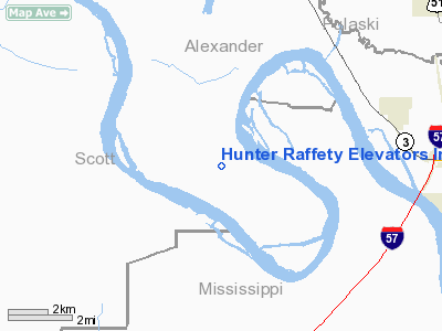
Hunter Raffety Elevators Incorporated Airport |
Location
& QuickFacts
|
FAA
Information Effective: |
2007-12-20 |
|
Airport
Identifier: |
92IL |
|
Airport
Status: |
Operational |
|
Longitude/Latitude: |
089-19-15.2770W/37-02-20.1810N
-89.320910/37.038939 (Estimated) |
|
Elevation: |
323 ft / 98.45 m (Surveyed) |
|
Land: |
0 acres |
|
From
nearest city: |
7 nautical miles NW of Cairo, IL |
|
Location: |
Alexander County, IL |
|
Magnetic Variation: |
01E (1985) |
Owner & Manager
|
Ownership: |
Privately owned |
|
Owner: |
Hunter Raffety Elevators |
|
Address: |
Wyatt, MO 63882 |
|
Phone number: |
314-675-3344 |
|
Manager: |
Elott H. Raffety |
|
Address: |
Wyatt, MO 63882 |
|
Phone number: |
314-675-3344 |
Airport Operations and Facilities
|
Airport Use: |
Private |
|
Wind indicator: |
No |
|
Segmented Circle: |
No |
|
Control Tower: |
No |
|
Landing fee charge: |
No |
|
Sectional chart: |
St Louis |
|
Region: |
AGL - Great Lakes |
|
Boundary ARTCC: |
ZME - Memphis |
|
Tie-in FSS: |
COU - Columbia |
|
FSS on Airport: |
No |
|
FSS Toll Free: |
1-800-WX-BRIEF |
Airport Services
|
Airframe
Repair: |
NONE |
|
Power
Plant Repair: |
NONE |
|
Runway Information
Runway 03/21
|
Dimension: |
1800
x 100 ft / 548.6 x 30.5 m |
|
Surface: |
TURF, |
|
|
Runway 03 |
Runway 21 |
|
Traffic
Pattern: |
Left |
Left |
|
Radio Navigation
Aids
|
ID |
Type |
Name |
Ch |
Freq |
Var |
Dist |
|
CIR |
NDB |
Cairo |
|
397.00 |
00E |
4.9
nm |
|
CHQ |
NDB |
Charleston |
|
208.00 |
01E |
11.8
nm |
|
BDD |
NDB |
Bellgrade |
|
254.00 |
00E |
31.8
nm |
|
DXE |
NDB |
Dexter |
|
423.00 |
00E |
33.4
nm |
|
GGK |
NDB |
Mayfield |
|
401.00 |
00E |
40.8
nm |
|
UC |
NDB |
Obion |
|
212.00 |
00E |
47.3
nm |
|
CGI |
VOR/DME |
Cape
Girardeau |
076X |
112.90 |
01E |
16.5
nm |
|
MWA |
VOR/DME |
Marion |
041X |
110.40 |
04E |
45.5
nm |
|
CNG |
VORTAC |
Cunningham |
078X |
113.10 |
03E |
23.3
nm |
|
MAW |
VORTAC |
Malden |
049X |
111.20 |
03E |
40.7
nm |
Remarks
Hunter Raffety Elevators Incorporated
Airport
Address:
Alexander County, IL
Tel:
314-675-3344
Images
and information placed above are from
http://www.airport-data.com/airport/92IL/
We
thank them for the data!
| General
Info |
| Country |
United
States |
| State |
ILLINOIS
|
| FAA ID |
92IL |
| Latitude |
37-02-20.181N
|
| Longitude |
089-19-15.277W
|
| Elevation |
323 feet
|
| Near City |
CAIRO
|
We don't guarantee the information is fresh and accurate. The data may
be wrong or outdated.
For more up-to-date information please refer to other sources.
|
|


