 |
|
Location
& QuickFacts
|
FAA
Information Effective: |
2007-12-20 |
|
Airport
Identifier: |
IL16 |
|
Airport
Status: |
Operational |
|
Longitude/Latitude: |
089-07-21.2820W/37-32-24.1810N
-89.122578/37.540050 (Estimated) |
|
Elevation: |
800 ft / 243.84 m (Estimated) |
|
Land: |
6 acres |
|
From
nearest city: |
7 nautical miles E of Cobden, IL |
|
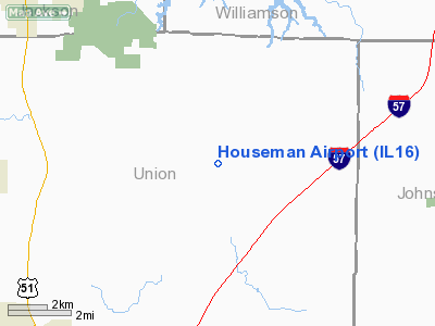
Location: |
Union County, IL |
|
Magnetic Variation: |
01E (1985) |
Owner & Manager
|
Ownership: |
Privately owned |
|
Owner: |
Ray E Houseman |
|
Address: |
Rt 2
Cobden, IL 62920 |
|
Phone number: |
618-893-2144 |
|
Manager: |
Ray E Houseman |
|
Address: |
Rt 2
Cobden, IL 62920 |
|
Phone number: |
618-893-2144 |
Airport
Operations and Facilities
|
Airport
Use: |
Private |
|
Wind
indicator: |
Yes |
|
Segmented Circle: |
No |
|
Control
Tower: |
No |
|
Sectional chart: |
St Louis |
|
Region: |
AGL - Great Lakes |
|
Boundary
ARTCC: |
ZKC - Kansas City |
|
Tie-in
FSS: |
COU - Columbia |
|
FSS
Toll Free: |
1-800-WX-BRIEF |
|
Runway Information
Runway 07/25
|
Dimension: |
1600
x 70 ft / 487.7 x 21.3 m |
|
Surface: |
TURF, |
|
|
Runway 07 |
Runway 25 |
|
Traffic
Pattern: |
Left |
Left |
|
Radio Navigation
Aids
|
ID |
Type |
Name |
Ch |
Freq |
Var |
Dist |
|
PJY |
NDB |
Pinckneyville |
|
215.00 |
00E |
28.5
nm |
|
CIR |
NDB |
Cairo |
|
397.00 |
00E |
29.2
nm |
|
HSB |
NDB |
Harrisburg-raleigh |
|
230.00 |
00E |
31.9
nm |
|
BDD |
NDB |
Bellgrade |
|
254.00 |
00E |
32.1
nm |
|
CHQ |
NDB |
Charleston |
|
208.00 |
01E |
43.3
nm |
|
SAR |
NDB |
Sparta |
|
239.00 |
01E |
45.6
nm |
|
MWA |
VOR/DME |
Marion |
041X |
110.40 |
04E |
13.9
nm |
|
CGI |
VOR/DME |
Cape
Girardeau |
076X |
112.90 |
01E |
28.5
nm |
|
CNG |
VORTAC |
Cunningham |
078X |
113.10 |
03E |
34.7
nm |
Based
Aircraft
|
Aircraft
based on field: |
2 |
|
Single
Engine Airplanes: |
2 |
Houseman Airport
Address:
Union County, IL
Tel:
618-893-2144
Images
and information placed above are from
http://www.airport-data.com/airport/IL16/
We
thank them for the data!
| General
Info |
| Country |
United
States |
| State |
ILLINOIS
|
| FAA ID |
IL16 |
| Latitude |
37-32-24.181N
|
| Longitude |
089-07-21.282W
|
| Elevation |
800 feet
|
| Near City |
COBDEN
|
We don't guarantee the information is fresh and accurate. The data may
be wrong or outdated.
For more up-to-date information please refer to other sources.
|
|


