 |
|
Hoopeston Community Memorial Hospital Heliport |
|
|
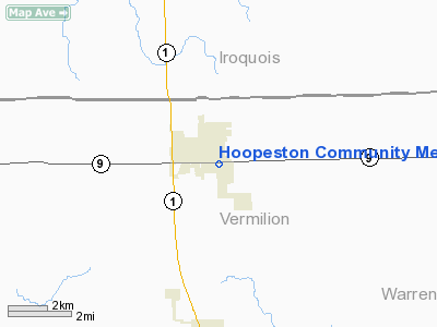
Location
& QuickFacts
|
FAA
Information Effective: |
2007-12-20 |
|
Airport
Identifier: |
01IL |
|
Airport
Status: |
Operational |
|
Longitude/Latitude: |
087-39-34.0850W/40-27-31.1310N
-87.659468/40.458647 (Estimated) |
|
Elevation: |
583 ft / 177.70 m (Estimated) |
|
Land: |
0 acres |
|
From
nearest city: |
0 nautical miles N of Hoopeston, IL |
|
Location: |
Vermilion County, IL |
|
Magnetic Variation: |
01W (1985) |
Owner & Manager
|
Ownership: |
Privately owned |
|
Owner: |
Hoopeston Community Mem Hosp |
|
Address: |
701 East Orange
Hoopeston, IL 60942 |
|
Phone number: |
217-283-5531 |
|
Manager: |
Rod B. Burkett, Admin. |
|
Address: |
701 East Orange
Hoopeston, IL 60942 |
|
Phone number: |
217-283-5531 |
Airport Operations and Facilities
|
Airport Use: |
Private
MEDICAL USE. |
|
Wind indicator: |
No |
|
Segmented Circle: |
No |
|
Control Tower: |
No |
|
Landing fee charge: |
No |
|
Sectional chart: |
Chicago |
|
Region: |
AGL - Great Lakes |
|
Boundary ARTCC: |
ZAU - Chicago |
|
Tie-in FSS: |
STL - Saint Louis |
|
FSS on Airport: |
No |
|
FSS Toll Free: |
1-800-WX-BRIEF |
Airport Services
|
Airframe
Repair: |
NONE |
|
Power
Plant Repair: |
NONE |
|
Runway Information
Helipad H1
|
Dimension: |
416
x 216 ft / 126.8 x 65.8 m |
|
Surface: |
TURF, |
|
|
Runway H1 |
Runway |
|
Traffic
Pattern: |
Left |
Left |
|
Radio Navigation
Aids
|
ID |
Type |
Name |
Ch |
Freq |
Var |
Dist |
|
HMJ |
NDB |
Homer |
|
281.00 |
01E |
29.3
nm |
|
RZL |
NDB |
Rensselaer |
|
362.00 |
02W |
36.5
nm |
|
MCX |
NDB |
White
County |
|
377.00 |
03W |
43.7
nm |
|
CFJ |
NDB |
Crawfordsville |
|
388.00 |
02W |
44.6
nm |
|
PRG |
NDB |
Paris |
|
341.00 |
01E |
45.7
nm |
|
RBS |
VOR/DME |
Roberts |
115X |
116.80 |
02E |
24.2
nm |
|
IKK |
VOR/DME |
Kankakee |
053X |
111.60 |
00E |
38.0
nm |
|
DNV |
VORTAC |
Danville |
047X |
111.00 |
02E |
11.0
nm |
|
BVT |
VORTAC |
Boiler |
098X |
115.10 |
01E |
27.6
nm |
|
CMI |
VORTAC |
Champaign |
037X |
110.00 |
03E |
38.1
nm |
|
EON |
VORTAC |
Peotone |
079X |
113.20 |
02E |
49.1
nm |
Remarks
- INGRESS
TO W & N ONLY. EGRESS
TO E & S.
Hoopeston Community Memorial Hospital
Heliport
Address:
Vermilion County, IL
Tel:
217-283-5531
Images
and information placed above are from
http://www.airport-data.com/airport/01IL/
We
thank them for the data!
| General
Info |
| Country |
United
States |
| State |
ILLINOIS
|
| FAA ID |
01IL |
| Latitude |
40-27-31.131N
|
| Longitude |
087-39-34.085W
|
| Elevation |
583 feet
|
| Near City |
HOOPESTON
|
We don't guarantee the information is fresh and accurate. The data may
be wrong or outdated.
For more up-to-date information please refer to other sources.
|
|


