 |
|
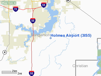
Location
& QuickFacts
|
FAA
Information Effective: |
2007-12-20 |
|
Airport
Identifier: |
3IS5 |
|
Airport
Status: |
Operational |
|
Longitude/Latitude: |
089-35-55.3460W/39-41-04.1830N
-89.598707/39.684495 (Estimated) |
|
Elevation: |
590 ft / 179.83 m (Estimated) |
|
Land: |
10 acres |
|
From
nearest city: |
6 nautical miles N of Pawnee, IL |
|
Location: |
Sangamon County, IL |
|
Magnetic Variation: |
01E (1985) |
Owner & Manager
|
Ownership: |
Privately owned |
|
Owner: |
David A. Holmes |
|
Address: |
Rte 1
Pawnee, IL 62558 |
|
Phone number: |
217-498-8157 |
|
Manager: |
David A. Holmes |
|
Address: |
Route 1
Pawnee, IL 62558 |
|
Phone number: |
217-498-8157 |
Airport
Operations and Facilities
|
Airport
Use: |
Private |
|
Wind
indicator: |
Yes |
|
Segmented Circle: |
No |
|
Control
Tower: |
No |
|
Sectional chart: |
St Louis |
|
Region: |
AGL - Great Lakes |
|
Boundary
ARTCC: |
ZKC - Kansas City |
|
Tie-in
FSS: |
STL - Saint Louis |
|
FSS
on Airport: |
No |
|
FSS
Toll Free: |
1-800-WX-BRIEF |
|
Runway
Information
Runway E/W
|
Dimension: |
2950
x 100 ft / 899.2 x 30.5 m |
|
Surface: |
TURF, |
|
|
Runway E |
Runway W |
|
Traffic
Pattern: |
Left |
Left |
|
Radio Navigation
Aids
|
ID |
Type |
Name |
Ch |
Freq |
Var |
Dist |
|
SP |
NDB |
Huskk |
|
382.00 |
01W |
9.2
nm |
|
LQ |
NDB |
Licol |
|
375.00 |
01W |
13.7
nm |
|
TAZ |
NDB |
Taylorville |
|
395.00 |
00E |
15.6
nm |
|
AAA |
NDB |
Abraham |
|
329.00 |
00E |
31.0
nm |
|
LTD |
NDB |
Litchfield |
|
371.00 |
01E |
31.4
nm |
|
SYZ |
NDB |
Shelbyville |
|
365.00 |
01E |
38.8
nm |
|
IJX |
VOR/DME |
Jacksonville |
023X |
108.60 |
02E |
30.1
nm |
|
SPI |
VORTAC |
Spinner |
74X |
112.70 |
01W |
10.0
nm |
|
CAP |
VORTAC |
Capital |
074X |
112.70 |
04E |
12.5
nm |
|
DEC |
VORTAC |
Decatur |
119X |
117.20 |
03E |
34.5
nm |
|
VLA |
VORTAC |
Vandalia |
090X |
114.30 |
04E |
40.9
nm |
Based
Aircraft
|
Aircraft
based on field: |
3 |
|
Single
Engine Airplanes: |
3 |
Holmes Airport
Address:
Sangamon County, IL
Tel:
217-498-8157
Images
and information placed above are from
http://www.airport-data.com/airport/3IS5/
We
thank them for the data!
| General
Info |
| Country |
United
States |
| State |
ILLINOIS
|
| FAA ID |
3IS5 |
| Latitude |
39-41-04.183N
|
| Longitude |
089-35-55.346W
|
| Elevation |
590 feet
|
| Near City |
PAWNEE
|
We don't guarantee the information is fresh and accurate. The data may
be wrong or outdated.
For more up-to-date information please refer to other sources.
|
|


