 |
|
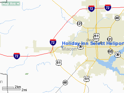
Holiday Inn Select Heliport |
Location
& QuickFacts
|
FAA
Information Effective: |
2007-12-20 |
|
Airport
Identifier: |
49LL |
|
Airport
Status: |
Operational |
|
Longitude/Latitude: |
089-01-37.2880W/39-50-48.1350N
-89.027024/39.846704 (Estimated) |
|
Elevation: |
678 ft / 206.65 m (Estimated) |
|
Land: |
0 acres |
|
From
nearest city: |
2 nautical miles N of Decatur, IL |
|
Location: |
Macon County, IL |
|
Magnetic Variation: |
01E (1985) |
Owner
& Manager
|
Ownership: |
Privately
owned |
|
Owner: |
Cardwell & Randall Hospitality Svcs |
|
Address: |
4191 Us Route 36 & Wyckles Road
Decatur, IL 62522 |
|
Phone
number: |
217-422-8800 |
|
Manager: |
Lisa Schaive |
|
Address: |
4191 Us Route 36 & Wyckles Road
Decatur, IL 62522 |
|
Phone number: |
217-422-8800 |
Airport Operations and Facilities
|
Airport
Use: |
Private |
|
Segmented Circle: |
No |
|
Control
Tower: |
No |
|
Sectional chart: |
St Louis |
|
Region: |
AGL - Great Lakes |
|
Boundary
ARTCC: |
ZKC - Kansas City |
|
Tie-in
FSS: |
STL - Saint Louis |
|
FSS
Toll Free: |
1-800-WX-BRIEF |
|
Runway Information
Helipad H1
|
Dimension: |
30
x 30 ft / 9.1 x 9.1 m |
|
Surface: |
CONC, Good Condition |
|
|
Runway H1 |
Runway |
|
Traffic
Pattern: |
Left |
Left |
|
Radio Navigation
Aids
|
ID |
Type |
Name |
Ch |
Freq |
Var |
Dist |
|
TAZ |
NDB |
Taylorville |
|
395.00 |
00E |
23.2
nm |
|
AAA |
NDB |
Abraham |
|
329.00 |
00E |
23.7
nm |
|
LQ |
NDB |
Licol |
|
375.00 |
01W |
26.9
nm |
|
SYZ |
NDB |
Shelbyville |
|
365.00 |
01E |
27.8
nm |
|
SP |
NDB |
Huskk |
|
382.00 |
01W |
34.1
nm |
|
MT |
NDB |
Zebre |
|
347.00 |
00E |
46.4
nm |
|
BMI |
VOR/DME |
Bloomington |
019X |
108.20 |
03E |
38.4
nm |
|
MTO |
VOR/DME |
Mattoon |
031X |
109.40 |
03E |
40.8
nm |
|
DEC |
VORTAC |
Decatur |
119X |
117.20 |
03E |
10.3
nm |
|
CAP |
VORTAC |
Capital |
074X |
112.70 |
04E |
27.7
nm |
|
SPI |
VORTAC |
Spinner |
74X |
112.70 |
01W |
30.0
nm |
|
CMI |
VORTAC |
Champaign |
037X |
110.00 |
03E |
36.4
nm |
|
VLA |
VORTAC |
Vandalia |
090X |
114.30 |
04E |
45.7
nm |
Remarks
- OPNS
ARE CONDUCTED FM 150 TO 220 DEGS; AREA IS MKD & WIND INDICATOR IS
MAINTAINED.
Holiday Inn Select Heliport
Address:
Macon County, IL
Tel:
217-422-8800
Images
and information placed above are from
http://www.airport-data.com/airport/49LL/
We
thank them for the data!
| General
Info |
| Country |
United
States |
| State |
ILLINOIS
|
| FAA ID |
49LL |
| Latitude |
39-50-48.135N
|
| Longitude |
089-01-37.288W
|
| Elevation |
678 feet
|
| Near City |
DECATUR
|
We don't guarantee the information is fresh and accurate. The data may
be wrong or outdated.
For more up-to-date information please refer to other sources.
|
|


