 |
|
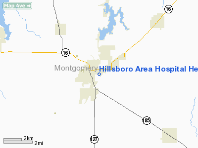
Hillsboro Area Hospital Heliport |
Location
& QuickFacts
|
FAA
Information Effective: |
2007-12-20 |
|
Airport
Identifier: |
8IS4 |
|
Airport
Status: |
Operational |
|
Longitude/Latitude: |
089-28-53.0000W/39-09-06.0000N
-89.481389/39.151667 (Estimated) |
|
Elevation: |
650 ft / 198.12 m (Estimated) |
|
Land: |
0 acres |
|
From
nearest city: |
0 nautical miles SE of Hillsboro, IL |
|
Location: |
Montgomery County, IL |
|
Magnetic Variation: |
01E (1985) |
Owner
& Manager
|
Ownership: |
Privately
owned |
|
Owner: |
Hillsboro Hospital Assn Inc |
|
Address: |
1200 East Tremont St
Hillsboro, IL 62049 |
|
Phone
number: |
217-532-6111 |
|
Manager: |
Dave Stearns |
|
Address: |
1200 East Tremont St
Hillsboro, IL 62049 |
|
Phone number: |
217-532-6111
EXT 161. |
Airport Operations and Facilities
|
Airport
Use: |
Private
MEDICAL USE. |
|
Wind
indicator: |
Yes |
|
Segmented Circle: |
No |
|
Control
Tower: |
No |
|
Sectional chart: |
St Louis |
|
Region: |
AGL - Great Lakes |
|
Boundary
ARTCC: |
ZKC - Kansas City |
|
Tie-in
FSS: |
STL - Saint Louis |
|
FSS
on Airport: |
No |
|
FSS
Toll Free: |
1-800-WX-BRIEF |
|
Runway Information
Helipad H1
|
Dimension: |
40
x 40 ft / 12.2 x 12.2 m |
|
Surface: |
CONC, |
|
|
Runway H1 |
Runway |
|
Traffic
Pattern: |
Left |
Left |
|
Radio Navigation
Aids
|
ID |
Type |
Name |
Ch |
Freq |
Var |
Dist |
|
LTD |
NDB |
Litchfield |
|
371.00 |
01E |
9.1
nm |
|
TAZ |
NDB |
Taylorville |
|
395.00 |
00E |
24.2
nm |
|
CVM |
NDB |
Civic
Memorial |
|
263.00 |
02E |
31.0
nm |
|
SYZ |
NDB |
Shelbyville |
|
365.00 |
01E |
33.4
nm |
|
SLO |
NDB |
Salem |
|
400.00 |
01W |
38.8
nm |
|
SP |
NDB |
Huskk |
|
382.00 |
01W |
39.5
nm |
|
BL |
NDB |
Belleville |
|
362.00 |
02E |
43.2
nm |
|
LQ |
NDB |
Licol |
|
375.00 |
01W |
46.0
nm |
|
SKE |
TACAN |
Scott |
059X |
|
02E |
40.4
nm |
|
CSX |
VOR/DME |
Cardinal |
111Y |
116.45 |
00E |
47.6
nm |
|
VLA |
VORTAC |
Vandalia |
090X |
114.30 |
04E |
15.3
nm |
|
TOY |
VORTAC |
Troy |
107X |
116.00 |
04E |
32.1
nm |
|
SPI |
VORTAC |
Spinner |
74X |
112.70 |
01W |
42.3
nm |
|
CAP |
VORTAC |
Capital |
074X |
112.70 |
04E |
45.0
nm |
|
DEC |
VORTAC |
Decatur |
119X |
117.20 |
03E |
45.6
nm |
|
ENL |
VORTAC |
Centralia |
097X |
115.00 |
04E |
46.5
nm |
|
BIB |
VORTAC |
Bible
Grove |
027X |
109.00 |
03E |
48.7
nm |
|
STL |
VORTAC |
St
Louis |
121X |
117.40 |
01E |
49.9
nm |
|
STL |
VOT |
St
Louis Lambert |
|
111.00 |
|
47.8
nm |
Remarks
- PRVDD
APCH/DEP 205 CLKWS TO 215 & 005 CLKWS TO 015; AREA IS MKD; WIND
INDICATOR IS MAINTAINED; & COMPLY WITH 14 CFR 91.126(B)(2).
Hillsboro Area Hospital Heliport
Address:
Montgomery County, IL
Tel:
217-532-6111
Images
and information placed above are from
http://www.airport-data.com/airport/8IS4/
We
thank them for the data!
| General
Info |
| Country |
United
States |
| State |
ILLINOIS
|
| FAA ID |
8IS4 |
| Latitude |
39-09-10.000N
|
| Longitude |
089-28-40.000W
|
| Elevation |
650 feet
|
| Near City |
HILLSBORO
|
We don't guarantee the information is fresh and accurate. The data may
be wrong or outdated.
For more up-to-date information please refer to other sources.
|
|


