 |
|
Location
& QuickFacts
|
FAA
Information Effective: |
2007-12-20 |
|
Airport
Identifier: |
IS56 |
|
Airport
Status: |
Operational |
|
Longitude/Latitude: |
090-53-07.4770W/40-05-17.1690N
-90.885410/40.088102 (Estimated) |
|
Elevation: |
654 ft / 199.34 m (Surveyed) |
|
Land: |
0 acres |
|
From
nearest city: |
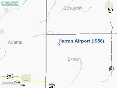
5 nautical miles N of Timewell, IL |
|
Location: |
Brown County, IL |
|
Magnetic Variation: |
02E (1985) |
Owner & Manager
|
Ownership: |
Privately owned |
|
Owner: |
Roger L. Herren |
|
Address: |
Rr 1
Clayton, IL 62324 |
|
Phone number: |
217-696-2779 |
|
Address: |
|
Airport Operations and Facilities
|
Airport Use: |
Private |
|
Wind indicator: |
Yes |
|
Segmented Circle: |
No |
|
Control Tower: |
No |
|
Landing fee charge: |
No |
|
Sectional chart: |
Chicago |
|
Region: |
AGL - Great Lakes |
|
Boundary ARTCC: |
ZKC - Kansas City |
|
Tie-in FSS: |
STL - Saint Louis |
|
FSS on Airport: |
No |
|
FSS Toll Free: |
1-800-WX-BRIEF |
Airport Services
|
Airframe
Repair: |
NONE |
|
Power
Plant Repair: |
NONE |
|
Runway Information
Runway 17/35
|
Dimension: |
1500
x 70 ft / 457.2 x 21.3 m |
|
Surface: |
TURF, |
|
|
Runway 17 |
Runway 35 |
|
Traffic
Pattern: |
Left |
Left |
|
Radio Navigation
Aids
|
ID |
Type |
Name |
Ch |
Freq |
Var |
Dist |
|
UI |
NDB |
Quincy |
|
293.00 |
02E |
20.8
nm |
|
PPQ |
NDB |
Pittsfield |
|
344.00 |
02E |
27.3
nm |
|
JZY |
NDB |
Macomb |
|
251.00 |
01E |
29.8
nm |
|
EOK |
NDB |
Keokuk |
|
366.00 |
02E |
33.8
nm |
|
HAE |
NDB |
Hannibal |
|
411.00 |
03E |
33.8
nm |
|
CTK |
NDB |
Canton |
|
236.00 |
02E |
46.9
nm |
|
IJX |
VOR/DME |
Jacksonville |
023X |
108.60 |
02E |
35.2
nm |
|
UIN |
VORTAC |
Quincy |
083X |
113.60 |
05E |
23.2
nm |
|
BRL |
VORTAC |
Burlington |
051X |
111.40 |
05E |
38.2
nm |
Based
Aircraft
|
Aircraft
based on field: |
2 |
|
Single
Engine Airplanes: |
2 |
Havana Regional Airport
Address:
Brown County, IL
Tel:
217-696-2779
Images
and information placed above are from
http://www.airport-data.com/airport/IS56/
We
thank them for the data!
| General
Info |
| Country |
United
States |
| State |
ILLINOIS
|
| FAA ID |
IS56 |
| Latitude |
40-05-17.169N
|
| Longitude |
090-53-07.477W
|
| Elevation |
654 feet
|
| Near City |
TIMEWELL
|
We don't guarantee the information is fresh and accurate. The data may
be wrong or outdated.
For more up-to-date information please refer to other sources.
|
|


