 |
|
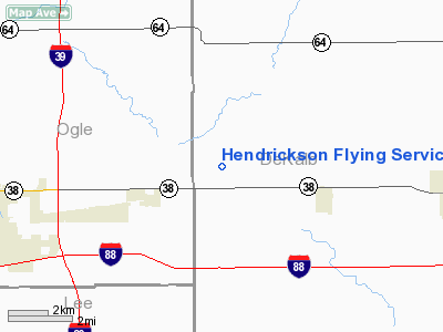
Hendrickson Flying Service Airport |
Location
& QuickFacts
|
FAA
Information Effective: |
2007-12-20 |
|
Airport
Identifier: |
IL93 |
|
Airport
Status: |
Operational |
|
Longitude/Latitude: |
088-55-26.3340W/41-56-43.1020N
-88.923982/41.945306 (Estimated) |
|
Elevation: |
889 ft / 270.97 m (Estimated) |
|
Land: |
5 acres |
|
From
nearest city: |
2 nautical miles NE of Creston, IL |
|
Location: |
De Kalb County, IL |
|
Magnetic Variation: |
00W (1985) |
Owner & Manager
|
Ownership: |
Privately owned |
|
Owner: |
Hendrickson Flying Service |
|
Address: |
Rr 2
Rochelle, IL 61068 |
|
Phone number: |
815-384-5151 |
|
Manager: |
Charles W. Hendrickson |
|
Address: |
Rr 2
Rochelle, IL 61068 |
|
Phone number: |
815-384-5151 |
Airport Operations and Facilities
|
Airport Use: |
Private |
|
Wind indicator: |
Yes |
|
Segmented Circle: |
No |
|
Control Tower: |
No |
|
Landing fee charge: |
No |
|
Sectional chart: |
Chicago |
|
Region: |
AGL - Great Lakes |
|
Boundary ARTCC: |
ZAU - Chicago |
|
Tie-in FSS: |
IKK - Kankakee |
|
FSS on Airport: |
No |
|
FSS Toll Free: |
1-800-WX-BRIEF |
Airport Services
|
Airframe
Repair: |
NONE |
|
Power
Plant Repair: |
NONE |
|
Runway Information
Runway 18/36
|
Dimension: |
2800
x 80 ft / 853.4 x 24.4 m |
|
Surface: |
TURF, |
|
|
Runway 18 |
Runway 36 |
|
Traffic
Pattern: |
Left |
Left |
|
Obstruction: |
|
20 ft pline, 640.0 ft from runway |
|
Helipad H1
|
Dimension: |
150
x 150 ft / 45.7 x 45.7 m |
|
Surface: |
TURF, |
|
|
Runway H1 |
Runway |
|
Traffic
Pattern: |
Left |
Left |
|
Radio Navigation
Aids
|
ID |
Type |
Name |
Ch |
Freq |
Var |
Dist |
|
DKB |
NDB |
Dekalb |
|
209.00 |
02W |
9.7
nm |
|
FEP |
NDB |
Freeport |
|
335.00 |
00E |
34.6
nm |
|
OIX |
NDB |
Ottawa |
|
266.00 |
01E |
35.2
nm |
|
VYS |
NDB |
Valley |
|
230.00 |
00W |
36.9
nm |
|
ME |
NDB |
Deana |
|
350.00 |
00E |
40.1
nm |
|
JVL |
NDB |
Janesville |
|
375.00 |
03E |
40.6
nm |
|
BOZ |
NDB |
Whiteside |
|
254.00 |
01E |
41.1
nm |
|
LVV |
NDB |
Lake
Lawn |
|
404.00 |
00W |
47.6
nm |
|
RFD |
VOR/DME |
Rockford |
045X |
110.80 |
01E |
20.8
nm |
|
DPA |
VOR/DME |
Dupage |
021X |
108.40 |
02E |
25.9
nm |
|
PLL |
VOR/DME |
Polo |
049X |
111.20 |
03E |
26.9
nm |
|
JVL |
VOR/DME |
Janesville |
090X |
114.30 |
03E |
37.7
nm |
|
ORD |
VOR/DME |
Chicago
O'hare |
086X |
113.90 |
02E |
45.6
nm |
|
OBK |
VOR/DME |
Northbrook |
077X |
113.00 |
02W |
46.4
nm |
|
JOT |
VORTAC |
Joliet |
070X |
112.30 |
02E |
36.2
nm |
|
ORD |
VOT |
Chicago
O'hare Intl |
|
112.00 |
|
45.5
nm |
Remarks
- HELIPAD
IS WEST OF SOUTH END OF RWY.
- NO
OBJECTION.
Based
Aircraft
|
Aircraft
based on field: |
7 |
|
Single
Engine Airplanes: |
4 |
|
Helicopters: |
3 |
Hendrickson Flying Service Airport
Address:
De Kalb County, IL
Tel:
815-384-5151
Images
and information placed above are from
http://www.airport-data.com/airport/IL93/
We
thank them for the data!
| General
Info |
| Country |
United
States |
| State |
ILLINOIS
|
| FAA ID |
IL93 |
| Latitude |
41-56-43.102N
|
| Longitude |
088-55-26.334W
|
| Elevation |
889 feet
|
| Near City |
CRESTON
|
We don't guarantee the information is fresh and accurate. The data may
be wrong or outdated.
For more up-to-date information please refer to other sources.
|
|


