 |
|
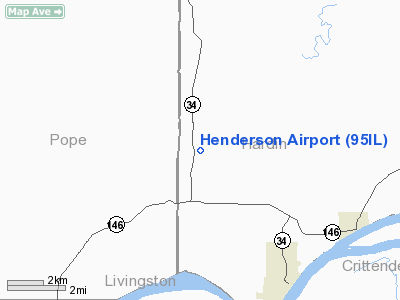
Location
& QuickFacts
|
FAA
Information Effective: |
2007-12-20 |
|
Airport
Identifier: |
95IL |
|
Airport
Status: |
Operational |
|
Longitude/Latitude: |
088-24-00.1450W/37-29-10.1800N
-88.400040/37.486161 (Estimated) |
|
Elevation: |
485 ft / 147.83 m (Estimated) |
|
Land: |
0 acres |
|
From
nearest city: |
4 nautical miles NW of Rosiclare, IL |
|
Location: |
Hardin County, IL |
|
Magnetic Variation: |
01E (1985) |
Owner
& Manager
|
Ownership: |
Privately
owned |
|
Owner: |
Cindy Henderson |
|
Address: |
Rr 1 Box 175a
Golconda, IL 62938 |
|
Phone
number: |
618-264-2991 |
|
Manager: |
Cindy Henderson |
|
Address: |
Rr 1 Box 175a
Golconda, IL 62938 |
|
Phone number: |
618-264-2991 |
Airport Operations and Facilities
|
Airport
Use: |
Private |
|
Wind
indicator: |
Yes |
|
Segmented Circle: |
Yes |
|
Control
Tower: |
No |
|
Landing
fee charge: |
No |
|
Sectional chart: |
St Louis |
|
Region: |
AGL - Great Lakes |
|
Boundary
ARTCC: |
ZME - Memphis |
|
Tie-in
FSS: |
COU - Columbia |
|
FSS
on Airport: |
No |
|
FSS
Toll Free: |
1-800-WX-BRIEF |
|
Runway Information
Runway 03/21
|
Dimension: |
2750
x 100 ft / 838.2 x 30.5 m |
|
Surface: |
TURF, |
|
|
Runway 03 |
Runway 21 |
|
Traffic
Pattern: |
Left |
Left |
|
Radio Navigation
Aids
|
ID |
Type |
Name |
Ch |
Freq |
Var |
Dist |
|
HSB |
NDB |
Harrisburg-raleigh |
|
230.00 |
00E |
20.7
nm |
|
TWT |
NDB |
Tradewater |
|
276.00 |
00E |
21.6
nm |
|
BDD |
NDB |
Bellgrade |
|
254.00 |
00E |
24.2
nm |
|
GVA |
NDB |
Geneva |
|
224.00 |
01W |
35.5
nm |
|
CUL |
NDB |
Carmi |
|
332.00 |
01W |
38.9
nm |
|
CIR |
NDB |
Cairo |
|
397.00 |
00E |
46.9
nm |
|
GGK |
NDB |
Mayfield |
|
401.00 |
00E |
48.7
nm |
|
MWA |
VOR/DME |
Marion |
041X |
110.40 |
04E |
33.3
nm |
|
CNG |
VORTAC |
Cunningham |
078X |
113.10 |
03E |
35.5
nm |
|
PXV |
VORTAC |
Pocket
City |
080X |
113.30 |
03E |
40.3
nm |
Henderson Hardin Airport
Address:
Hardin County, IL
Tel:
618-264-2991
Images
and information placed above are from
http://www.airport-data.com/airport/95IL/
We
thank them for the data!
| General
Info |
| Country |
United
States |
| State |
ILLINOIS
|
| FAA ID |
95IL |
| Latitude |
37-29-10.180N
|
| Longitude |
088-24-00.145W
|
| Elevation |
485 feet
|
| Near City |
ROSICLARE
|
We don't guarantee the information is fresh and accurate. The data may
be wrong or outdated.
For more up-to-date information please refer to other sources.
|
|


