|
|
|
 |
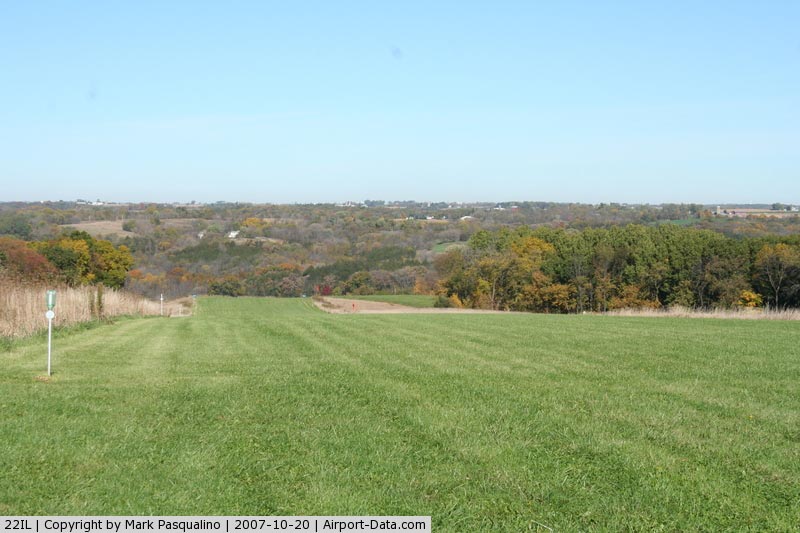
(Click on the photo to enlarge) |
|
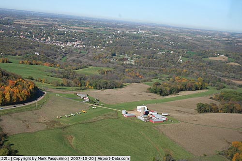 |
(Click on the photo to enlarge) |
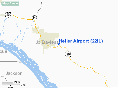
Location
& QuickFacts
|
FAA
Information Effective: |
2007-12-20 |
|
Airport
Identifier: |
22IL |
|
Airport
Status: |
Operational |
|
Longitude/Latitude: |
090-24-00.4600W/42-24-43.0280N
-90.400128/42.411952 (Estimated) |
|
Elevation: |
820 ft / 249.94 m (Estimated) |
|
Land: |
0 acres |
|
From
nearest city: |
2 nautical miles E of Galena, IL |
|
Location: |
Jo Daviess County, IL |
|
Magnetic Variation: |
01E (1985) |
Owner & Manager
|
Ownership: |
Privately owned |
|
Owner: |
Hal Heller |
|
Address: |
9000 Rt. 20w
Galena, IL 61036 |
|
Phone number: |
815-777-1662 |
|
Manager: |
Hal Heller |
|
Address: |
9000 Rt. 20w
Galena, IL 61936 |
|
Phone number: |
815-777-1662 |
Airport
Operations and Facilities
|
Airport
Use: |
Private |
|
Wind
indicator: |
Yes |
|
Segmented Circle: |
No |
|
Control
Tower: |
No |
|
Sectional chart: |
Chicago |
|
Region: |
AGL - Great Lakes |
|
Boundary
ARTCC: |
ZAU - Chicago |
|
Tie-in
FSS: |
IKK - Kankakee |
|
FSS
Toll Free: |
1-800-WX-BRIEF |
|
Runway Information
Runway 15/33
|
Dimension: |
1900
x 100 ft / 579.1 x 30.5 m |
|
Surface: |
TURF, Good Condition |
|
|
Runway 15 |
Runway 33 |
|
Traffic
Pattern: |
Left |
Right |
|
Radio Navigation
Aids
|
ID |
Type |
Name |
Ch |
Freq |
Var |
Dist |
|
PVB |
NDB |
Platteville |
|
203.00 |
01E |
16.7
nm |
|
OQW |
NDB |
Maquoketa |
|
386.00 |
02E |
26.5
nm |
|
MRJ |
NDB |
Mineral
Point |
|
365.00 |
00W |
29.6
nm |
|
MXO |
NDB |
Monticello |
|
397.00 |
01E |
35.1
nm |
|
CWI |
NDB |
Clinton |
|
377.00 |
01E |
35.2
nm |
|
FEP |
NDB |
Freeport |
|
335.00 |
00E |
37.5
nm |
|
PLL |
VOR/DME |
Polo |
049X |
111.20 |
03E |
47.3
nm |
|
DBQ |
VORTAC |
Dubuque |
105X |
115.80 |
04E |
13.7
nm |
|
CVA |
VORTAC |
Davenport |
085X |
113.80 |
04E |
42.4
nm |
|
DVN |
VOT |
Davenport
Municipal |
|
111.80 |
|
48.8
nm |
Remarks
- PRVDD
THAT OBSTRUCTION TO APCH SLOPE ARE REMOVED/LOWERED TO PRVD A 20:1 APCH
CLNC SOME OBSTRUCTIONS ARE POWERLINE E OF RY & TREES PRESENT OFF
EITHER RY END; AREA OF 125 FT ON EITHER SIDE OF RY IS CLEAR OF OBSTRUCTIONS.
Heller Airport
Address:
Jo Daviess County, IL
Tel:
815-777-1662
Images
and information placed above are from
http://www.airport-data.com/airport/22IL/
We
thank them for the data!
| General
Info |
| Country |
United
States |
| State |
ILLINOIS
|
| FAA ID |
22IL |
| Latitude |
42-24-43.028N
|
| Longitude |
090-24-00.460W
|
| Elevation |
820 feet
|
| Near City |
GALENA
|
We don't guarantee the information is fresh and accurate. The data may
be wrong or outdated.
For more up-to-date information please refer to other sources.
|
|