 |
|
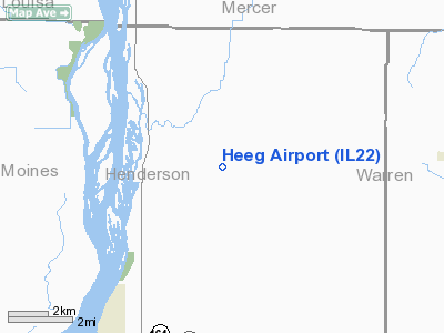
Location
& QuickFacts
|
FAA
Information Effective: |
2007-12-20 |
|
Airport
Identifier: |
IL22 |
|
Airport
Status: |
Operational |
|
Longitude/Latitude: |
090-52-58.4000W/41-00-25.6000N
-90.882889/41.007111 (Estimated) |
|
Elevation: |
600 ft / 182.88 m (Estimated) |
|
Land: |
0 acres |
|
From
nearest city: |
6 nautical miles NE of Oquawka, IL |
|
Location: |
Henderson County, IL |
|
Magnetic Variation: |
00E (2000) |
Owner
& Manager
|
Ownership: |
Privately
owned |
|
Owner: |
Pearl F. Heeg |
|
Address: |
Rt #1 Box 181 H
Oquawka, IL 61469 |
|
Phone
number: |
309-374-2421 |
|
Manager: |
Pearl F. Heeg |
|
Address: |
Rt #1 Box 181h
Oquawka, IL 61469 |
|
Phone number: |
309-374-2421 |
Airport Operations and Facilities
|
Airport
Use: |
Private |
|
Wind
indicator: |
Yes |
|
Segmented Circle: |
No |
|
Control
Tower: |
No |
|
Sectional chart: |
Chicago |
|
Region: |
AGL - Great Lakes |
|
Boundary
ARTCC: |
ZAU - Chicago |
|
Tie-in
FSS: |
IKK - Kankakee |
|
FSS
Toll Free: |
1-800-WX-BRIEF |
|
Runway Information
Runway 18/36
|
Dimension: |
1882
x 70 ft / 573.6 x 21.3 m |
|
Surface: |
TURF, Good Condition |
|
|
Runway 18 |
Runway 36 |
|
Traffic
Pattern: |
Left |
Left |
|
Displaced
threshold: |
0.00 ft |
265.00 ft
DSPLCD THLD MKD WITH TIRES. |
|
Obstruction: |
25 ft trees, 390.0 ft from runway |
25 ft pline, 110.0 ft from runway |
|
Radio Navigation
Aids
|
ID |
Type |
Name |
Ch |
Freq |
Var |
Dist |
|
MPZ |
NDB |
Mount
Pleasant |
|
212.00 |
02E |
28.7
nm |
|
JZY |
NDB |
Macomb |
|
251.00 |
01E |
32.8
nm |
|
AWG |
NDB |
Washington |
|
219.00 |
02E |
39.3
nm |
|
EOK |
NDB |
Keokuk |
|
366.00 |
02E |
41.1
nm |
|
EZI |
NDB |
Kewanee |
|
245.00 |
01E |
43.4
nm |
|
CTK |
NDB |
Canton |
|
236.00 |
02E |
45.3
nm |
|
GBG |
VOR/DME |
Galesburg |
035X |
109.80 |
03E |
20.8
nm |
|
DDD |
VOR/DME |
Port
City |
112X |
116.50 |
01E |
24.7
nm |
|
BRL |
VORTAC |
Burlington |
051X |
111.40 |
05E |
17.2
nm |
|
MZV |
VORTAC |
Moline |
091X |
114.40 |
05E |
21.9
nm |
|
IOW |
VORTAC |
Iowa
City |
109X |
116.20 |
05E |
45.1
nm |
|
CVA |
VORTAC |
Davenport |
085X |
113.80 |
04E |
45.9
nm |
|
DVN |
VOT |
Davenport
Municipal |
|
111.80 |
|
38.7
nm |
Remarks
- PRVDD
LTR OF AGRMT WITH MEYER ARPT.
Based
Aircraft
|
Aircraft
based on field: |
1 |
|
Single
Engine Airplanes: |
1 |
Heeg Airport
Address:
Henderson County, IL
Tel:
309-374-2421
Images
and information placed above are from
http://www.airport-data.com/airport/IL22/
We
thank them for the data!
| General
Info |
| Country |
United
States |
| State |
ILLINOIS
|
| FAA ID |
IL22 |
| Latitude |
41-00-25.600N
|
| Longitude |
090-52-58.400W
|
| Elevation |
600 feet
|
| Near City |
OQUAWKA
|
We don't guarantee the information is fresh and accurate. The data may
be wrong or outdated.
For more up-to-date information please refer to other sources.
|
|


