 |
|
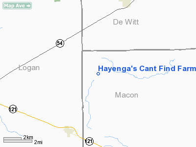
Hayenga's Cant Find Farms Airport |
Location
& QuickFacts
|
FAA
Information Effective: |
2007-12-20 |
|
Airport
Identifier: |
00IS |
|
Airport
Status: |
Operational |
|
Longitude/Latitude: |
089-07-22.3130W/40-01-32.1420N
-89.122865/40.025595 (Estimated) |
|
Elevation: |
820 ft / 249.94 m (Estimated) |
|
Land: |
0 acres |
|
From
nearest city: |
1 nautical miles NW of Kings, IL |
|
Location: |
Ogle County, IL |
|
Magnetic Variation: |
01E (1985) |
Owner & Manager
|
Ownership: |
Privately owned |
|
Owner: |
Roger Hayenga |
|
Address: |
Rr 1
Kings, IL 61045 |
|
Address: |
|
Airport
Operations and Facilities
|
Airport
Use: |
Private |
|
Wind
indicator: |
Yes |
|
Segmented Circle: |
No |
|
Control
Tower: |
No |
|
Sectional chart: |
Chicago |
|
Region: |
AGL - Great Lakes |
|
Boundary
ARTCC: |
ZAU - Chicago |
|
Tie-in
FSS: |
IKK - Kankakee |
|
FSS
Toll Free: |
1-800-WX-BRIEF |
|
Runway
Information
Runway E/W
|
Dimension: |
1600
x 70 ft / 487.7 x 21.3 m |
|
Surface: |
TURF, |
|
|
Runway E |
Runway W |
|
Traffic
Pattern: |
Left |
Left |
|
Radio Navigation
Aids
|
ID |
Type |
Name |
Ch |
Freq |
Var |
Dist |
|
AAA |
NDB |
Abraham |
|
329.00 |
00E |
12.8
nm |
|
LQ |
NDB |
Licol |
|
375.00 |
01W |
23.2
nm |
|
TAZ |
NDB |
Taylorville |
|
395.00 |
00E |
30.8
nm |
|
SP |
NDB |
Huskk |
|
382.00 |
01W |
33.1
nm |
|
SYZ |
NDB |
Shelbyville |
|
365.00 |
01E |
39.4
nm |
|
PI |
NDB |
Tungg |
|
356.00 |
01E |
41.0
nm |
|
BMI |
VOR/DME |
Bloomington |
019X |
108.20 |
03E |
28.7
nm |
|
DEC |
VORTAC |
Decatur |
119X |
117.20 |
03E |
21.2
nm |
|
CAP |
VORTAC |
Capital |
074X |
112.70 |
04E |
24.5
nm |
|
SPI |
VORTAC |
Spinner |
74X |
112.70 |
01W |
27.9
nm |
|
CMI |
VORTAC |
Champaign |
037X |
110.00 |
03E |
39.0
nm |
|
PIA |
VORTAC |
Peoria |
099X |
115.20 |
04E |
49.9
nm |
Based
Aircraft
|
Aircraft
based on field: |
2 |
|
Single
Engine Airplanes: |
2 |
Hayenga's Cant Find Farms Airport
Address:
Ogle County, IL
Tel:
Images
and information placed above are from
http://www.airport-data.com/airport/00IS/
We
thank them for the data!
| General
Info |
| Country |
United
States |
| State |
ILLINOIS
|
| FAA ID |
00IS |
| Latitude |
40-01-32.142N
|
| Longitude |
089-07-22.313W
|
| Elevation |
820 feet
|
| Near City |
KINGS
|
We don't guarantee the information is fresh and accurate. The data may
be wrong or outdated.
For more up-to-date information please refer to other sources.
|
|


