 |
|
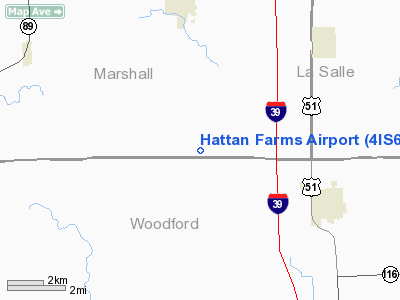
Location
& QuickFacts
|
FAA
Information Effective: |
2007-12-20 |
|
Airport
Identifier: |
4IS6 |
|
Airport
Status: |
Operational |
|
Longitude/Latitude: |
089-07-14.2920W/40-55-50.1220N
-89.120637/40.930589 (Estimated) |
|
Elevation: |
710 ft / 216.41 m (Estimated) |
|
Land: |
3 acres |
|
From
nearest city: |
5 nautical miles W of Minonk, IL |
|
Location: |
Marshall County, IL |
|
Magnetic Variation: |
00E (1984) |
Owner & Manager
|
Ownership: |
Privately owned |
|
Owner: |
Hattan Farms |
|
Address: |
Rr 1, Box 32
Minonk, IL 61760 |
|
Phone number: |
815-452-2605 |
|
Manager: |
William Leigh |
|
Address: |
Rr 1, Box 32
Minonk, IL 61760 |
|
Phone number: |
815-452-2605 |
Airport
Operations and Facilities
|
Airport
Use: |
Private |
|
Wind
indicator: |
Yes |
|
Segmented Circle: |
No |
|
Control
Tower: |
No |
|
Landing
fee charge: |
No |
|
Sectional chart: |
Chicago |
|
Region: |
AGL - Great Lakes |
|
Boundary
ARTCC: |
ZAU - Chicago |
|
Tie-in
FSS: |
IKK - Kankakee |
|
FSS
on Airport: |
No |
|
FSS
Toll Free: |
1-800-WX-BRIEF |
|
Runway Information
Runway 18/36
|
Dimension: |
1800
x 70 ft / 548.6 x 21.3 m |
|
Surface: |
TURF, |
|
|
Runway 18 |
Runway 36 |
|
Traffic
Pattern: |
Left |
Left |
|
Radio Navigation
Aids
|
ID |
Type |
Name |
Ch |
Freq |
Var |
Dist |
|
VYS |
NDB |
Valley |
|
230.00 |
00W |
25.5
nm |
|
OIX |
NDB |
Ottawa |
|
266.00 |
01E |
28.6
nm |
|
PI |
NDB |
Tungg |
|
356.00 |
01E |
29.1
nm |
|
EZI |
NDB |
Kewanee |
|
245.00 |
01E |
41.3
nm |
|
AAA |
NDB |
Abraham |
|
329.00 |
00E |
47.4
nm |
|
CTK |
NDB |
Canton |
|
236.00 |
02E |
48.8
nm |
|
PNT |
VOR/DME |
Pontiac |
033X |
109.60 |
03E |
18.8
nm |
|
BMI |
VOR/DME |
Bloomington |
019X |
108.20 |
03E |
28.4
nm |
|
RBS |
VOR/DME |
Roberts |
115X |
116.80 |
02E |
48.3
nm |
|
BDF |
VORTAC |
Bradford |
094X |
114.70 |
00E |
25.3
nm |
|
PIA |
VORTAC |
Peoria |
099X |
115.20 |
04E |
34.1
nm |
Remarks
- PROVIDED
ANY OBSTRUCTIONS ARE REMOVED OR THE THRESHOLD DISPLACED TO PROVIDE A
20 TO 1 APPROACH CLEARANCE.
Based Aircraft
|
Aircraft
based on field: |
1 |
|
Single
Engine Airplanes: |
1 |
Hattan Farms Airport
Address:
Marshall County, IL
Tel:
815-452-2605
Images
and information placed above are from
http://www.airport-data.com/airport/4IS6/
We
thank them for the data!
| General
Info |
| Country |
United
States |
| State |
ILLINOIS
|
| FAA ID |
4IS6 |
| Latitude |
40-55-50.122N
|
| Longitude |
089-07-14.292W
|
| Elevation |
710 feet
|
| Near City |
MINONK
|
We don't guarantee the information is fresh and accurate. The data may
be wrong or outdated.
For more up-to-date information please refer to other sources.
|
|


