 |
|
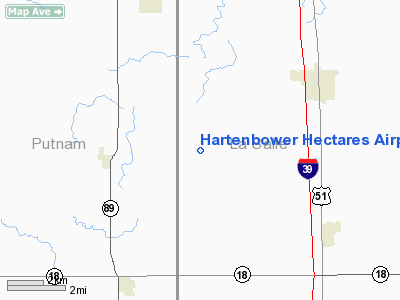
Hartenbower Hectares Airport |
|
|
Location
& QuickFacts
|
FAA
Information Effective: |
2007-12-20 |
|
Airport
Identifier: |
2V3 |
|
Airport
Status: |
Operational |
|
Longitude/Latitude: |
089-08-48.1000W/41-10-53.4000N
-89.146694/41.181500 (Estimated) |
|
Elevation: |
733 ft / 223.42 m (Surveyed) |
|
Land: |
12 acres |
|
From
nearest city: |
5 nautical miles NW of Lostant, IL |
|
Location: |
La Salle County, IL |
|
Magnetic Variation: |
00E (1985) |
Owner
& Manager
|
Ownership: |
Privately
owned |
|
Owner: |
Joanne Hartenbower |
|
Address: |
81 N 17th Road
Lostant, IL 61334 |
|
Phone
number: |
815-882-2371 |
|
Manager: |
Joanne Hartenbower |
|
Address: |
81 N 17th Road
Lostant, IL 61334 |
|
Phone number: |
815-882-2573 |
Airport Operations and Facilities
|
Airport
Use: |
Open
to public |
|
Wind
indicator: |
Yes |
|
Segmented Circle: |
No |
|
Control
Tower: |
No |
|
Lighting
Schedule: |
RDO-CTL
ACTVT ROTG BCN - CTAF. |
|
Beacon
Color: |
Clear-Green (lighted land airport) |
|
Landing
fee charge: |
No |
|
Sectional chart: |
Chicago |
|
Region: |
AGL - Great Lakes |
|
Boundary
ARTCC: |
ZAU - Chicago |
|
Tie-in
FSS: |
IKK - Kankakee |
|
FSS
on Airport: |
No |
|
FSS
Toll Free: |
1-800-WX-BRIEF |
|
NOTAMs
Facility: |
IKK (NOTAM-d service avaliable) |
Airport Communications
|
CTAF: |
122.700 |
|
Unicom: |
122.700 |
Airport Services
|
Fuel
available: |
100LLMOGAS |
|
Runway Information
Runway 18/36
|
Dimension: |
2413
x 100 ft / 735.5 x 30.5 m |
|
Surface: |
TURF, Good Condition |
|
Edge
Lights: |
Non-standard lighting system
NSTD LIRL; LIGHT INTENSITY VARIES. |
|
|
Runway 18 |
Runway 36 |
|
Longitude: |
089-08-48.1827W |
089-08-47.9933W |
|
Latitude: |
41-11-05.2890N |
41-10-41.4511N |
|
Elevation: |
717.00 ft |
731.00 ft |
|
Alignment: |
127 |
127 |
|
Traffic
Pattern: |
Left |
Left |
|
Obstruction: |
10 ft crops, 200.0 ft from runway, 20:1 slope
to clear
RY 18 CLNCL SLOPE 50:1 WHEN CROPS ARE HARVESTED. |
15 ft road, 480.0 ft from runway, 32:1 slope
to clear
CLEARANCE SLOPE IS 50:1 WHEN CROPS ARE HARVESTED. |
|
Radio Navigation
Aids
|
ID |
Type |
Name |
Ch |
Freq |
Var |
Dist |
|
VYS |
NDB |
Valley |
|
230.00 |
00W |
10.4
nm |
|
OIX |
NDB |
Ottawa |
|
266.00 |
01E |
17.1
nm |
|
EZI |
NDB |
Kewanee |
|
245.00 |
01E |
36.8
nm |
|
PI |
NDB |
Tungg |
|
356.00 |
01E |
40.1
nm |
|
BOZ |
NDB |
Whiteside |
|
254.00 |
01E |
42.9
nm |
|
DKB |
NDB |
Dekalb |
|
209.00 |
02W |
49.4
nm |
|
PNT |
VOR/DME |
Pontiac |
033X |
109.60 |
03E |
28.6
nm |
|
BMI |
VOR/DME |
Bloomington |
019X |
108.20 |
03E |
43.2
nm |
|
BDF |
VORTAC |
Bradford |
094X |
114.70 |
00E |
20.0
nm |
|
PIA |
VORTAC |
Peoria |
099X |
115.20 |
04E |
42.1
nm |
|
JOT |
VORTAC |
Joliet |
070X |
112.30 |
02E |
43.3
nm |
Based
Aircraft
|
Aircraft
based on field: |
5 |
|
Single
Engine Airplanes: |
4 |
|
Ultralights: |
1 |
Operational Statistics
Time Period: 2006-01-01 - 2006-12-31
|
Aircraft
Operations: |
58/Week |
|
General
Aviation Local: |
66.7% |
|
General
Aviation Itinerant: |
33.3% |
Hartenbower Hectares Airport
Address:
La Salle County, IL
Tel:
815-882-2371,
815-882-2573
Images
and information placed above are from
http://www.airport-data.com/airport/2V3/
We
thank them for the data!
| General
Info |
| Country |
United
States |
| State |
ILLINOIS
|
| FAA ID |
2V3 |
| Latitude |
41-10-53.400N
|
| Longitude |
089-08-48.100W
|
| Elevation |
733 feet
|
| Near City |
LOSTANT
|
We don't guarantee the information is fresh and accurate. The data may
be wrong or outdated.
For more up-to-date information please refer to other sources.
|
|


