 |
|
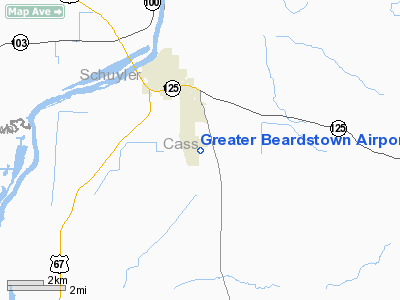
Greater Beardstown Airport |
|
|
Location
& QuickFacts
|
FAA
Information Effective: |
2007-12-20 |
|
Airport
Identifier: |
K06 |
|
Airport
Status: |
Operational |
|
Longitude/Latitude: |
090-24-13.4480W/39-58-24.1730N
-90.403736/39.973381 (Estimated) |
|
Elevation: |
465 ft / 141.73 m (Estimated) |
|
Land: |
104 acres |
|
From
nearest city: |
3 nautical miles SE of Beardstown, IL |
|
Location: |
Cass County, IL |
|
Magnetic Variation: |
02E (1985) |
Owner
& Manager
|
Ownership: |
Publicly
owned |
|
Owner: |
City Of Beardstown |
|
Address: |
City Hall 101 W. 3rd
Beardstown, IL 62618 |
|
Phone number: |
217-323-3261 |
|
Manager: |
Stephan Wubker |
|
Address: |
9487 Arpt Rd
Beardstown, IL 62618-7840 |
|
Phone number: |
217-491-0061 |
Airport
Operations and Facilities
|
Airport
Use: |
Open
to public |
|
Wind
indicator: |
Yes |
|
Segmented Circle: |
No |
|
Control
Tower: |
No |
|
Lighting
Schedule: |
DUSK-DAWN
LIRL RY 18/36 PRESET ON LOW INTST; TO INCR INTST ACTVT -
CTAF. |
|
Beacon
Color: |
Clear-Green (lighted land airport) |
|
Landing
fee charge: |
No |
|
Sectional chart: |
St Louis |
|
Region: |
AGL - Great Lakes |
|
Traffic
Pattern Alt: |
800 ft |
|
Boundary
ARTCC: |
ZKC - Kansas City |
|
Tie-in
FSS: |
STL - Saint Louis |
|
FSS
on Airport: |
No |
|
FSS
Toll Free: |
1-800-WX-BRIEF |
|
NOTAMs
Facility: |
STL (NOTAM-d service avaliable) |
|
Federal Agreements: |
NGY |
Airport Communications
|
Runway Information
Runway 18/36
|
Dimension: |
4000
x 60 ft / 1219.2 x 18.3 m |
|
Surface: |
ASPH, Fair Condition |
|
Weight
Limit: |
Single wheel: 12500 lbs. |
|
Edge
Lights: |
Low |
|
|
Runway 18 |
Runway 36 |
|
Longitude: |
090-24-20.7200W |
090-24-21.6800W |
|
Latitude: |
39-58-43.9000N |
39-58-04.3700N |
|
Elevation: |
464.00 ft |
465.00 ft |
|
Traffic
Pattern: |
Left |
Left |
|
Markings: |
Basic, Good Condition |
Basic, Good Condition |
|
Runway
End Identifier: |
No |
No |
|
Centerline
Lights: |
No |
No |
|
Touchdown
Lights: |
No |
No |
|
Obstruction: |
, 50:1 slope to clear |
80 ft tree, 1988.0 ft from runway, 61 ft left
of centerline, 22:1 slope to clear |
|
Radio Navigation
Aids
|
ID |
Type |
Name |
Ch |
Freq |
Var |
Dist |
|
PPQ |
NDB |
Pittsfield |
|
344.00 |
02E |
26.6
nm |
|
SP |
NDB |
Huskk |
|
382.00 |
01W |
32.0
nm |
|
JZY |
NDB |
Macomb |
|
251.00 |
01E |
33.5
nm |
|
LQ |
NDB |
Licol |
|
375.00 |
01W |
37.1
nm |
|
CTK |
NDB |
Canton |
|
236.00 |
02E |
38.6
nm |
|
UI |
NDB |
Quincy |
|
293.00 |
02E |
39.5
nm |
|
IJX |
VOR/DME |
Jacksonville |
023X |
108.60 |
02E |
14.1
nm |
|
SPI |
VORTAC |
Spinner |
74X |
112.70 |
01W |
34.4
nm |
|
CAP |
VORTAC |
Capital |
074X |
112.70 |
04E |
36.2
nm |
|
UIN |
VORTAC |
Quincy |
083X |
113.60 |
05E |
41.0
nm |
Based
Aircraft
|
Aircraft
based on field: |
7 |
|
Single
Engine Airplanes: |
4 |
|
Ultralights: |
3 |
Operational Statistics
Time Period: 2006-01-01 - 2006-12-31
|
Aircraft
Operations: |
58/Week |
|
General
Aviation Local: |
66.7% |
|
General
Aviation Itinerant: |
33.3% |
Greater Beardstown Airport
Address:
Cass County, IL
Tel:
217-323-3261,
217-491-0061
Images
and information placed above are from
http://www.airport-data.com/airport/K06/
We
thank them for the data!
| General
Info |
| Country |
United
States |
| State |
ILLINOIS
|
| FAA ID |
K06 |
| Latitude |
39-58-24.173N
|
| Longitude |
090-24-13.448W
|
| Elevation |
465 feet
|
| Near City |
BEARDSTOWN
|
We don't guarantee the information is fresh and accurate. The data may
be wrong or outdated.
For more up-to-date information please refer to other sources.
|
|


