 |
|
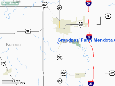
Grandpas' Farm Mendota Airport |
|
|
Location
& QuickFacts
|
FAA
Information Effective: |
2007-12-20 |
|
Airport
Identifier: |
0C7 |
|
Airport
Status: |
Operational |
|
Longitude/Latitude: |
089-07-57.3040W/41-31-19.1170N
-89.132584/41.521977 (Estimated) |
|
Elevation: |
727 ft / 221.59 m (Surveyed) |
|
Land: |
21 acres |
|
From
nearest city: |
2 nautical miles SW of Mendota, IL |
|
Location: |
La Salle County, IL |
|
Magnetic Variation: |
00E (1985) |
Owner
& Manager
|
Ownership: |
Privately
owned |
|
Owner: |
R. J. Krenz & J. Walton |
|
Address: |
4041 N. State Hwy 251
Mendota, IL 61342 |
|
Phone
number: |
815-539-9939 |
|
Manager: |
Robert J. Krenz, Jr. |
|
Address: |
4041 N State Hwy 251
Mendota, IL 61342 |
|
Phone number: |
815-539-9939
IF NO ANSWER CALL 815-539-5906/6359. |
Airport
Operations and Facilities
|
Airport
Use: |
Open
to public |
|
Wind
indicator: |
Yes |
|
Segmented Circle: |
No |
|
Control
Tower: |
No |
|
Lighting
Schedule: |
RDO-CTL
ACTVT NSTD LIRL RY 18/36 - CTAF. |
|
Landing
fee charge: |
No |
|
Sectional chart: |
Chicago |
|
Region: |
AGL - Great Lakes |
|
Traffic
Pattern Alt: |
800 ft |
|
Boundary
ARTCC: |
ZAU - Chicago |
|
Tie-in
FSS: |
IKK - Kankakee |
|
FSS
on Airport: |
No |
|
FSS
Toll Free: |
1-800-WX-BRIEF |
|
NOTAMs
Facility: |
IKK (NOTAM-d service avaliable) |
Airport Communications
Airport Services
|
Bottled
Oxygen: |
NONE |
|
Bulk
Oxygen: |
NONE |
|
Runway Information
Runway 18/36
|
Dimension: |
3980
x 200 ft / 1213.1 x 61.0 m |
|
Surface: |
TURF, Good Condition |
|
Edge
Lights: |
Non-standard lighting system
NSTD LIRL; FIXTURE SPACING & LGT INTST VARIES; NON-FAA APVD
L-800 SERIES. |
|
|
Runway 18 |
Runway 36 |
|
Longitude: |
089-07-58.5900W |
089-07-56.8000W |
|
Latitude: |
41-31-38.3900N |
41-30-59.1200N |
|
Elevation: |
727.00 ft |
715.00 ft |
|
Traffic
Pattern: |
Left |
Left |
|
Displaced
threshold: |
300.00 ft
RWY 18 /36 DSPLCD THLD IS 1 FT HIGH BLUE BARREL HALVES. |
80.00 ft |
|
Runway
End Identifier: |
No |
No |
|
Centerline
Lights: |
No |
No |
|
Touchdown
Lights: |
No |
No |
|
Obstruction: |
15 ft road
APCH RATIO 20:1 AT DSPLCD THR. |
4 ft fence, 0.0 ft from runway
APCH RATIO 20:1 AT DSPLCD THR. |
|
Radio Navigation
Aids
|
ID |
Type |
Name |
Ch |
Freq |
Var |
Dist |
|
VYS |
NDB |
Valley |
|
230.00 |
00W |
10.1
nm |
|
OIX |
NDB |
Ottawa |
|
266.00 |
01E |
15.8
nm |
|
DKB |
NDB |
Dekalb |
|
209.00 |
02W |
31.3
nm |
|
BOZ |
NDB |
Whiteside |
|
254.00 |
01E |
31.5
nm |
|
EZI |
NDB |
Kewanee |
|
245.00 |
01E |
42.0
nm |
|
FEP |
NDB |
Freeport |
|
335.00 |
00E |
48.0
nm |
|
PLL |
VOR/DME |
Polo |
049X |
111.20 |
03E |
31.9
nm |
|
DPA |
VOR/DME |
Dupage |
021X |
108.40 |
02E |
41.5
nm |
|
RFD |
VOR/DME |
Rockford |
045X |
110.80 |
01E |
42.4
nm |
|
PNT |
VOR/DME |
Pontiac |
033X |
109.60 |
03E |
45.8
nm |
|
BDF |
VORTAC |
Bradford |
094X |
114.70 |
00E |
29.9
nm |
|
JOT |
VORTAC |
Joliet |
070X |
112.30 |
02E |
36.7
nm |
Remarks
- RY
18/36 CLSD EXC PPR 815-866-9939/815-539-9939.
Based
Aircraft
|
Aircraft
based on field: |
7 |
|
Single
Engine Airplanes: |
6 |
|
Ultralights: |
1 |
Operational Statistics
Time Period: 2006-01-01 - 2006-12-31
|
Aircraft
Operations: |
116/Week |
|
General
Aviation Local: |
83.3% |
|
General
Aviation Itinerant: |
16.7% |
Grandpas' Farm Mendota Airport
Address:
La Salle County, IL
Tel:
815-539-9939
Images
and information placed above are from
http://www.airport-data.com/airport/0C7/
We
thank them for the data!
| General
Info |
| Country |
United
States |
| State |
ILLINOIS
|
| FAA ID |
0C7 |
| Latitude |
41-31-19.117N
|
| Longitude |
089-07-57.304W
|
| Elevation |
727 feet
|
| Near City |
MENDOTA
|
We don't guarantee the information is fresh and accurate. The data may
be wrong or outdated.
For more up-to-date information please refer to other sources.
|
|


