 |
|
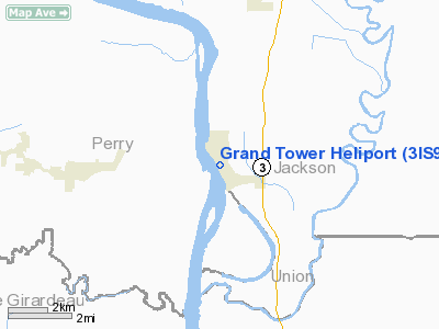
Location
& QuickFacts
|
FAA
Information Effective: |
2007-12-20 |
|
Airport
Identifier: |
3IS9 |
|
Airport
Status: |
Operational |
|
Longitude/Latitude: |
089-30-22.3480W/37-37-58.1800N
-89.506208/37.632828 (Estimated) |
|
Elevation: |
370 ft / 112.78 m (Estimated) |
|
Land: |
0 acres |
|
From
nearest city: |
0 nautical miles N of Grand Tower, IL |
|
Location: |
Jackson County, IL |
|
Magnetic Variation: |
01E (1990) |
Owner
& Manager
|
Ownership: |
Publicly
owned |
|
Owner: |
City Of Grand Tower |
|
Address: |
P O Box 273
Grand Tower, IL 62942 |
|
Phone
number: |
618-565-2559 |
|
Manager: |
Randy Ellet |
|
Address: |
P O Box 273
Grand Tower, IL 62942 |
|
Phone number: |
618-565-2559 |
Airport Operations and Facilities
|
Airport
Use: |
Private |
|
Wind
indicator: |
Yes |
|
Segmented Circle: |
No |
|
Control
Tower: |
No |
|
Lighting
Schedule: |
DUSK-DAWN |
|
Sectional chart: |
St Louis |
|
Region: |
AGL - Great Lakes |
|
Boundary
ARTCC: |
ZKC - Kansas City |
|
Tie-in
FSS: |
STL - Saint Louis |
|
FSS
on Airport: |
No |
|
FSS
Toll Free: |
1-800-WX-BRIEF |
|
Runway Information
Helipad H1
|
Dimension: |
40
x 40 ft / 12.2 x 12.2 m |
|
Surface: |
CONC, Good Condition |
|
|
Runway H1 |
Runway |
|
Traffic
Pattern: |
Left |
Left |
|
Radio Navigation
Aids
|
ID |
Type |
Name |
Ch |
Freq |
Var |
Dist |
|
PJY |
NDB |
Pinckneyville |
|
215.00 |
00E |
21.7
nm |
|
SAR |
NDB |
Sparta |
|
239.00 |
01E |
32.2
nm |
|
CIR |
NDB |
Cairo |
|
397.00 |
00E |
36.9
nm |
|
PRI |
NDB |
Perrine |
|
367.00 |
02E |
44.6
nm |
|
HSB |
NDB |
Harrisburg-raleigh |
|
230.00 |
00E |
46.9
nm |
|
CHQ |
NDB |
Charleston |
|
208.00 |
01E |
47.9
nm |
|
BDD |
NDB |
Bellgrade |
|
254.00 |
00E |
49.5
nm |
|
CGI |
VOR/DME |
Cape
Girardeau |
076X |
112.90 |
01E |
24.6
nm |
|
MWA |
VOR/DME |
Marion |
041X |
110.40 |
04E |
24.6
nm |
|
FAM |
VORTAC |
Farmington |
104X |
115.70 |
01E |
34.7
nm |
|
CNG |
VORTAC |
Cunningham |
078X |
113.10 |
03E |
49.3
nm |
Remarks
- (E111-3)
UNAUTHORIZED PERSONS RESTICTED FROM ACCESS DURING FLT OPS BY USE OF
NON-OBSTRUCTING SAFETY BARRIER. FIRE PROTECTION PRVDD IN ACCORDANCE
WITH LOCAL FIRE CODES & OR FAA AC 150/5390-2.
- PRVDD
APCH/DEP OPS 020 DEGREES - 160 DEGREES & 160 DEGREES - 250 DEGREES;
TKOF/LDG AREA APPROPRIATELY MKD; NON-OBSTRUCTING WIND INDICATOR MNTND.
50 FT TREE TO THES REMOVED; P-LINES NE BURIED; NO NIGHT OPS UNLESS TKOF/LDG
AREA & WIND INDICATOR LGTD & BCN INSTALLED.
Grand Tower Heliport
Address:
Jackson County, IL
Tel:
618-565-2559
Images
and information placed above are from
http://www.airport-data.com/airport/3IS9/
We
thank them for the data!
| General
Info |
| Country |
United
States |
| State |
ILLINOIS
|
| FAA ID |
3IS9 |
| Latitude |
37-37-58.180N
|
| Longitude |
089-30-22.348W
|
| Elevation |
370 feet
|
| Near City |
GRAND
TOWER |
We don't guarantee the information is fresh and accurate. The data may
be wrong or outdated.
For more up-to-date information please refer to other sources.
|
|


