 |
|
|
|
|
|
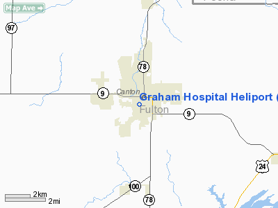
Location
& QuickFacts
|
FAA
Information Effective: |
2007-12-20 |
|
Airport
Identifier: |
97IL |
|
Airport
Status: |
Operational |
|
Longitude/Latitude: |
090-02-23.0000W/40-33-11.0000N
-90.039722/40.553056 (Estimated) |
|
Elevation: |
680 ft / 207.26 m (Estimated) |
|
Land: |
0 acres |
|
From
nearest city: |
0 nautical miles SW of Canton, IL |
|
Location: |
Fulton County, IL |
|
Magnetic Variation: |
00E (1995) |
Owner
& Manager
|
Ownership: |
Privately
owned |
|
Owner: |
Graham Hospital |
|
Address: |
210 West Walnut St
Canton, IL 61520 |
|
Phone
number: |
309-647-5240 |
|
Manager: |
Bob Ackerman, Jr |
|
Address: |
210 West Walnut St
Canton, IL 61520 |
|
Phone number: |
309-647-4096 |
Airport Operations and Facilities
|
Airport
Use: |
Private |
|
Wind
indicator: |
Yes |
|
Segmented Circle: |
No |
|
Control
Tower: |
No |
|
Lighting
Schedule: |
RDO-CTL
FOR FLOOD LGTS CALL
309-647-5240.
ACTIVATE PERIMETER LGTS & ROTG BCN - 123.05. |
|
Beacon
Color: |
Clear-Green-Yellow (heliport) |
|
Sectional chart: |
Chicago |
|
Region: |
AGL - Great Lakes |
|
Boundary
ARTCC: |
ZAU - Chicago |
|
Tie-in
FSS: |
IKK - Kankakee |
|
FSS
on Airport: |
No |
|
FSS
Toll Free: |
1-800-WX-BRIEF |
|
Runway Information
Helipad H1
|
Dimension: |
50
x 50 ft / 15.2 x 15.2 m |
|
Surface: |
ROOF-TOP, |
|
|
Runway H1 |
Runway |
|
Traffic
Pattern: |
Left |
Left |
|
Radio Navigation
Aids
|
ID |
Type |
Name |
Ch |
Freq |
Var |
Dist |
|
CTK |
NDB |
Canton |
|
236.00 |
02E |
1.9
nm |
|
PI |
NDB |
Tungg |
|
356.00 |
01E |
20.6
nm |
|
JZY |
NDB |
Macomb |
|
251.00 |
01E |
23.9
nm |
|
EZI |
NDB |
Kewanee |
|
245.00 |
01E |
39.1
nm |
|
AAA |
NDB |
Abraham |
|
329.00 |
00E |
39.9
nm |
|
LQ |
NDB |
Licol |
|
375.00 |
01W |
43.4
nm |
|
SP |
NDB |
Huskk |
|
382.00 |
01W |
48.6
nm |
|
GBG |
VOR/DME |
Galesburg |
035X |
109.80 |
03E |
29.3
nm |
|
IJX |
VOR/DME |
Jacksonville |
023X |
108.60 |
02E |
47.6
nm |
|
PIA |
VORTAC |
Peoria |
099X |
115.20 |
04E |
13.6
nm |
|
BRL |
VORTAC |
Burlington |
051X |
111.40 |
05E |
41.7
nm |
|
BDF |
VORTAC |
Bradford |
094X |
114.70 |
00E |
41.9
nm |
|
CAP |
VORTAC |
Capital |
074X |
112.70 |
04E |
44.0
nm |
|
SPI |
VORTAC |
Spinner |
74X |
112.70 |
01W |
46.0
nm |
Remarks
- PRVDD
ARR/DEP HELICOPTERS MONITOR & TRANSMIT POSITION INFO ON CANTON INGERSOLL
ARPT; ALL APCH/DEP OPNS ARE FM 045-070 DEGS & FM 230-240 DEGS; APPROPRIATELY
MKD; & AND WIND INDICATOR IS MAINTAINED.
Graham Hospital Heliport
Address:
Fulton County, IL
Tel:
309-647-5240,
309-647-4096
Images
and information placed above are from
http://www.airport-data.com/airport/97IL/
We
thank them for the data!
| General
Info |
| Country |
United
States |
| State |
ILLINOIS
|
| FAA ID |
97IL |
| Latitude |
40-33-08.000N
|
| Longitude |
090-02-12.000W
|
| Elevation |
660 feet
|
| Near City |
CANTON
|
We don't guarantee the information is fresh and accurate. The data may
be wrong or outdated.
For more up-to-date information please refer to other sources.
|
|


