 |
|
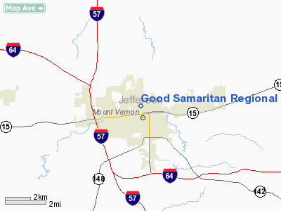
Good Samaritan Regional Health Care Center Heliport |
|
|
Location
& QuickFacts
|
FAA
Information Effective: |
2007-12-20 |
|
Airport
Identifier: |
6IS4 |
|
Airport
Status: |
Operational |
|
Longitude/Latitude: |
088-54-38.2330W/38-19-20.1770N
-88.910620/38.322271 (Estimated) |
|
Elevation: |
500 ft / 152.40 m (Estimated) |
|
Land: |
0 acres |
|
From
nearest city: |
0 nautical miles N of Mount Vernon, IL |
|
Location: |
Jefferson County, IL |
|
Magnetic Variation: |
01E (1985) |
Owner
& Manager
|
Ownership: |
Privately
owned |
|
Owner: |
Good Samaritan Rgnl |
|
Address: |
605 N 12th St
Mount Vernon, IL 62864 |
|
Phone
number: |
618-242-4600 |
|
Manager: |
Director Plant Facilities |
|
Address: |
605 N 12th St
Mount Vernon, IL 62864 |
|
Phone number: |
618-242-4600 |
Airport Operations and Facilities
|
Airport
Use: |
Private
MEDICAL USE. |
|
Wind
indicator: |
Yes |
|
Segmented Circle: |
No |
|
Control
Tower: |
No |
|
Lighting
Schedule: |
24 HRS |
|
Beacon
Color: |
Clear-Green-Yellow (heliport) |
|
Sectional chart: |
St Louis |
|
Region: |
AGL - Great Lakes |
|
Boundary
ARTCC: |
ZKC - Kansas City |
|
Tie-in
FSS: |
COU - Columbia |
|
FSS
on Airport: |
No |
|
FSS
Toll Free: |
1-800-WX-BRIEF |
|
Runway Information
Helipad H1
|
Dimension: |
44
x 44 ft / 13.4 x 13.4 m |
|
Surface: |
CONC, |
|
|
Runway H1 |
Runway |
|
Traffic
Pattern: |
Left |
Left |
|
Radio Navigation
Aids
|
ID |
Type |
Name |
Ch |
Freq |
Var |
Dist |
|
SLO |
NDB |
Salem |
|
400.00 |
01W |
19.5 nm |
|
FWC |
NDB |
Wayne County |
|
257.00 |
01E |
23.9 nm |
|
PJY |
NDB |
Pinckneyville |
|
215.00 |
00E |
29.9 nm |
|
FOA |
NDB |
Elm River |
|
353.00 |
00E |
30.0 nm |
|
HSB |
NDB |
Harrisburg-raleigh |
|
230.00 |
00E |
35.2 nm |
|
SAR |
NDB |
Sparta |
|
239.00 |
01E |
38.9 nm |
|
CUL |
NDB |
Carmi |
|
332.00 |
01W |
39.8 nm |
|
BL |
NDB |
Belleville |
|
362.00 |
02E |
40.8 nm |
|
OLY |
NDB |
Olney |
|
272.00 |
00W |
42.1 nm |
|
SKE |
TACAN |
Scott |
059X |
|
02E |
46.3 nm |
|
VNN |
VOR/DME |
Mount Vernon |
085X |
113.80 |
02E |
5.4 nm |
|
MWA |
VOR/DME |
Marion |
041X |
110.40 |
04E |
34.5 nm |
|
SAM |
VOR/DME |
Samsville |
113X |
116.60 |
03E |
40.1 nm |
|
ENL |
VORTAC |
Centralia |
097X |
115.00 |
04E |
13.1 nm |
|
BIB |
VORTAC |
Bible Grove |
027X |
109.00 |
03E |
41.2 nm |
|
VLA |
VORTAC |
Vandalia |
090X |
114.30 |
04E |
47.8 nm |
Remarks
- GND
LEVEL HELI LCTD 360'EAST HAS BEEN ABNDD.
- PRVDD
OPNS ARE CONDD IN AN AREA FROM 090-200 DEG, AREA IS MKD, WIND INDCR
IS MAINTD.
Good Samaritan Regional Health Care Center
Heliport
Address:
Jefferson County, IL
Tel:
618-242-4600
Images
and information placed above are from
http://www.airport-data.com/airport/6IS4/
We
thank them for the data!
| General
Info |
| Country |
United
States |
| State |
ILLINOIS
|
| FAA ID |
6IS4 |
| Latitude |
38-19-20.177N
|
| Longitude |
088-54-38.233W
|
| Elevation |
500 feet
|
| Near City |
MOUNT
VERNON |
We don't guarantee the information is fresh and accurate. The data may
be wrong or outdated.
For more up-to-date information please refer to other sources.
|
|


