 |
|
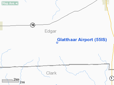
Location
& QuickFacts
|
FAA
Information Effective: |
2007-12-20 |
|
Airport
Identifier: |
55IS |
|
Airport
Status: |
Operational |
|
Longitude/Latitude: |
087-48-21.1080W/39-31-30.1250N
-87.805863/39.525035 (Estimated) |
|
Elevation: |
765 ft / 233.17 m (Estimated) |
|
Land: |
0 acres |
|
From
nearest city: |
2 nautical miles SE of Grandview, IL |
|
Location: |
Edgar County, IL |
|
Magnetic Variation: |
00W (1985) |
Owner & Manager
|
Ownership: |
Privately owned |
|
Owner: |
Richard Glatthaar |
|
Address: |
Rr 5, Box 220
Paris, IL 61944 |
|
Phone number: |
217-946-4238 |
|
Manager: |
Richard Glatthaar |
|
Address: |
Rr 5, Box 220
Paris, IL 61944 |
|
Phone number: |
217-946-4238 |
Airport
Operations and Facilities
|
Airport
Use: |
Private |
|
Wind
indicator: |
No |
|
Segmented Circle: |
No |
|
Control
Tower: |
No |
|
Landing
fee charge: |
No |
|
Sectional chart: |
St Louis |
|
Region: |
AGL - Great Lakes |
|
Boundary
ARTCC: |
ZID - Indianapolis |
|
Tie-in
FSS: |
STL - Saint Louis |
|
FSS
on Airport: |
No |
|
FSS
Toll Free: |
1-800-WX-BRIEF |
|
Runway
Information
Runway N/S
|
Dimension: |
1578
x 50 ft / 481.0 x 15.2 m |
|
Surface: |
TURF, |
|
|
Runway N |
Runway S |
|
Traffic
Pattern: |
Left |
Left |
|
Radio Navigation
Aids
|
ID |
Type |
Name |
Ch |
Freq |
Var |
Dist |
|
PRG |
NDB |
Paris |
|
341.00 |
01E |
12.1 nm |
|
CZB |
NDB |
Casey |
|
359.00 |
00E |
16.0 nm |
|
MT |
NDB |
Zebre |
|
347.00 |
00E |
17.8 nm |
|
HU |
NDB |
Yinno |
|
245.00 |
02W |
20.7 nm |
|
SIV |
NDB |
Sullivan |
|
326.00 |
02W |
29.8 nm |
|
HMJ |
NDB |
Homer |
|
281.00 |
01E |
30.9 nm |
|
PLX |
NDB |
Palestine |
|
391.00 |
00W |
31.7 nm |
|
TVX |
NDB |
Greencastle |
|
521.00 |
03W |
47.7 nm |
|
SYZ |
NDB |
Shelbyville |
|
365.00 |
01E |
48.7 nm |
|
CFJ |
NDB |
Crawfordsville |
|
388.00 |
02W |
49.4 nm |
|
MTO |
VOR/DME |
Mattoon |
031X |
109.40 |
03E |
22.4 nm |
|
RSV |
VOR/DME |
Robinson |
021X |
108.40 |
02E |
31.3 nm |
|
LWV |
VOR/DME |
Lawrenceville |
025X |
108.80 |
01W |
46.4 nm |
|
TTH |
VORTAC |
Terre Haute |
100X |
115.30 |
02E |
25.9 nm |
|
CMI |
VORTAC |
Champaign |
037X |
110.00 |
03E |
37.5 nm |
|
DNV |
VORTAC |
Danville |
047X |
111.00 |
02E |
47.6 nm |
|
BIB |
VORTAC |
Bible Grove |
027X |
109.00 |
03E |
48.1 nm |
Remarks
- NON
COMPLIANCE WITH FAR 157.
Glatthaar Airport
Address:
Edgar County, IL
Tel:
217-946-4238
Images
and information placed above are from
http://www.airport-data.com/airport/55IS/
We
thank them for the data!
| General
Info |
| Country |
United
States |
| State |
ILLINOIS
|
| FAA ID |
55IS |
| Latitude |
39-31-30.125N
|
| Longitude |
087-48-21.108W
|
| Elevation |
765 feet
|
| Near City |
GRANDVIEW
|
We don't guarantee the information is fresh and accurate. The data may
be wrong or outdated.
For more up-to-date information please refer to other sources.
|
|


