 |
|
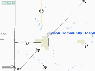
Gibson Community Hospital Heliport |
Location
& QuickFacts
|
FAA
Information Effective: |
2007-12-20 |
|
Airport
Identifier: |
9IS8 |
|
Airport
Status: |
Operational |
|
Longitude/Latitude: |
088-22-07.1930W/40-28-45.1220N
-88.368665/40.479201 (Estimated) |
|
Elevation: |
782 ft / 238.35 m (Estimated) |
|
Land: |
2 acres |
|
From
nearest city: |
0 nautical miles N of Gibson City, IL |
|
Location: |
Ford County, IL |
|
Magnetic Variation: |
00W (1985) |
Owner
& Manager
|
Ownership: |
Privately
owned |
|
Owner: |
Gibson Community Hospital |
|
Address: |
1120 N Melvin St
Gibson City, IL 60936 |
|
Phone
number: |
217-784-4251 |
|
Manager: |
Terry Thompson |
|
Address: |
1120 N Melvin St
Gibson, IL 60936 |
|
Phone number: |
217-784-4251 |
Airport Operations and Facilities
|
Airport
Use: |
Private
MEDICAL USE. |
|
Wind
indicator: |
Yes |
|
Segmented Circle: |
No |
|
Control
Tower: |
No |
|
Sectional chart: |
Chicago |
|
Region: |
AGL - Great Lakes |
|
Boundary
ARTCC: |
ZAU - Chicago |
|
Tie-in
FSS: |
STL - Saint Louis |
|
FSS
Toll Free: |
1-800-WX-BRIEF |
|
Runway Information
Helipad H1
|
Dimension: |
60
x 20 ft / 18.3 x 6.1 m |
|
Surface: |
ASPH, |
|
|
Runway H1 |
Runway |
|
Traffic
Pattern: |
Left |
Left |
|
Radio Navigation
Aids
|
ID |
Type |
Name |
Ch |
Freq |
Var |
Dist |
|
HMJ |
NDB |
Homer |
|
281.00 |
01E |
33.2 nm |
|
AAA |
NDB |
Abraham |
|
329.00 |
00E |
48.4 nm |
|
RBS |
VOR/DME |
Roberts |
115X |
116.80 |
02E |
11.2 nm |
|
BMI |
VOR/DME |
Bloomington |
019X |
108.20 |
03E |
25.7 nm |
|
PNT |
VOR/DME |
Pontiac |
033X |
109.60 |
03E |
26.4 nm |
|
IKK |
VOR/DME |
Kankakee |
053X |
111.60 |
00E |
42.9 nm |
|
CMI |
VORTAC |
Champaign |
037X |
110.00 |
03E |
27.1 nm |
|
DNV |
VORTAC |
Danville |
047X |
111.00 |
02E |
38.8 nm |
|
DEC |
VORTAC |
Decatur |
119X |
117.20 |
03E |
49.9 nm |
Remarks
- PRVDD
ALL OPNS ARE FM 306 DEG TO 090 DEG; AREA IS MKD; WIND INDICATOR IS MNTD.
Gibson Community Hospital Heliport
Address:
Ford County, IL
Tel:
217-784-4251
Images
and information placed above are from
http://www.airport-data.com/airport/9IS8/
We
thank them for the data!
| General
Info |
| Country |
United
States |
| State |
ILLINOIS
|
| FAA ID |
9IS8 |
| Latitude |
40-28-45.122N
|
| Longitude |
088-22-07.193W
|
| Elevation |
782 feet
|
| Near City |
GIBSON
CITY |
We don't guarantee the information is fresh and accurate. The data may
be wrong or outdated.
For more up-to-date information please refer to other sources.
|
|


