|
|
Galesburg Municipal Airport |
Coordinates: 40°56â²17â³N 090°25â²52â³W / 40.93806°N 90.43111°W / 40.93806; -90.43111
| Galesburg Municipal Airport |
| IATA: GBG â ICAO: KGBG â FAA LID: GBG |
| Summary |
| Airport type |
Public |
| Owner |
City of Galesburg |
| Serves |
Galesburg, Illinois |
| Elevation AMSL |
764 ft / 233 m |
| Website |
ci.galesburg.il.us/airport/ |
| Runways |
| Direction |
Length |
Surface |
| ft |
m |
| 3/21 |
5,793 |
1,766 |
Asphalt |
| 10/28 |
3,601 |
1,098 |
Asphalt |
| Statistics (2005) |
| Aircraft operations |
14,000 |
| Source: Federal Aviation Administration |
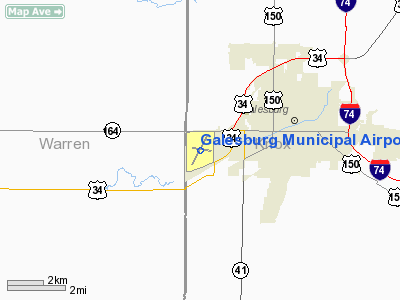
Galesburg Municipal Airport (IATA: GBG, ICAO: KGBG, FAA LID: GBG) is a city-owned public-use airport located three miles (5 km) southwest of the central business district of Galesburg, a city in Knox County, Illinois, United States..
Facilities and aircraft
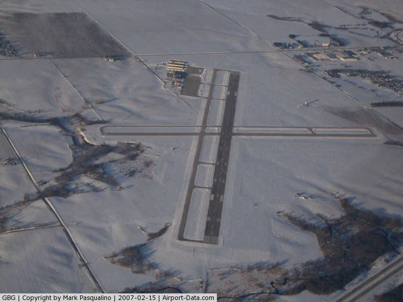
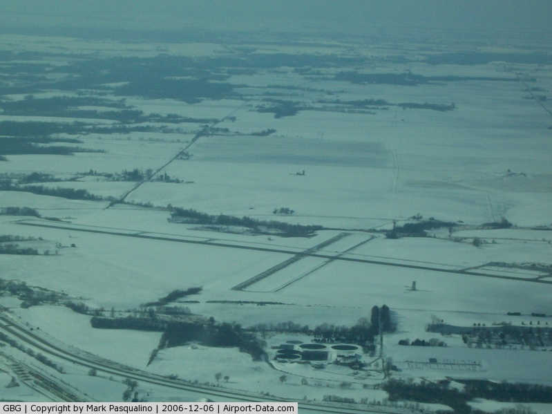
Galesburg Municipal Airport covers an area of 623 acres (252 ha) which contains two asphalt paved runways: 3/21 measuring 5,793 x 150 ft (1,766 x 46 m) and 10/28 measuring 3,601 x 100 ft (1,098 x 30 m). For the 12-month period ending December 31, 2005, the airport had 14,000 aircraft operations, an average of 38 per day: 79% general aviation, 18% air taxi and 3% military.
The above content comes from Wikipedia and is published under free licenses – click here to read more.
|
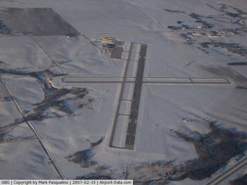 |
(Click on the photo to enlarge) |
|
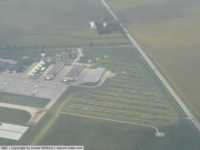
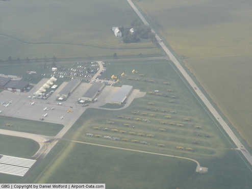 |
(Click on the photo to enlarge) |
|
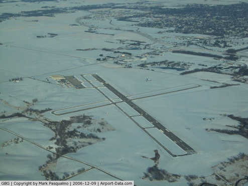 |
(Click on the photo to enlarge) |
|
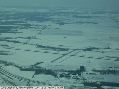 |
(Click on the photo to enlarge) |
Location
& QuickFacts
|
FAA
Information Effective: |
2007-12-20 |
|
Airport
Identifier: |
GBG |
|
Airport
Status: |
Operational |
|
Longitude/Latitude: |
090-25-52.0520W/40-56-16.8070N
-90.431126/40.938002 (Estimated) |
|
Elevation: |
764 ft / 232.87 m (Surveyed) |
|
Land: |
623 acres |
|
From
nearest city: |
3 nautical miles SW of Galesburg, IL |
|
Location: |
Knox County, IL |
|
Magnetic
Variation: |
03E (1980) |
Owner
& Manager
|
Ownership: |
Publicly
owned |
|
Owner: |
City Of Galesburg |
|
Address: |
Route 2
Galesburg, IL 61401 |
|
Phone
number: |
309-343-4181 |
|
Manager: |
Larry Cox |
|
Address: |
Route 2, Box 117
Galesburg, IL 61401 |
|
Phone
number: |
309-345-3623 |
Airport
Operations and Facilities
|
Airport
Use: |
Open
to public |
|
Wind
indicator: |
Yes |
|
Segmented Circle: |
Yes |
|
Control
Tower: |
No |
|
Lighting
Schedule: |
DUSK-DAWN
HIRL RY 03/21 & MIRL RY 10/28 PRESET ON LOW INTST NIGHT;
TO INCR INTST NIGHT & ACTVT HIRL RY 03/21 & MIRL
RY 10/28 DAY; MALSR RY 03; REIL & VASI RY 21 - CTAF. |
|
Beacon
Color: |
Clear-Green (lighted land airport) |
|
Landing
fee charge: |
No |
|
Sectional chart: |
Chicago |
|
Region: |
AGL - Great Lakes |
|
Boundary
ARTCC: |
ZAU - Chicago |
|
Tie-in
FSS: |
IKK - Kankakee |
|
FSS
on Airport: |
No |
|
FSS
Toll Free: |
1-800-WX-BRIEF |
|
NOTAMs
Facility: |
GBG (NOTAM-d service avaliable) |
|
Federal
Agreements: |
NGY |
Airport
Communications
|
CTAF: |
123.000 |
|
Unicom: |
123.000
|
Airport
Services
|
Fuel
available: |
100LLA
SELF SERVE 100LL AVAILABLE 24 HRS. |
|
Airframe
Repair: |
MAJOR |
|
Power
Plant Repair: |
MAJOR |
|
Bottled
Oxygen: |
NONE |
|
Bulk
Oxygen: |
LOW |
|
Runway Information
Runway 03/21
|
Dimension: |
5793
x 150 ft / 1765.7 x 45.7 m |
|
Surface: |
ASPH, Good Condition |
|
Surface
Treatment: |
Porous Friction Course |
|
Weight
Limit: |
Single wheel: 47000 lbs.
Dual wheel: 57000 lbs.
Dual tandem wheel: 85000 lbs. |
|
Edge
Lights: |
High |
|
|
Runway 03 |
Runway 21 |
|
Longitude: |
090-26-11.3610W |
090-25-35.7300W |
|
Latitude: |
40-55-51.2450N |
40-56-41.7040N |
|
Elevation: |
754.00 ft |
764.00 ft |
|
Alignment: |
28 |
127 |
|
ILS
Type: |
ILS |
|
|
Traffic
Pattern: |
Left |
Left |
|
Markings: |
Precision instrument, Good Condition |
Precision instrument, Good Condition |
|
Crossing
Height: |
0.00 ft |
43.00 ft |
|
VASI: |
|
4-box on left side |
|
Visual
Glide Angle: |
0.00° |
3.00° |
|
Approach
lights: |
MALSR |
|
|
Runway
End Identifier: |
|
Yes |
|
Centerline
Lights: |
No |
No |
|
Touchdown
Lights: |
No |
No |
|
Obstruction: |
, 50:1 slope to clear |
10 ft ant, 650.0 ft from runway, 240 ft left
of centerline, 45:1 slope to clear |
|
Runway 10/28
|
Dimension: |
3601
x 100 ft / 1097.6 x 30.5 m |
|
Surface: |
ASPH, Good Condition |
|
Weight
Limit: |
Single wheel: 30000 lbs.
Dual wheel: 40000 lbs. |
|
Edge
Lights: |
Medium |
|
|
Runway 10 |
Runway 28 |
|
Longitude: |
090-26-12.6700W |
090-25-26.6210W |
|
Latitude: |
40-56-20.7370N |
40-56-13.9450N |
|
Elevation: |
758.00 ft |
758.00 ft |
|
Alignment: |
101 |
127 |
|
Traffic
Pattern: |
Left |
Left |
|
Markings: |
Basic, Good Condition |
Basic, Good Condition |
|
Runway
End Identifier: |
No |
No |
|
Centerline
Lights: |
No |
No |
|
Touchdown
Lights: |
No |
No |
|
Obstruction: |
49 ft tree, 1472.0 ft from runway, 360 ft left
of centerline, 25:1 slope to clear |
62 ft tree, 1631.0 ft from runway, 100 ft left
of centerline, 23:1 slope to clear |
|
Radio Navigation
Aids
|
ID |
Type |
Name |
Ch |
Freq |
Var |
Dist |
|
JZY |
NDB |
Macomb |
|
251.00 |
01E |
25.9 nm |
|
EZI |
NDB |
Kewanee |
|
245.00 |
01E |
26.6 nm |
|
CTK |
NDB |
Canton |
|
236.00 |
02E |
27.6 nm |
|
PI |
NDB |
Tungg |
|
356.00 |
01E |
43.1 nm |
|
MPZ |
NDB |
Mount Pleasant |
|
212.00 |
02E |
49.0 nm |
|
GBG |
VOR/DME |
Galesburg |
035X |
109.80 |
03E |
0.2 nm |
|
DDD |
VOR/DME |
Port City |
112X |
116.50 |
01E |
41.5 nm |
|
MZV |
VORTAC |
Moline |
091X |
114.40 |
05E |
24.9 nm |
|
BRL |
VORTAC |
Burlington |
051X |
111.40 |
05E |
25.9 nm |
|
PIA |
VORTAC |
Peoria |
099X |
115.20 |
04E |
32.9 nm |
|
BDF |
VORTAC |
Bradford |
094X |
114.70 |
00E |
40.5 nm |
|
CVA |
VORTAC |
Davenport |
085X |
113.80 |
04E |
46.4 nm |
|
DVN |
VOT |
Davenport Municipal |
|
111.80 |
|
41.1 nm |
Based Aircraft
|
Aircraft
based on field: |
46 |
|
Single
Engine Airplanes: |
33 |
|
Multi
Engine Airplanes: |
5 |
|
Jet
Engine Airplanes: |
5 |
|
Helicopters: |
1 |
|
Ultralights: |
2 |
Operational Statistics
Time Period: 2005-01-01 - 2005-12-31
|
Aircraft
Operations: |
270/Week |
|
Air
Taxi: |
17.9% |
|
General
Aviation Local: |
25.0% |
|
General
Aviation Itinerant: |
53.9% |
|
Military: |
3.2% |
Galesburg Municipal Airport
Address:
Knox County, IL
Tel:
309-343-4181,
309-345-3623
Images
and information placed above are from
http://www.airport-data.com/airport/GBG/
We
thank them for the data!
| General
Info |
| Country |
United
States |
| State |
ILLINOIS
|
| FAA ID |
GBG |
| Latitude |
40-56-16.807N
|
| Longitude |
090-25-52.052W
|
| Elevation |
764 feet
|
| Near City |
GALESBURG
|
We don't guarantee the information is fresh and accurate. The data may
be wrong or outdated.
For more up-to-date information please refer to other sources.
|
|