 |
|
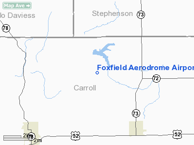
Foxfield Aerodrome Airport |
Location
& QuickFacts
|
FAA
Information Effective: |
2007-12-20 |
|
Airport
Identifier: |
6IL4 |
|
Airport
Status: |
Operational |
|
Longitude/Latitude: |
089-53-10.4400W/42-09-37.0800N
-89.886233/42.160300 (Estimated) |
|
Elevation: |
895 ft / 272.80 m (Estimated) |
|
Land: |
0 acres |
|
From
nearest city: |
4 nautical miles NW of Lanark, IL |
|
Location: |
Carroll County, IL |
|
Magnetic
Variation: |
00W (1995) |
Owner
& Manager
|
Ownership: |
Privately
owned |
|
Owner: |
Ed Midgley/ruth Littlefield |
|
Address: |
560 Lark Street
Geneva, IL 60134 |
|
Phone
number: |
815-493-2671 |
|
Manager: |
Ed Midgley |
|
Address: |
560 Lark Street
Geneva, IL 60134 |
|
Phone
number: |
630-232-2777 |
Airport
Operations and Facilities
|
Airport
Use: |
Private |
|
Wind
indicator: |
Yes |
|
Segmented Circle: |
No |
|
Control
Tower: |
No |
|
Sectional chart: |
Chicago |
|
Region: |
AGL - Great Lakes |
|
Boundary
ARTCC: |
ZAU - Chicago |
|
Tie-in
FSS: |
IKK - Kankakee |
|
FSS
on Airport: |
No |
|
FSS
Toll Free: |
1-800-WX-BRIEF |
|
Runway Information
Runway 17/35
|
Dimension: |
2200
x 80 ft / 670.6 x 24.4 m |
|
Surface: |
TURF, |
|
|
Runway 17 |
Runway 35 |
|
Traffic
Pattern: |
Left |
Left |
|
Obstruction: |
30 ft pline, 650.0 ft from runway |
10 ft road, 400.0 ft from runway |
|
Radio Navigation
Aids
|
ID |
Type |
Name |
Ch |
Freq |
Var |
Dist |
|
FEP |
NDB |
Freeport |
|
335.00 |
00E |
14.3 nm |
|
BOZ |
NDB |
Whiteside |
|
254.00 |
01E |
27.4 nm |
|
CWI |
NDB |
Clinton |
|
377.00 |
01E |
28.0 nm |
|
OQW |
NDB |
Maquoketa |
|
386.00 |
02E |
38.7 nm |
|
PVB |
NDB |
Platteville |
|
203.00 |
01E |
40.0 nm |
|
MRJ |
NDB |
Mineral Point |
|
365.00 |
00W |
46.3 nm |
|
JVL |
NDB |
Janesville |
|
375.00 |
03E |
46.4 nm |
|
PLL |
VOR/DME |
Polo |
049X |
111.20 |
03E |
19.9 nm |
|
RFD |
VOR/DME |
Rockford |
045X |
110.80 |
01E |
30.8 nm |
|
JVL |
VOR/DME |
Janesville |
090X |
114.30 |
03E |
42.1 nm |
|
CVA |
VORTAC |
Davenport |
085X |
113.80 |
04E |
38.1 nm |
|
DBQ |
VORTAC |
Dubuque |
105X |
115.80 |
04E |
39.4 nm |
|
DVN |
VOT |
Davenport Municipal |
|
111.80 |
|
45.5 nm |
Remarks
- PRVDD
MINIMUM 20:1 APCH CLNC OVER OBSTNS; 125 FT EACH SIDE OF RY & 200
FT OFF RY ENDS CLEARED OF OBSTNS; 60 FT EACH SIDE OF RY & 240 FT
OFF RY ENDS CLEARED & GRADED.
Based Aircraft
|
Aircraft
based on field: |
1 |
|
Single
Engine Airplanes: |
1 |
Foxfield Aerodrome Airport
Address:
Carroll County, IL
Tel:
815-493-2671,
630-232-2777
Images
and information placed above are from
http://www.airport-data.com/airport/6IL4/
We
thank them for the data!
| General
Info |
| Country |
United
States |
| State |
ILLINOIS
|
| FAA ID |
6IL4 |
| Latitude |
42-09-37.080N
|
| Longitude |
089-53-10.440W
|
| Elevation |
895 feet
|
| Near City |
LANARK
|
We don't guarantee the information is fresh and accurate. The data may
be wrong or outdated.
For more up-to-date information please refer to other sources.
|
|


