 |
|
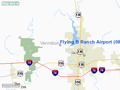
Location
& QuickFacts
|
FAA
Information Effective: |
2007-12-20 |
|
Airport
Identifier: |
0IL3 |
|
Airport
Status: |
Operational |
|
Longitude/Latitude: |
087-40-28.0790W/40-09-25.1300N
-87.674466/40.156981 (Estimated) |
|
Elevation: |
696 ft / 212.14 m (Estimated) |
|
Land: |
0 acres |
|
From
nearest city: |
3 nautical miles NW of Danville, IL |
|
Location: |
Vermilion County, IL |
|
Magnetic
Variation: |
01W (1985) |
Owner
& Manager
|
Ownership: |
Privately
owned |
|
Owner: |
Charles R. Boes |
|
Address: |
3711 Pershing
Danville, IL 61832 |
|
Phone
number: |
217-442-0709 |
|
Manager: |
Charles R. Boes |
|
Address: |
3711 Pershing
Danville, IL 61832 |
|
Phone
number: |
217-442-3302
OR 217-759-7672. |
Airport
Operations and Facilities
|
Airport Use: |
Private |
|
Wind
indicator: |
Yes |
|
Segmented
Circle: |
No |
|
Control
Tower: |
No |
|
Landing
fee charge: |
No |
|
Sectional
chart: |
Chicago |
|
Region: |
AGL - Great Lakes |
|
Boundary
ARTCC: |
ZAU - Chicago |
|
Tie-in
FSS: |
STL - Saint Louis |
|
FSS
on Airport: |
No |
|
FSS
Toll Free: |
1-800-WX-BRIEF |
Airport
Services
|
Airframe
Repair: |
NONE |
|
Power
Plant Repair: |
NONE |
|
Runway Information
Runway 18/36
|
Dimension: |
1800
x 200 ft / 548.6 x 61.0 m |
|
Surface: |
TURF, |
|
|
Runway 18 |
Runway 36 |
|
Traffic
Pattern: |
Right |
Left |
|
Radio Navigation
Aids
|
ID |
Type |
Name |
Ch |
Freq |
Var |
Dist |
|
HMJ |
NDB |
Homer |
|
281.00 |
01E |
15.0 nm |
|
PRG |
NDB |
Paris |
|
341.00 |
01E |
27.6 nm |
|
CFJ |
NDB |
Crawfordsville |
|
388.00 |
02W |
36.5 nm |
|
HU |
NDB |
Yinno |
|
245.00 |
02W |
48.0 nm |
|
TVX |
NDB |
Greencastle |
|
521.00 |
03W |
48.1 nm |
|
MT |
NDB |
Zebre |
|
347.00 |
00E |
48.7 nm |
|
RBS |
VOR/DME |
Roberts |
115X |
116.80 |
02E |
34.0 nm |
|
MTO |
VOR/DME |
Mattoon |
031X |
109.40 |
03E |
49.6 nm |
|
DNV |
VORTAC |
Danville |
047X |
111.00 |
02E |
9.8 nm |
|
CMI |
VORTAC |
Champaign |
037X |
110.00 |
03E |
28.6 nm |
|
BVT |
VORTAC |
Boiler |
098X |
115.10 |
01E |
36.7 nm |
|
TTH |
VORTAC |
Terre Haute |
100X |
115.30 |
02E |
44.7 nm |
Remarks
- TWR
& PLINE E.
- WX
AVBL BY PHONE TO DEC FSS.
Flying B Ranch Airport
Address:
Vermilion County, IL
Tel:
217-442-0709,
217-442-3302, 217-759-7672
Images
and information placed above are from
http://www.airport-data.com/airport/0IL3/
We
thank them for the data!
| General
Info |
| Country |
United
States |
| State |
ILLINOIS
|
| FAA ID |
0IL3 |
| Latitude |
40-09-25.130N
|
| Longitude |
087-40-28.079W
|
| Elevation |
696 feet
|
| Near City |
DANVILLE
|
We don't guarantee the information is fresh and accurate. The data may
be wrong or outdated.
For more up-to-date information please refer to other sources.
|
|


