 |
|
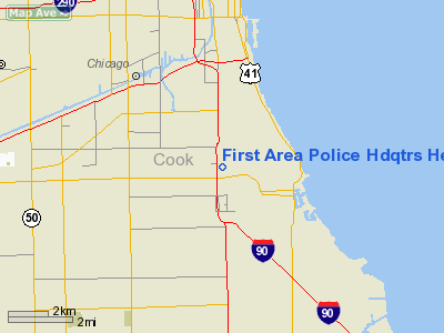
First Area Police Hdqtrs Heliport |
Location
& QuickFacts
|
FAA Information Effective: |
2007-12-20 |
|
Airport
Identifier: |
IL69 |
|
Airport
Status: |
Operational |
|
Longitude/Latitude: |
087-37-40.1800W/41-48-00.1210N
-87.627828/41.800034 (Estimated) |
|
Elevation: |
600 ft / 182.88 m (Estimated) |
|
Land: |
0 acres |
|
From
nearest city: |
0 nautical miles N of Chicago, IL |
|
Location: |
Cook County, IL |
|
Magnetic
Variation: |
01W (1985) |
Owner
& Manager
|
Ownership: |
Publicly
owned |
|
Owner: |
Chicago Police Dept. |
|
Address: |
|
|
Manager: |
Lt. John F. Tolley |
|
Address: |
5219 S. Wentworth Ave
Chicago, ILL 60609 |
|
Phone
number: |
312-744-6278 |
Airport
Operations and Facilities
|
Airport Use: |
Private |
|
Wind
indicator: |
Yes |
|
Segmented
Circle: |
No |
|
Control
Tower: |
No |
|
Landing
fee charge: |
No |
|
Sectional
chart: |
Chicago |
|
Region: |
AGL - Great Lakes |
|
Boundary
ARTCC: |
ZAU - Chicago |
|
Tie-in
FSS: |
IKK - Kankakee |
|
FSS
on Airport: |
No |
|
FSS
Toll Free: |
1-800-WX-BRIEF |
Airport
Services
|
Airframe
Repair: |
NONE |
|
Power
Plant Repair: |
NONE |
|
Runway Information
Helipad H1
|
Dimension: |
75
x 75 ft / 22.9 x 22.9 m |
|
Surface: |
CONC, |
|
Edge
Lights: |
Low |
|
|
Runway H1 |
Runway |
|
Traffic
Pattern: |
Left |
Left |
|
Radio Navigation
Aids
|
ID |
Type |
Name |
Ch |
Freq |
Var |
Dist |
|
MX |
NDB |
Kedzi |
|
248.00 |
01W |
4.5 nm |
|
HK |
NDB |
Ermin |
|
332.00 |
01W |
10.5 nm |
|
ME |
NDB |
Deana |
|
350.00 |
00E |
20.5 nm |
|
MGC |
NDB |
Michigan City |
|
203.00 |
01W |
36.8 nm |
|
VP |
NDB |
Sedly |
|
212.00 |
02W |
39.7 nm |
|
IUL |
NDB |
La Porte |
|
356.00 |
03W |
42.5 nm |
|
DKB |
NDB |
Dekalb |
|
209.00 |
02W |
49.0 nm |
|
ORD |
VOR/DME |
Chicago O'hare |
086X |
113.90 |
02E |
16.8 nm |
|
OBK |
VOR/DME |
Northbrook |
077X |
113.00 |
02W |
29.2 nm |
|
DPA |
VOR/DME |
Dupage |
021X |
108.40 |
02E |
32.8 nm |
|
IKK |
VOR/DME |
Kankakee |
053X |
111.60 |
00E |
44.7 nm |
|
ENW |
VOR/DME |
Kenosha |
029X |
109.20 |
02W |
49.9 nm |
|
CGT |
VORTAC |
Chicago Heights |
089X |
114.20 |
02E |
17.6 nm |
|
EON |
VORTAC |
Peotone |
079X |
113.20 |
02E |
32.7 nm |
|
JOT |
VORTAC |
Joliet |
070X |
112.30 |
02E |
34.6 nm |
|
MDW |
VOT |
Chicago Midway |
|
111.00 |
|
5.6 nm |
|
ORD |
VOT |
Chicago O'hare Intl |
|
112.00 |
|
16.6 nm |
Remarks
- PAD
IS MARKED & LIGHTED.
- RESTRICTED
TO CHICAGO POLICE/FIRE HELICOPTERS ONLY.
- PPR
FROM AMGR FOR MILITARY ACFT CALL 312-744-6278.
- HELIPORT
CLSD INDEF.
First Area Police Hdqtrs Heliport
Address:
Cook County, IL
Tel:
312-744-6278
Images
and information placed above are from
http://www.airport-data.com/airport/IL69/
We
thank them for the data!
| General
Info |
| Country |
United
States |
| State |
ILLINOIS
|
| FAA ID |
IL69 |
| Latitude |
41-48-00.121N
|
| Longitude |
087-37-40.180W
|
| Elevation |
600 feet
|
| Near City |
CHICAGO
|
We don't guarantee the information is fresh and accurate. The data may
be wrong or outdated.
For more up-to-date information please refer to other sources.
|
|


