 |
|
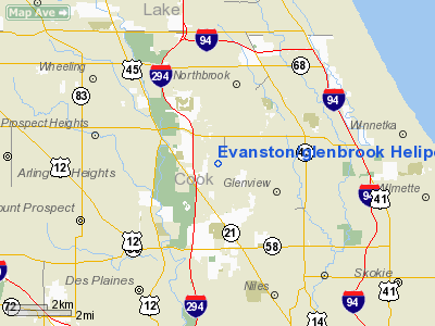
Evanston / Glenbrook Heliport |
Location
& QuickFacts
|
FAA
Information Effective: |
2007-12-20 |
|
Airport
Identifier: |
0IS2 |
|
Airport
Status: |
Operational |
|
Longitude/Latitude: |
087-51-09.2370W/42-05-35.0990N
-87.852566/42.093083 (Estimated) |
|
Elevation: |
678 ft / 206.65 m (Estimated) |
|
Land: |
0 acres |
|
From
nearest city: |
2 nautical miles W of Glenview, IL |
|
Location: |
Cook County, IL |
|
Magnetic
Variation: |
01W (1985) |
Owner
& Manager
|
Ownership: |
Privately
owned |
|
Owner: |
Evanston Hospital |
|
Address: |
2650 Ridge Ave
Evanston, IL 60201 |
|
Phone
number: |
708-570-2000 |
|
Manager: |
Raymond Grady |
|
Address: |
2100 Pfingsten Rd
Glenview, IL 60025 |
|
Phone
number: |
708-657-5600 |
Airport
Operations and Facilities
|
Airport
Use: |
Private |
|
Wind
indicator: |
Yes |
|
Segmented Circle: |
No |
|
Control
Tower: |
No |
|
Lighting
Schedule: |
DUSK-DAWN |
|
Landing
fee charge: |
No |
|
Sectional chart: |
Chicago |
|
Region: |
AGL - Great Lakes |
|
Boundary
ARTCC: |
ZAU - Chicago |
|
Tie-in
FSS: |
IKK - Kankakee |
|
FSS
Toll Free: |
1-800-WX-BRIEF |
|
Runway Information
Helipad H1
|
Dimension: |
60
x 60 ft / 18.3 x 18.3 m |
|
Surface: |
CONC, |
|
Edge
Lights: |
Low |
|
|
Runway H1 |
Runway |
|
Traffic
Pattern: |
Left |
Left |
|
Radio Navigation
Aids
|
ID |
Type |
Name |
Ch |
Freq |
Var |
Dist |
|
ME |
NDB |
Deana |
|
350.00 |
00E |
10.8 nm |
|
MX |
NDB |
Kedzi |
|
248.00 |
01W |
22.4 nm |
|
HK |
NDB |
Ermin |
|
332.00 |
01W |
22.5 nm |
|
RA |
NDB |
Paser |
|
206.00 |
00E |
35.5 nm |
|
DKB |
NDB |
Dekalb |
|
209.00 |
02W |
39.4 nm |
|
LVV |
NDB |
Lake Lawn |
|
404.00 |
00W |
49.1 nm |
|
GM |
NDB |
Teels |
|
242.00 |
02W |
49.8 nm |
|
ORD |
VOR/DME |
Chicago O'hare |
086X |
113.90 |
02E |
6.8 nm |
|
OBK |
VOR/DME |
Northbrook |
077X |
113.00 |
02W |
8.9 nm |
|
DPA |
VOR/DME |
Dupage |
021X |
108.40 |
02E |
25.4 nm |
|
ENW |
VOR/DME |
Kenosha |
029X |
109.20 |
02W |
30.6 nm |
|
HRK |
VOR/DME |
Horlick |
124X |
117.70 |
02W |
40.2 nm |
|
BUU |
VOR/DME |
Burbun |
092X |
114.50 |
01W |
41.0 nm |
|
CGT |
VORTAC |
Chicago Heights |
089X |
114.20 |
02E |
37.2 nm |
|
JOT |
VORTAC |
Joliet |
070X |
112.30 |
02E |
38.9 nm |
|
EON |
VORTAC |
Peotone |
079X |
113.20 |
02E |
49.6 nm |
|
ORD |
VOT |
Chicago O'hare Intl |
|
112.00 |
|
7.1 nm |
|
MDW |
VOT |
Chicago Midway |
|
111.00 |
|
19.0 nm |
Remarks
- PRVDD
INGRESS/EGRESS LIMITED TO 223 DEG TO 266 DEG USING THE PAD AS CENTER
OF COMPASS ROSE.
Evanston/glenbrook Heliport
Address:
Cook County, IL
Tel:
708-570-2000,
708-657-5600
Images
and information placed above are from
http://www.airport-data.com/airport/0IS2/
We
thank them for the data!
| General
Info |
| Country |
United
States |
| State |
ILLINOIS
|
| FAA ID |
0IS2 |
| Latitude |
42-05-35.099N
|
| Longitude |
087-51-09.237W
|
| Elevation |
678 feet
|
| Near City |
GLENVIEW
|
We don't guarantee the information is fresh and accurate. The data may
be wrong or outdated.
For more up-to-date information please refer to other sources.
|
|


