 |
|
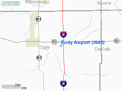
Location
& QuickFacts
|
FAA
Information Effective: |
2007-12-20 |
|
Airport
Identifier: |
IS40 |
|
Airport
Status: |
Operational |
|
Longitude/Latitude: |
089-01-38.0000W/42-05-40.0000N
-89.027222/42.094444 (Estimated) |
|
Elevation: |
785 ft / 239.27 m (Estimated) |
|
Land: |
0 acres |
|
From
nearest city: |
2 nautical miles W of Monroe Center, IL |
|
Location: |
Ogle County, IL |
|
Magnetic
Variation: |
01W (1995) |
Owner
& Manager
|
Ownership: |
Privately
owned |
|
Owner: |
John Eudy |
|
Address: |
5053 Kilbuck Rd
Monroe Center, IL 61052 |
|
Phone
number: |
815-393-3250 |
|
Manager: |
John Eudy |
|
Address: |
5053 Kilbuck Rd
Monroe Centeril, IL 61052 |
|
Phone
number: |
815-393-3250 |
Airport
Operations and Facilities
|
Airport
Use: |
Private |
|
Wind
indicator: |
Yes |
|
Segmented Circle: |
No |
|
Control
Tower: |
No |
|
Sectional chart: |
Chicago |
|
Region: |
AGL - Great Lakes |
|
Boundary
ARTCC: |
ZAU - Chicago |
|
Tie-in
FSS: |
IKK - Kankakee |
|
FSS
Toll Free: |
1-800-WX-BRIEF |
|
Runway Information
Runway 09/27
|
Dimension: |
2235
x 60 ft / 681.2 x 18.3 m |
|
Surface: |
TURF, |
|
|
Runway 09 |
Runway 27 |
|
Traffic
Pattern: |
Left |
Left |
|
Radio Navigation
Aids
|
ID |
Type |
Name |
Ch |
Freq |
Var |
Dist |
|
DKB |
NDB |
Dekalb |
|
209.00 |
02W |
17.2 nm |
|
FEP |
NDB |
Freeport |
|
335.00 |
00E |
26.5 nm |
|
JVL |
NDB |
Janesville |
|
375.00 |
03E |
31.3 nm |
|
BOZ |
NDB |
Whiteside |
|
254.00 |
01E |
41.0 nm |
|
LVV |
NDB |
Lake Lawn |
|
404.00 |
00W |
41.1 nm |
|
OIX |
NDB |
Ottawa |
|
266.00 |
01E |
44.7 nm |
|
VYS |
NDB |
Valley |
|
230.00 |
00W |
44.8 nm |
|
ME |
NDB |
Deana |
|
350.00 |
00E |
45.3 nm |
|
RFD |
VOR/DME |
Rockford |
045X |
110.80 |
01E |
11.0 nm |
|
PLL |
VOR/DME |
Polo |
049X |
111.20 |
03E |
23.5 nm |
|
JVL |
VOR/DME |
Janesville |
090X |
114.30 |
03E |
28.1 nm |
|
DPA |
VOR/DME |
Dupage |
021X |
108.40 |
02E |
32.6 nm |
|
BUU |
VOR/DME |
Burbun |
092X |
114.50 |
01W |
48.1 nm |
|
OBK |
VOR/DME |
Northbrook |
077X |
113.00 |
02W |
48.5 nm |
|
JOT |
VORTAC |
Joliet |
070X |
112.30 |
02E |
45.8 nm |
Remarks
- PRVDD
ARPT MEETS IDOT DIV OF AERONAUTICS MIN REQ.
Based Aircraft
|
Aircraft
based on field: |
2 |
|
Single
Engine Airplanes: |
2 |
Eudy Airport
Address:
Ogle County, IL
Tel:
815-393-3250
Images
and information placed above are from
http://www.airport-data.com/airport/IS40/
We
thank them for the data!
| General
Info |
| Country |
United
States |
| State |
ILLINOIS
|
| FAA ID |
IS40 |
| Latitude |
42-05-40.000N
|
| Longitude |
089-01-38.000W
|
| Elevation |
785 feet
|
| Near City |
MONROE
CENTER |
We don't guarantee the information is fresh and accurate. The data may
be wrong or outdated.
For more up-to-date information please refer to other sources.
|
|


