 |
|
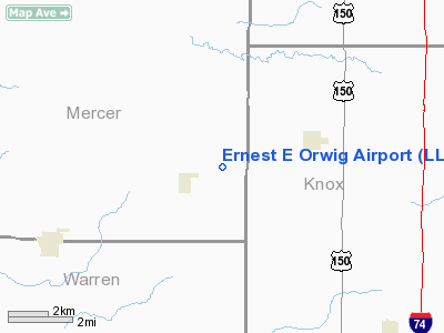
Location
& QuickFacts
|
FAA
Information Effective: |
2007-12-20 |
|
Airport
Identifier: |
LL18 |
|
Airport
Status: |
Operational |
|
Longitude/Latitude: |
090-27-10.4710W/41-05-50.1320N
-90.452909/41.097259 (Estimated) |
|
Elevation: |
790 ft / 240.79 m (Estimated) |
|
Land: |
0 acres |
|
From
nearest city: |
1 nautical miles NE of North Henderson, IL |
|
Location: |
Mercer County, IL |
|
Magnetic
Variation: |
02E (1985) |
Owner
& Manager
|
Ownership: |
Privately
owned |
|
Owner: |
Mrs. Ernest E. Orwig |
|
Address: |
North Henderson, IL 61466 |
|
Phone
number: |
309-464-5319 |
|
Manager: |
Russell Orwig |
|
Address: |
Rr 1
North Henderson, IL |
Airport
Operations and Facilities
|
Airport Use: |
Private |
|
Wind
indicator: |
No |
|
Segmented
Circle: |
No |
|
Control
Tower: |
No |
|
Landing
fee charge: |
No |
|
Sectional
chart: |
Chicago |
|
Region: |
AGL - Great Lakes |
|
Boundary
ARTCC: |
ZAU - Chicago |
|
Tie-in
FSS: |
IKK - Kankakee |
|
FSS
on Airport: |
No |
|
FSS
Toll Free: |
1-800-WX-BRIEF |
Airport
Services
|
Airframe
Repair: |
NONE |
|
Power
Plant Repair: |
NONE |
|
Runway Information
Runway E/W
|
Dimension: |
2200
x 66 ft / 670.6 x 20.1 m |
|
Surface: |
TURF, |
|
|
Runway E |
Runway W |
|
Traffic
Pattern: |
Left |
Left |
|
Obstruction: |
50 ft plines-m |
|
|
Radio Navigation
Aids
|
ID |
Type |
Name |
Ch |
Freq |
Var |
Dist |
|
EZI |
NDB |
Kewanee |
|
245.00 |
01E |
23.2 nm |
|
JZY |
NDB |
Macomb |
|
251.00 |
01E |
35.1 nm |
|
CTK |
NDB |
Canton |
|
236.00 |
02E |
36.2 nm |
|
CWI |
NDB |
Clinton |
|
377.00 |
01E |
44.3 nm |
|
BOZ |
NDB |
Whiteside |
|
254.00 |
01E |
47.6 nm |
|
MPZ |
NDB |
Mount Pleasant |
|
212.00 |
02E |
48.8 nm |
|
PI |
NDB |
Tungg |
|
356.00 |
01E |
49.0 nm |
|
GBG |
VOR/DME |
Galesburg |
035X |
109.80 |
03E |
9.6 nm |
|
DDD |
VOR/DME |
Port City |
112X |
116.50 |
01E |
35.4 nm |
|
MZV |
VORTAC |
Moline |
091X |
114.40 |
05E |
15.8 nm |
|
BRL |
VORTAC |
Burlington |
051X |
111.40 |
05E |
31.1 nm |
|
CVA |
VORTAC |
Davenport |
085X |
113.80 |
04E |
36.8 nm |
|
PIA |
VORTAC |
Peoria |
099X |
115.20 |
04E |
39.1 nm |
|
BDF |
VORTAC |
Bradford |
094X |
114.70 |
00E |
39.3 nm |
|
DVN |
VOT |
Davenport Municipal |
|
111.80 |
|
31.5 nm |
Remarks
Based
Aircraft
|
Aircraft
based on field: |
2 |
|
Single
Engine Airplanes: |
2 |
Ernest E Orwig Airport
Address:
Mercer County, IL
Tel:
309-464-5319
Images
and information placed above are from
http://www.airport-data.com/airport/LL18/
We
thank them for the data!
| General
Info |
| Country |
United
States |
| State |
ILLINOIS
|
| FAA ID |
LL18 |
| Latitude |
41-05-50.132N
|
| Longitude |
090-27-10.471W
|
| Elevation |
790 feet
|
| Near City |
NORTH
HENDERSON |
We don't guarantee the information is fresh and accurate. The data may
be wrong or outdated.
For more up-to-date information please refer to other sources.
|
|


