 |
|
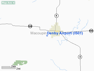
Location
& QuickFacts
|
FAA
Information Effective: |
2007-07-05 |
|
Airport
Identifier: |
IS01 |
|
Airport
Status: |
Operational |
|
Longitude/Latitude: |
089-54-14.3610W/39-16-08.1700N
-89.903989/39.268936 (Estimated) |
|
Elevation: |
620 ft / 188.98 m (Estimated) |
|
Land: |
0 acres |
|
From
nearest city: |
1 nautical miles W of Carlinville, IL |
|
Location: |
Macoupin County, IL |
|
Magnetic Variation: |
01E (1985) |
Owner & Manager
|
Ownership: |
Privately owned |
|
Owner: |
James & Wm Denby |
|
Address: |
Rr 2
Carlinville, IL 62626 |
|
Phone number: |
217-854-3412 |
|
Manager: |
James Denby |
|
Address: |
Rr 2
Carlinville, IL 62626 |
|
Phone number: |
217-854-3412 |
Airport
Operations and Facilities
|
Airport
Use: |
Private |
|
Wind
indicator: |
Yes |
|
Segmented Circle: |
No |
|
Control
Tower: |
No |
|
Landing
fee charge: |
No |
|
Sectional chart: |
St Louis |
|
Region: |
AGL - Great Lakes |
|
Boundary
ARTCC: |
ZKC - Kansas City |
|
Tie-in
FSS: |
STL - Saint Louis |
|
FSS
on Airport: |
No |
|
FSS
Phone: |
636-536-2980 |
|
FSS
Toll Free: |
1-800-WX-BRIEF |
|
Runway Information
Runway 18/36
|
Dimension: |
2640
x 80 ft / 804.7 x 24.4 m |
|
Surface: |
TRTD-DIRT, |
|
|
Runway 18 |
Runway 36 |
|
Traffic
Pattern: |
Left |
Left |
|
Radio Navigation
Aids
|
ID |
Type |
Name |
Ch |
Freq |
Var |
Dist |
|
LTD |
NDB |
Litchfield |
|
371.00 |
01E |
12.3 nm |
|
CVM |
NDB |
Civic Memorial |
|
263.00 |
02E |
23.7 nm |
|
SP |
NDB |
Huskk |
|
382.00 |
01W |
31.0 nm |
|
TAZ |
NDB |
Taylorville |
|
395.00 |
00E |
31.4 nm |
|
LM |
NDB |
Oblio |
|
338.00 |
00E |
38.8 nm |
|
LQ |
NDB |
Licol |
|
375.00 |
01W |
41.1 nm |
|
PPQ |
NDB |
Pittsfield |
|
344.00 |
02E |
46.5 nm |
|
BL |
NDB |
Belleville |
|
362.00 |
02E |
48.8 nm |
|
SYZ |
NDB |
Shelbyville |
|
365.00 |
01E |
50.0 nm |
|
SKE |
TACAN |
Scott |
059X |
|
02E |
43.6 nm |
|
IJX |
VOR/DME |
Jacksonville |
023X |
108.60 |
02E |
34.2 nm |
|
CSX |
VOR/DME |
Cardinal |
111Y |
116.45 |
00E |
37.7 nm |
|
TOY |
VORTAC |
Troy |
107X |
116.00 |
04E |
31.9 nm |
|
SPI |
VORTAC |
Spinner |
74X |
112.70 |
01W |
35.9 nm |
|
VLA |
VORTAC |
Vandalia |
090X |
114.30 |
04E |
36.1 nm |
|
STL |
VORTAC |
St Louis |
121X |
117.40 |
01E |
36.5 nm |
|
CAP |
VORTAC |
Capital |
074X |
112.70 |
04E |
39.6 nm |
|
STL |
VOT |
St Louis Lambert |
|
111.00 |
|
37.9 nm |
Based
Aircraft
|
Aircraft
based on field: |
3 |
|
Single
Engine Airplanes: |
2 |
|
Helicopters: |
1 |
Denby Airport
Address:
Macoupin County, IL
Tel:
217-854-3412
Images
and information placed above are from
http://www.airport-data.com/airport/IS01/
We
thank them for the data!
| General
Info |
| Country |
United
States |
| State |
ILLINOIS
|
| FAA ID |
IS01 |
| Latitude |
39-16-08.170N
|
| Longitude |
089-54-14.361W
|
| Elevation |
620 feet
|
| Near City |
CARLINVILLE
|
We don't guarantee the information is fresh and accurate. The data may
be wrong or outdated.
For more up-to-date information please refer to other sources.
|
|


