 |
|
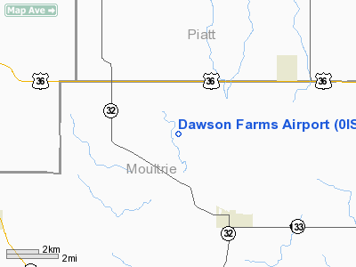
Location
& QuickFacts
|
FAA
Information Effective: |
2007-07-05 |
|
Airport
Identifier: |
0IS4 |
|
Airport
Status: |
Operational |
|
Longitude/Latitude: |
088-40-17.2390W/39-45-45.1240N
-88.671455/39.762534 (Estimated) |
|
Elevation: |
670 ft / 204.22 m (Estimated) |
|
Land: |
5 acres |
|
From
nearest city: |
3 nautical miles NW of Lovington, IL |
|
Location: |
Moultrie County, IL |
|
Magnetic Variation: |
00E (1985) |
Owner
& Manager
|
Ownership: |
Privately
owned |
|
Owner: |
Kevin Dawson |
|
Address: |
4200 South Lake St
Decatur, IL 62521-8439 |
|
Phone
number: |
217-873-4354 |
|
Manager: |
Kevin Dawson |
|
Address: |
4200 South Lake St
Decatur, IL 62521-8439 |
|
Phone number: |
217-873-4354 |
Airport Operations and Facilities
|
Airport
Use: |
Private |
|
Wind
indicator: |
Yes |
|
Segmented Circle: |
No |
|
Control
Tower: |
No |
|
Sectional chart: |
St Louis |
|
Region: |
AGL - Great Lakes |
|
Boundary
ARTCC: |
ZKC - Kansas City |
|
Tie-in
FSS: |
STL - Saint Louis |
|
FSS
on Airport: |
No |
|
FSS
Phone: |
636-536-2980 |
|
FSS
Toll Free: |
1-800-WX-BRIEF |
|
Runway Information
Runway 18/36
|
Dimension: |
2415
x 60 ft / 736.1 x 18.3 m |
|
Surface: |
TURF, |
|
|
Runway 18 |
Runway 36 |
|
Traffic
Pattern: |
Left |
Left |
|
Radio Navigation
Aids
|
ID |
Type |
Name |
Ch |
Freq |
Var |
Dist |
|
SYZ |
NDB |
Shelbyville |
|
365.00 |
01E |
22.8 nm |
|
MT |
NDB |
Zebre |
|
347.00 |
00E |
30.0 nm |
|
TAZ |
NDB |
Taylorville |
|
395.00 |
00E |
33.1 nm |
|
HMJ |
NDB |
Homer |
|
281.00 |
01E |
36.7 nm |
|
AAA |
NDB |
Abraham |
|
329.00 |
00E |
38.9 nm |
|
CZB |
NDB |
Casey |
|
359.00 |
00E |
41.5 nm |
|
LQ |
NDB |
Licol |
|
375.00 |
01W |
43.9 nm |
|
PRG |
NDB |
Paris |
|
341.00 |
01E |
46.3 nm |
|
MTO |
VOR/DME |
Mattoon |
031X |
109.40 |
03E |
24.7 nm |
|
BMI |
VOR/DME |
Bloomington |
019X |
108.20 |
03E |
44.8 nm |
|
DEC |
VORTAC |
Decatur |
119X |
117.20 |
03E |
8.7 nm |
|
CMI |
VORTAC |
Champaign |
037X |
110.00 |
03E |
24.5 nm |
|
CAP |
VORTAC |
Capital |
074X |
112.70 |
04E |
44.7 nm |
|
VLA |
VORTAC |
Vandalia |
090X |
114.30 |
04E |
46.2 nm |
|
SPI |
VORTAC |
Spinner |
74X |
112.70 |
01W |
46.7 nm |
Based
Aircraft
|
Aircraft
based on field: |
2 |
|
Single
Engine Airplanes: |
1 |
|
Multi
Engine Airplanes: |
1 |
Dawson Farms Airport
Address:
Moultrie County, IL
Tel:
217-873-4354
Images
and information placed above are from
http://www.airport-data.com/airport/0IS4/
We
thank them for the data!
| General
Info |
| Country |
United
States |
| State |
ILLINOIS
|
| FAA ID |
0IS4 |
| Latitude |
39-45-45.124N
|
| Longitude |
088-40-17.239W
|
| Elevation |
670 feet
|
| Near City |
LOVINGTON
|
We don't guarantee the information is fresh and accurate. The data may
be wrong or outdated.
For more up-to-date information please refer to other sources.
|
|


