 |
|
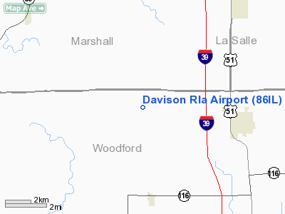
Location
& QuickFacts
|
FAA
Information Effective: |
2007-07-05 |
|
Airport
Identifier: |
86IL |
|
Airport
Status: |
Operational |
|
Longitude/Latitude: |
089-07-43.2920W/40-54-53.1220N
-89.128692/40.914756 (Estimated) |
|
Elevation: |
740 ft / 225.55 m (Estimated) |
|
Land: |
0 acres |
|
From
nearest city: |
4 nautical miles W of Minonk, IL |
|
Location: |
Woodford County, IL |
|
Magnetic Variation: |
00E (1985) |
Owner & Manager
|
Ownership: |
Privately owned |
|
Owner: |
John H. Davison |
|
Address: |
Rr 1
Minonk, IL 61760 |
|
Phone number: |
309-432-2195 |
|
Address: |
|
Airport Operations and Facilities
|
Airport Use: |
Private |
|
Wind indicator: |
No |
|
Segmented Circle: |
No |
|
Control Tower: |
No |
|
Landing fee charge: |
No |
|
Sectional chart: |
Chicago |
|
Region: |
AGL - Great Lakes |
|
Boundary ARTCC: |
ZAU - Chicago |
|
Tie-in FSS: |
IKK - Kankakee |
|
FSS on Airport: |
No |
|
FSS Toll Free: |
1-800-WX-BRIEF |
Airport Services
|
Airframe
Repair: |
NONE |
|
Power
Plant Repair: |
NONE |
|
Runway Information
Runway 18/36
|
Dimension: |
2200
x 70 ft / 670.6 x 21.3 m |
|
Surface: |
TURF, |
|
|
Runway 18 |
Runway 36 |
|
Traffic
Pattern: |
Left |
Left |
|
Obstruction: |
|
20 ft pline, 400.0 ft from runway |
|
Radio Navigation
Aids
|
ID |
Type |
Name |
Ch |
Freq |
Var |
Dist |
|
VYS |
NDB |
Valley |
|
230.00 |
00W |
26.5 nm |
|
PI |
NDB |
Tungg |
|
356.00 |
01E |
28.1 nm |
|
OIX |
NDB |
Ottawa |
|
266.00 |
01E |
29.6 nm |
|
EZI |
NDB |
Kewanee |
|
245.00 |
01E |
41.4 nm |
|
AAA |
NDB |
Abraham |
|
329.00 |
00E |
46.4 nm |
|
CTK |
NDB |
Canton |
|
236.00 |
02E |
48.0 nm |
|
PNT |
VOR/DME |
Pontiac |
033X |
109.60 |
03E |
18.8 nm |
|
BMI |
VOR/DME |
Bloomington |
019X |
108.20 |
03E |
27.6 nm |
|
RBS |
VOR/DME |
Roberts |
115X |
116.80 |
02E |
48.3 nm |
|
BDF |
VORTAC |
Bradford |
094X |
114.70 |
00E |
25.5 nm |
|
PIA |
VORTAC |
Peoria |
099X |
115.20 |
04E |
33.3 nm |
Remarks
Based
Aircraft
|
Aircraft
based on field: |
1 |
|
Single
Engine Airplanes: |
1 |
Davison Rla Airport
Address:
Woodford County, IL
Tel:
309-432-2195
Images
and information placed above are from
http://www.airport-data.com/airport/86IL/
We
thank them for the data!
| General
Info |
| Country |
United
States |
| State |
ILLINOIS
|
| FAA ID |
86IL |
| Latitude |
40-54-53.122N
|
| Longitude |
089-07-43.292W
|
| Elevation |
740 feet
|
| Near City |
MINONK
|
We don't guarantee the information is fresh and accurate. The data may
be wrong or outdated.
For more up-to-date information please refer to other sources.
|
|


