 |
|
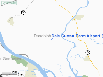
Location
& QuickFacts
|
FAA
Information Effective: |
2007-07-05 |
|
Airport
Identifier: |
37LL |
|
Airport
Status: |
Operational |
|
Longitude/Latitude: |
089-59-49.3950W/38-02-52.1860N
-89.997054/38.047829 (Estimated) |
|
Elevation: |
615 ft / 187.45 m (Estimated) |
|
Land: |
0 acres |
|
From
nearest city: |
3 nautical miles SE of Modoc, IL |
|
Location: |
Randolph County, IL |
|
Magnetic Variation: |
02E (1985) |
Owner & Manager
|
Ownership: |
Privately owned |
|
Owner: |
Dale Curten |
|
Address: |
4366 Modoc Road
Evansville, IL 62242 |
|
Phone number: |
618-284-6689 |
|
Address: |
|
Airport
Operations and Facilities
|
Airport
Use: |
Private |
|
Wind
indicator: |
No |
|
Segmented Circle: |
No |
|
Control
Tower: |
No |
|
Landing
fee charge: |
No |
|
Sectional chart: |
St Louis |
|
Region: |
AGL - Great Lakes |
|
Boundary
ARTCC: |
ZKC - Kansas City |
|
Tie-in
FSS: |
COU - Columbia |
|
FSS
on Airport: |
No |
|
FSS
Toll Free: |
1-800-WX-BRIEF |
|
Runway Information
Runway 06/24
|
Dimension: |
1750
x 70 ft / 533.4 x 21.3 m |
|
Surface: |
TURF, |
|
|
Runway 06 |
Runway 24 |
|
Traffic
Pattern: |
Right |
Left |
|
Radio Navigation
Aids
|
ID |
Type |
Name |
Ch |
Freq |
Var |
Dist |
|
SAR |
NDB |
Sparta |
|
239.00 |
01E |
15.1 nm |
|
FES |
NDB |
Festus |
|
269.00 |
01E |
20.5 nm |
|
PRI |
NDB |
Perrine |
|
367.00 |
02E |
26.6 nm |
|
BL |
NDB |
Belleville |
|
362.00 |
02E |
27.5 nm |
|
PJY |
NDB |
Pinckneyville |
|
215.00 |
00E |
30.3 nm |
|
SKE |
TACAN |
Scott |
059X |
|
02E |
30.7 nm |
|
CSX |
VOR/DME |
Cardinal |
111Y |
116.45 |
00E |
45.7 nm |
|
MWA |
VOR/DME |
Marion |
041X |
110.40 |
04E |
50.0 nm |
|
FAM |
VORTAC |
Farmington |
104X |
115.70 |
01E |
25.2 nm |
|
TOY |
VORTAC |
Troy |
107X |
116.00 |
04E |
41.7 nm |
|
ENL |
VORTAC |
Centralia |
097X |
115.00 |
04E |
45.5 nm |
|
STL |
VOT |
St Louis Lambert |
|
111.00 |
|
45.5 nm |
|
SUS |
VOT |
Spirit Of St Louis |
|
112.20 |
|
48.1 nm |
Based
Aircraft
|
Aircraft
based on field: |
1 |
|
Single
Engine Airplanes: |
1 |
Dale Curten Farm Airport
Address:
Randolph County, IL
Tel:
618-284-6689
Images
and information placed above are from
http://www.airport-data.com/airport/37LL/
We
thank them for the data!
| General
Info |
| Country |
United
States |
| State |
ILLINOIS
|
| FAA ID |
37LL |
| Latitude |
38-02-52.186N
|
| Longitude |
089-59-49.395W
|
| Elevation |
615 feet
|
| Near City |
MODOC
|
We don't guarantee the information is fresh and accurate. The data may
be wrong or outdated.
For more up-to-date information please refer to other sources.
|
|


