 |
|
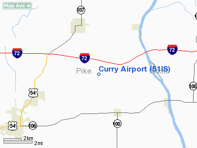
Location
& QuickFacts
|
FAA
Information Effective: |
2007-07-05 |
|
Airport
Identifier: |
51IS |
|
Airport
Status: |
Operational |
|
Longitude/Latitude: |
090-42-00.4580W/39-39-33.1700N
-90.700127/39.659214 (Estimated) |
|
Elevation: |
620 ft / 188.98 m (Estimated) |
|
Land: |
0 acres |
|
From
nearest city: |
4 nautical miles SE of Griggsville, IL |
|
Location: |
Pike County, IL |
|
Magnetic Variation: |
02E (1985) |
Owner & Manager
|
Ownership: |
Privately owned |
|
Owner: |
Kim Curry |
|
Address: |
Rr 1, Box 65
Griggsville, IL 62340 |
|
Phone number: |
217-833-2484 |
|
Address: |
|
Airport
Operations and Facilities
|
Airport
Use: |
Private
PERSONAL USE. |
|
Wind
indicator: |
Yes |
|
Segmented Circle: |
No |
|
Control
Tower: |
No |
|
Landing
fee charge: |
No |
|
Sectional chart: |
St Louis |
|
Region: |
AGL - Great Lakes |
|
Boundary
ARTCC: |
ZKC - Kansas City |
|
Tie-in
FSS: |
STL - Saint Louis |
|
FSS
Phone: |
636-536-2980 |
|
FSS
Toll Free: |
1-800-WX-BRIEF |
|
Runway Information
Runway 15/33
|
Dimension: |
1600
x 70 ft / 487.7 x 21.3 m |
|
Surface: |
TURF, |
|
|
Runway 15 |
Runway 33 |
|
Traffic
Pattern: |
Left |
Left |
|
Obstruction: |
20 ft pline, 300.0 ft from runway |
|
|
Radio Navigation
Aids
|
ID |
Type |
Name |
Ch |
Freq |
Var |
Dist |
|
PPQ |
NDB |
Pittsfield |
|
344.00 |
02E |
4.0 nm |
|
UI |
NDB |
Quincy |
|
293.00 |
02E |
29.0 nm |
|
HAE |
NDB |
Hannibal |
|
411.00 |
03E |
34.9 nm |
|
SP |
NDB |
Huskk |
|
382.00 |
01W |
44.0 nm |
|
IJX |
VOR/DME |
Jacksonville |
023X |
108.60 |
02E |
22.5 nm |
|
UIN |
VORTAC |
Quincy |
083X |
113.60 |
05E |
29.0 nm |
|
SPI |
VORTAC |
Spinner |
74X |
112.70 |
01W |
48.5 nm |
|
STL |
VORTAC |
St Louis |
121X |
117.40 |
01E |
49.1 nm |
Based
Aircraft
|
Aircraft
based on field: |
3 |
|
Single
Engine Airplanes: |
3 |
Curry Airport
Address:
Pike County, IL
Tel:
217-833-2484
Images
and information placed above are from
http://www.airport-data.com/airport/51IS/
We
thank them for the data!
| General
Info |
| Country |
United
States |
| State |
ILLINOIS
|
| FAA ID |
51IS |
| Latitude |
39-39-33.170N
|
| Longitude |
090-42-00.458W
|
| Elevation |
620 feet
|
| Near City |
GRIGGSVILLE
|
We don't guarantee the information is fresh and accurate. The data may
be wrong or outdated.
For more up-to-date information please refer to other sources.
|
|


