 |
|
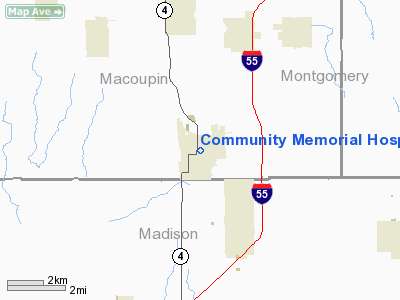
Community Memorial Hospital Heliport |
Location
& QuickFacts
|
FAA
Information Effective: |
2007-07-05 |
|
Airport
Identifier: |
IS21 |
|
Airport
Status: |
Operational |
|
Longitude/Latitude: |
089-47-20.3420W/39-00-47.1660N
-89.788984/39.013102 (Estimated) |
|
Elevation: |
622 ft / 189.59 m (Estimated) |
|
Land: |
0 acres |
|
From
nearest city: |
0 nautical miles N of Staunton, IL |
|
Location: |
Macoupin County, IL |
|
Magnetic Variation: |
01E (1985) |
Owner & Manager
|
Ownership: |
Privately owned |
|
Owner: |
Community Memorial Hospital |
|
Address: |
400 Caldwell
Staunton, IL 62088 |
|
Phone number: |
618-635-2200 |
|
Manager: |
Patrick B. Heise |
|
Address: |
400 Caldwell
Staunton, IL 62088 |
|
Phone number: |
618-635-2200 |
Airport
Operations and Facilities
|
Airport
Use: |
Private
MEDICAL USE. |
|
Wind
indicator: |
Yes |
|
Segmented Circle: |
No |
|
Control
Tower: |
No |
|
Sectional chart: |
St Louis |
|
Region: |
AGL - Great Lakes |
|
Boundary
ARTCC: |
ZKC - Kansas City |
|
Tie-in
FSS: |
STL - Saint Louis |
|
FSS
on Airport: |
No |
|
FSS
Phone: |
636-536-2980 |
|
FSS
Toll Free: |
1-800-WX-BRIEF |
|
Runway Information
Helipad H1
|
Dimension: |
48
x 48 ft / 14.6 x 14.6 m |
|
Surface: |
ASPH, |
|
|
Runway H1 |
Runway |
|
Traffic
Pattern: |
Left |
Left |
|
Radio Navigation
Aids
|
ID |
Type |
Name |
Ch |
Freq |
Var |
Dist |
|
LTD |
NDB |
Litchfield |
|
371.00 |
01E |
10.6 nm |
|
CVM |
NDB |
Civic Memorial |
|
263.00 |
02E |
14.5 nm |
|
BL |
NDB |
Belleville |
|
362.00 |
02E |
33.0 nm |
|
LM |
NDB |
Oblio |
|
338.00 |
00E |
34.5 nm |
|
TAZ |
NDB |
Taylorville |
|
395.00 |
00E |
38.2 nm |
|
SLO |
NDB |
Salem |
|
400.00 |
01W |
44.4 nm |
|
SP |
NDB |
Huskk |
|
382.00 |
01W |
45.7 nm |
|
SYZ |
NDB |
Shelbyville |
|
365.00 |
01E |
50.0 nm |
|
SKE |
TACAN |
Scott |
059X |
|
02E |
28.3 nm |
|
CSX |
VOR/DME |
Cardinal |
111Y |
116.45 |
00E |
31.0 nm |
|
TOY |
VORTAC |
Troy |
107X |
116.00 |
04E |
17.5 nm |
|
VLA |
VORTAC |
Vandalia |
090X |
114.30 |
04E |
29.6 nm |
|
STL |
VORTAC |
St Louis |
121X |
117.40 |
01E |
33.7 nm |
|
ENL |
VORTAC |
Centralia |
097X |
115.00 |
04E |
46.3 nm |
|
SPI |
VORTAC |
Spinner |
74X |
112.70 |
01W |
50.0 nm |
|
STL |
VOT |
St Louis Lambert |
|
111.00 |
|
31.2 nm |
|
SUS |
VOT |
Spirit Of St Louis |
|
112.20 |
|
45.6 nm |
Remarks
- (E111-2)
E111 CONT'D: OF ALL VEHICLES DURING HELICOPTER OPNS; TREES/PLINES LOCATED
ADJ TO LNDG AREA BE REMOVED/BURIED; HELIPORT BE USIND ONLY....
- (E111-3)
E111 CONT'D: IN LIFE-THREATENING EMERGENCY EVACUATION SITUATIONS; EACH
PILOT BE BRIEFED ON THE UNIQUE OPNL ASPECTS OF HELIPORT.
- E111:
PVDD ALL APCH/DEP RTE OPNS ARE CONDUCTED IN AN AREA FROM 350 DEGS CLKWS
TO 360 DEGS USING THE TOUCHDOWN PAD AS CNTR OF COMPASS ROSE; E111 CONT'D:
TKOF/LNDG AREA IS APROPLY MARKED; NON-OBSTRUCTING WIND INDCR IS MAINTD
ADJ TO TKOF/LNDG AREA; TKOF/LNDG AREA IS CLEARED....
Community Memorial Hospital Heliport
Address:
Macoupin County, IL
Tel:
618-635-2200
Images
and information placed above are from
http://www.airport-data.com/airport/IS21/
We
thank them for the data!
| General
Info |
| Country |
United
States |
| State |
ILLINOIS
|
| FAA ID |
IS21 |
| Latitude |
39-00-47.166N
|
| Longitude |
089-47-20.342W
|
| Elevation |
622 feet
|
| Near City |
STAUNTON
|
We don't guarantee the information is fresh and accurate. The data may
be wrong or outdated.
For more up-to-date information please refer to other sources.
|
|


