 |
|
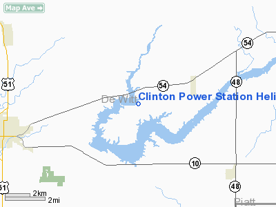
Clinton Power Station Heliport |
Location
& QuickFacts
|
FAA
Information Effective: |
2007-07-05 |
|
Airport
Identifier: |
II41 |
|
Airport
Status: |
Operational |
|
Longitude/Latitude: |
088-50-15.0000W/40-10-18.0000N
-88.837500/40.171667 (Estimated) |
|
Elevation: |
737 ft / 224.64 m (Estimated) |
|
Land: |
0 acres |
|
From
nearest city: |
7 nautical miles EN of Clinton, IL |
|
Location: |
De Witt County, IL |
|
Magnetic Variation: |
01W (2000) |
Owner
& Manager
|
Ownership: |
Privately
owned |
|
Owner: |
Amergen Energy Co Llc |
|
Address: |
Clinton Power Station, Po Box 678
Clinton, IL 61727 |
|
Phone
number: |
217-935-8881 |
|
Manager: |
Joe Ernst |
|
Address: |
Clinton Power Station, Po Box 678
Clinton, IL 61727 |
|
Phone number: |
217-935-8881 |
Airport Operations and Facilities
|
Airport
Use: |
Private |
|
Wind
indicator: |
Yes |
|
Segmented Circle: |
No |
|
Control
Tower: |
No |
|
Lighting
Schedule: |
PHONE REQ
FOR PERIMETER & FLOOD LGTS CALL 217-935-8881. |
|
Sectional chart: |
Chicago |
|
Region: |
AGL - Great Lakes |
|
Boundary
ARTCC: |
ZKC - Kansas City |
|
Tie-in
FSS: |
IKK - Kankakee |
|
FSS
Toll Free: |
1-800-WX-BRIEF |
|
Runway Information
Helipad H1
|
Dimension: |
50
x 50 ft / 15.2 x 15.2 m |
|
Surface: |
CONC, |
|
|
Runway H1 |
Runway |
|
Traffic
Pattern: |
Left |
Left |
|
Radio Navigation
Aids
|
ID |
Type |
Name |
Ch |
Freq |
Var |
Dist |
|
AAA |
NDB |
Abraham |
|
329.00 |
00E |
23.0 nm |
|
LQ |
NDB |
Licol |
|
375.00 |
01W |
38.5 nm |
|
HMJ |
NDB |
Homer |
|
281.00 |
01E |
41.6 nm |
|
PI |
NDB |
Tungg |
|
356.00 |
01E |
43.3 nm |
|
TAZ |
NDB |
Taylorville |
|
395.00 |
00E |
44.3 nm |
|
SYZ |
NDB |
Shelbyville |
|
365.00 |
01E |
46.0 nm |
|
SP |
NDB |
Huskk |
|
382.00 |
01W |
48.8 nm |
|
BMI |
VOR/DME |
Bloomington |
019X |
108.20 |
03E |
19.1 nm |
|
PNT |
VOR/DME |
Pontiac |
033X |
109.60 |
03E |
39.3 nm |
|
RBS |
VOR/DME |
Roberts |
115X |
116.80 |
02E |
39.5 nm |
|
MTO |
VOR/DME |
Mattoon |
031X |
109.40 |
03E |
48.9 nm |
|
DEC |
VORTAC |
Decatur |
119X |
117.20 |
03E |
26.1 nm |
|
CMI |
VORTAC |
Champaign |
037X |
110.00 |
03E |
27.1 nm |
|
CAP |
VORTAC |
Capital |
074X |
112.70 |
04E |
40.0 nm |
|
SPI |
VORTAC |
Spinner |
74X |
112.70 |
01W |
43.5 nm |
Remarks
- PRVDD
ALL APCH/DEP FM 135-145 & 225-235, AREA IS MKD, WIND INDICATOR MAINTAINED
AND COMPLY WITH FAR PART 91.126(B)(2).
Clinton Power Station Heliport
Address:
De Witt County, IL
Tel:
217-935-8881
Images
and information placed above are from
http://www.airport-data.com/airport/II41/
We
thank them for the data!
| General
Info |
| Country |
United
States |
| State |
ILLINOIS
|
| FAA ID |
II41 |
| Latitude |
40-10-18.000N
|
| Longitude |
088-50-15.000W
|
| Elevation |
737 feet
|
| Near City |
CLINTON
|
We don't guarantee the information is fresh and accurate. The data may
be wrong or outdated.
For more up-to-date information please refer to other sources.
|
|


