 |
|
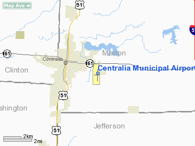
Centralia Municipal Airport |
|
|
Location
& QuickFacts
|
FAA
Information Effective: |
2007-07-05 |
|
Airport
Identifier: |
ENL |
|
Airport
Status: |
Operational |
|
Longitude/Latitude: |
089-05-28.0850W/38-30-54.3310N
-89.091135/38.515092 (Estimated) |
|
Elevation: |
534 ft / 162.76 m (Estimated) |
|
Land: |
314 acres |
|
From
nearest city: |
2 nautical miles SE of Centralia, IL |
|
Location: |
Marion County, IL |
|
Magnetic Variation: |
01W (2000) |
Owner
& Manager
|
Ownership: |
Publicly
owned |
|
Owner: |
City Of Centralia |
|
Address: |
222 South Poplar St.
Centralia, IL 62801 |
|
Phone number: |
618-533-7621 |
|
Manager: |
Leslie Erb |
|
Address: |
2331 E. Calumet
Centralia, IL 62801 |
|
Phone number: |
618-533-1698 |
Airport
Operations and Facilities
|
Airport
Use: |
Open
to public |
|
Wind
indicator: |
Yes |
|
Segmented Circle: |
No |
|
Control
Tower: |
No |
|
Lighting
Schedule: |
DUSK-DAWN
MIRL RY 09/27 & REIL RYS 09 & 27 ON REQUEST THRU
UNICOM. |
|
Beacon
Color: |
Clear-Green (lighted land airport) |
|
Landing
fee charge: |
No |
|
Sectional chart: |
St Louis |
|
Region: |
AGL - Great Lakes |
|
Boundary
ARTCC: |
ZKC - Kansas City |
|
Tie-in
FSS: |
STL - Saint Louis |
|
FSS
on Airport: |
No |
|
FSS
Phone: |
636-536-2980 |
|
FSS
Toll Free: |
1-800-WX-BRIEF |
|
NOTAMs
Facility: |
ENL (NOTAM-d service avaliable) |
|
Federal Agreements: |
NGY |
Airport Communications
|
CTAF: |
122.800 |
|
Unicom: |
122.800
|
Airport
Services
|
Fuel
available: |
100LLA |
|
Airframe
Repair: |
MINOR |
|
Power
Plant Repair: |
MINOR |
|
Bottled
Oxygen: |
NONE |
|
Bulk
Oxygen: |
NONE |
|
Runway Information
Runway 09/27
|
Dimension: |
3300
x 60 ft / 1005.8 x 18.3 m |
|
Surface: |
ASPH, Good Condition |
|
Weight
Limit: |
Single wheel: 12500 lbs. |
|
Edge
Lights: |
Medium |
|
|
Runway 09 |
Runway 27 |
|
Longitude: |
089-05-45.7490W |
089-05-04.2760W |
|
Latitude: |
38-30-54.7450N |
38-30-56.3637N |
|
Elevation: |
522.00 ft |
520.00 ft |
|
Alignment: |
87 |
127 |
|
Traffic
Pattern: |
Left |
Left |
|
Markings: |
Basic, Good Condition |
Basic, Good Condition |
|
Runway
End Identifier: |
Yes |
Yes |
|
Centerline
Lights: |
No |
No |
|
Touchdown
Lights: |
No |
No |
|
Obstruction: |
13 ft road, 470.0 ft from runway, 20:1 slope
to clear |
50 ft tree, 2000.0 ft from runway, 200 ft left
of centerline, 36:1 slope to clear |
|
Runway 18/36
|
Dimension: |
5001
x 75 ft / 1524.3 x 22.9 m |
|
Surface: |
ASPH, Fair Condition |
|
Weight
Limit: |
Single wheel: 30000 lbs.
Dual wheel: 40000 lbs. |
|
Edge
Lights: |
Medium |
|
|
Runway 18 |
Runway 36 |
|
Longitude: |
089-05-29.7581W |
089-05-30.4692W |
|
Latitude: |
38-31-18.2379N |
38-30-28.8091N |
|
Elevation: |
519.00 ft |
534.00 ft |
|
Alignment: |
127 |
127 |
|
Traffic
Pattern: |
Left |
Left |
|
Markings: |
Non-precision instrument, Fair Condition |
Non-precision instrument, Fair Condition |
|
Crossing
Height: |
25.00 ft |
25.00 ft |
|
VASI: |
2-box on left side |
2-box on left side |
|
Visual
Glide Angle: |
3.00° |
3.00° |
|
Runway
End Identifier: |
Yes |
Yes |
|
Centerline
Lights: |
No |
No |
|
Touchdown
Lights: |
No |
No |
|
Obstruction: |
69 ft tree, 1505.0 ft from runway, 216 ft left
of centerline, 18:1 slope to clear |
, 50:1 slope to clear |
|
Radio Navigation
Aids
|
ID |
Type |
Name |
Ch |
Freq |
Var |
Dist |
|
SLO |
NDB |
Salem |
|
400.00 |
01W |
9.7 nm |
|
FOA |
NDB |
Elm River |
|
353.00 |
00E |
31.4 nm |
|
BL |
NDB |
Belleville |
|
362.00 |
02E |
31.4 nm |
|
FWC |
NDB |
Wayne County |
|
257.00 |
01E |
33.1 nm |
|
PJY |
NDB |
Pinckneyville |
|
215.00 |
00E |
34.9 nm |
|
SAR |
NDB |
Sparta |
|
239.00 |
01E |
36.4 nm |
|
OLY |
NDB |
Olney |
|
272.00 |
00W |
44.8 nm |
|
LTD |
NDB |
Litchfield |
|
371.00 |
01E |
47.7 nm |
|
HSB |
NDB |
Harrisburg-raleigh |
|
230.00 |
00E |
49.5 nm |
|
SKE |
TACAN |
Scott |
059X |
|
02E |
35.8 nm |
|
VNN |
VOR/DME |
Mount Vernon |
085X |
113.80 |
02E |
16.2 nm |
|
MWA |
VOR/DME |
Marion |
041X |
110.40 |
04E |
45.9 nm |
|
SAM |
VOR/DME |
Samsville |
113X |
116.60 |
03E |
47.3 nm |
|
ENL |
VORTAC |
Centralia |
097X |
115.00 |
04E |
6.5 nm |
|
VLA |
VORTAC |
Vandalia |
090X |
114.30 |
04E |
34.9 nm |
|
BIB |
VORTAC |
Bible Grove |
027X |
109.00 |
03E |
37.5 nm |
|
TOY |
VORTAC |
Troy |
107X |
116.00 |
04E |
41.1 nm |
Based
Aircraft
|
Aircraft
based on field: |
30 |
|
Single
Engine Airplanes: |
28 |
|
Multi
Engine Airplanes: |
1 |
|
Ultralights: |
1 |
Operational Statistics
Time Period: 2003-06-30
- 2004-06-28
|
Aircraft
Operations: |
77/Day |
|
Air
Taxi: |
7.1% |
|
General
Aviation Local: |
78.4% |
|
General
Aviation Itinerant: |
14.3% |
|
Military: |
0.2% |
Centralia Municipal Airport
Address:
Marion County, IL
Tel:
618-533-7621, 618-533-1698
Images
and information placed above are from
http://www.airport-data.com/airport/ENL/
We
thank them for the data!
| General
Info |
| Country |
United
States |
| State |
ILLINOIS
|
| FAA ID |
ENL |
| Latitude |
38-30-53.245N
|
| Longitude |
089-05-31.838W
|
| Elevation |
534 feet
|
| Near City |
CENTRALIA
|
We don't guarantee the information is fresh and accurate. The data may
be wrong or outdated.
For more up-to-date information please refer to other sources.
|
|


