 |
|
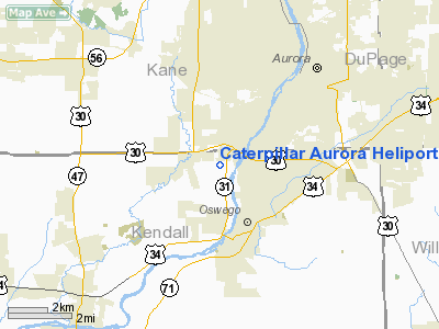
Caterpillar Aurora Heliport |
Location
& QuickFacts
|
FAA
Information Effective: |
2007-07-05 |
|
Airport
Identifier: |
IS74 |
|
Airport
Status: |
Operational |
|
Longitude/Latitude: |
088-21-33.2570W/41-43-01.1050N
-88.359238/41.716974 (Estimated) |
|
Elevation: |
660 ft / 201.17 m (Estimated) |
|
Land: |
0 acres |
|
From
nearest city: |
1 nautical miles NE of Montgomery, IL |
|
Location: |
Kendall County, IL |
|
Magnetic Variation: |
00W (1985) |
Owner & Manager
|
Ownership: |
Privately owned |
|
Owner: |
Caterpillar Inc |
|
Address: |
Po Box 348
Aurora, IL 60507 |
|
Phone number: |
708-859-5000 |
|
Address: |
|
Airport
Operations and Facilities
|
Airport
Use: |
Private |
|
Wind
indicator: |
Yes |
|
Segmented Circle: |
Yes |
|
Control
Tower: |
No |
|
Landing
fee charge: |
No |
|
Sectional chart: |
Chicago |
|
Region: |
AGL - Great Lakes |
|
Boundary
ARTCC: |
ZAU - Chicago |
|
Tie-in
FSS: |
IKK - Kankakee |
|
FSS
on Airport: |
No |
|
FSS
Toll Free: |
1-800-WX-BRIEF |
|
Runway Information
Helipad H1
|
Dimension: |
10
x 10 ft / 3.0 x 3.0 m |
|
Surface: |
CONC, |
|
|
Runway H1 |
Runway |
|
Traffic
Pattern: |
Left |
Left |
|
Radio Navigation
Aids
|
ID |
Type |
Name |
Ch |
Freq |
Var |
Dist |
|
DKB |
NDB |
Dekalb |
|
209.00 |
02W |
20.3 nm |
|
ME |
NDB |
Deana |
|
350.00 |
00E |
21.2 nm |
|
HK |
NDB |
Ermin |
|
332.00 |
01W |
23.5 nm |
|
MX |
NDB |
Kedzi |
|
248.00 |
01W |
30.1 nm |
|
OIX |
NDB |
Ottawa |
|
266.00 |
01E |
30.8 nm |
|
VYS |
NDB |
Valley |
|
230.00 |
00W |
41.6 nm |
|
DPA |
VOR/DME |
Dupage |
021X |
108.40 |
02E |
10.4 nm |
|
ORD |
VOR/DME |
Chicago O'hare |
086X |
113.90 |
02E |
26.0 nm |
|
OBK |
VOR/DME |
Northbrook |
077X |
113.00 |
02W |
35.4 nm |
|
IKK |
VOR/DME |
Kankakee |
053X |
111.60 |
00E |
44.9 nm |
|
RFD |
VOR/DME |
Rockford |
045X |
110.80 |
01E |
48.4 nm |
|
JOT |
VORTAC |
Joliet |
070X |
112.30 |
02E |
10.4 nm |
|
EON |
VORTAC |
Peotone |
079X |
113.20 |
02E |
37.1 nm |
|
CGT |
VORTAC |
Chicago Heights |
089X |
114.20 |
02E |
37.5 nm |
|
ORD |
VOT |
Chicago O'hare Intl |
|
112.00 |
|
25.8 nm |
|
MDW |
VOT |
Chicago Midway |
|
111.00 |
|
27.5 nm |
Remarks
- PROVIDED
ALL APCH/DEPARTURE ROUTE HELICOPTER OPERATIONS ARE CONDUCTED IN AN AREA
FROM 350 DEGS CLOCKWISE TO 100 DEGS USING TOUCHDOWN PAD AS THE CENTER
OF A COMPASS ROSE; TAKEOFF/LANDING AREA IS APPROPRIATELY MARKED, NON-OBSTRUCTING
WIND INDICATOR IS MAINTAINED ADJACENT TO TAKEOFF/LANDING AREA.
Caterpillar Aurora Heliport
Address:
Kendall County, IL
Tel:
708-859-5000
Images
and information placed above are from
http://www.airport-data.com/airport/IS74/
We
thank them for the data!
| General
Info |
| Country |
United
States |
| State |
ILLINOIS
|
| FAA ID |
IS74 |
| Latitude |
41-43-01.105N
|
| Longitude |
088-21-33.257W
|
| Elevation |
660 feet
|
| Near City |
MONTGOMERY
|
We don't guarantee the information is fresh and accurate. The data may
be wrong or outdated.
For more up-to-date information please refer to other sources.
|
|


