 |
|
Location
& QuickFacts
|
FAA
Information Effective: |
2007-07-05 |
|
Airport
Identifier: |
6IS1 |
|
Airport
Status: |
Operational |
|
Longitude/Latitude: |
088-15-08.2980W/42-12-45.0860N
-88.252305/42.212524 (Estimated) |
|
Elevation: |
830 ft / 252.98 m (Estimated) |
|
Land: |
4 acres |
|
From
nearest city: |
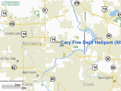
0 nautical miles N of Cary, IL |
|
Location: |
Mc Henry County, IL |
|
Magnetic Variation: |
01W (1990) |
Owner
& Manager
|
Ownership: |
Publicly
owned |
|
Owner: |
Cary Fire Protection District |
|
Address: |
400 Cary-algonquin Road
Cary, IL 60013 |
|
Phone
number: |
708-639-2121 |
|
Manager: |
Jeffrey C. Macko, Fire Chief |
|
Address: |
400 Cary-algonquin Road
Cary, IL 60013 |
|
Phone number: |
708-639-2121 |
Airport Operations and Facilities
|
Airport
Use: |
Private |
|
Segmented Circle: |
No |
|
Control
Tower: |
No |
|
Lighting
Schedule: |
PHONE REQ
FOR FLOODLIGHTS PHONE 708-639-2121. |
|
Sectional chart: |
Chicago |
|
Region: |
AGL - Great Lakes |
|
Boundary
ARTCC: |
ZAU - Chicago |
|
Tie-in
FSS: |
IKK - Kankakee |
|
FSS
Toll Free: |
1-800-WX-BRIEF |
|
Runway Information
Helipad H1
|
Dimension: |
100
x 100 ft / 30.5 x 30.5 m |
|
Surface: |
CONC, |
|
|
Runway H1 |
Runway |
|
Traffic
Pattern: |
Left |
Left |
|
Radio Navigation
Aids
|
ID |
Type |
Name |
Ch |
Freq |
Var |
Dist |
|
ME |
NDB |
Deana |
|
350.00 |
00E |
17.8 nm |
|
DKB |
NDB |
Dekalb |
|
209.00 |
02W |
26.3 nm |
|
RA |
NDB |
Paser |
|
206.00 |
00E |
32.3 nm |
|
LVV |
NDB |
Lake Lawn |
|
404.00 |
00W |
32.9 nm |
|
HK |
NDB |
Ermin |
|
332.00 |
01W |
35.0 nm |
|
MX |
NDB |
Kedzi |
|
248.00 |
01W |
37.9 nm |
|
JVL |
NDB |
Janesville |
|
375.00 |
03E |
42.6 nm |
|
GM |
NDB |
Teels |
|
242.00 |
02W |
42.9 nm |
|
OBK |
VOR/DME |
Northbrook |
077X |
113.00 |
02W |
13.4 nm |
|
DPA |
VOR/DME |
Dupage |
021X |
108.40 |
02E |
19.9 nm |
|
ORD |
VOR/DME |
Chicago O'hare |
086X |
113.90 |
02E |
20.6 nm |
|
ENW |
VOR/DME |
Kenosha |
029X |
109.20 |
02W |
27.2 nm |
|
BUU |
VOR/DME |
Burbun |
092X |
114.50 |
01W |
28.7 nm |
|
HRK |
VOR/DME |
Horlick |
124X |
117.70 |
02W |
38.3 nm |
|
RFD |
VOR/DME |
Rockford |
045X |
110.80 |
01E |
42.2 nm |
|
JVL |
VOR/DME |
Janesville |
090X |
114.30 |
03E |
43.2 nm |
|
JOT |
VORTAC |
Joliet |
070X |
112.30 |
02E |
40.1 nm |
|
ORD |
VOT |
Chicago O'hare Intl |
|
112.00 |
|
20.7 nm |
|
MDW |
VOT |
Chicago Midway |
|
111.00 |
|
34.0 nm |
|
MKE |
VOT |
Milwaukee |
|
109.00 |
|
46.9 nm |
Remarks
- PRVDD
LGT POLE NORTH SIDE OF LANDING AREA REMOVED; APCH/DEP OBSTNS 300-320
DEGS & FM 090-110 DEGS; TAKEOFF/LNDG AREA MARKED; NON-OBSTRUCTING
WIND INDICATOR MAINTAINED & UNAUTHORIZED PERSON BE RESTRICTED FM
TAKEOFF/LNDG AREA DURG OPNS BY USE OFNON-OBSTN SAFETY BARRIER.
Cary Fire Dept Heliport
Address:
Mc Henry County, IL
Tel:
708-639-2121
Images
and information placed above are from
http://www.airport-data.com/airport/6IS1/
We
thank them for the data!
| General
Info |
| Country |
United
States |
| State |
ILLINOIS
|
| FAA ID |
6IS1 |
| Latitude |
42-12-45.086N
|
| Longitude |
088-15-08.298W
|
| Elevation |
830 feet
|
| Near City |
CARY |
We don't guarantee the information is fresh and accurate. The data may
be wrong or outdated.
For more up-to-date information please refer to other sources.
|
|


