 |
|
|
|
|
|
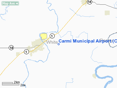
Location
& QuickFacts
|
FAA
Information Effective: |
2007-07-05 |
|
Airport
Identifier: |
CUL |
|
Airport
Status: |
Operational |
|
Longitude/Latitude: |
088-07-23.0200W/38-05-22.1250N
-88.123061/38.089479 (Estimated) |
|
Elevation: |
388 ft / 118.26 m (Surveyed) |
|
Land: |
187 acres |
|
From
nearest city: |
2 nautical miles E of Carmi, IL |
|
Location: |
White County, IL |
|
Magnetic Variation: |
01W (2000) |
Owner
& Manager
|
Ownership: |
Publicly
owned |
|
Owner: |
City Of Carmi |
|
Address: |
Municipal Bldg 225 E Main
Carmi, IL 62821 |
|
Phone
number: |
618-382-8118 |
|
Manager: |
Lorelei Stone |
|
Address: |
1379 County Rd 1500 N
Carmi, IL 62821 |
|
Phone number: |
618-382-7316 |
Airport Operations and Facilities
|
Airport
Use: |
Open
to public |
|
Wind
indicator: |
Yes |
|
Segmented Circle: |
Yes |
|
Control
Tower: |
No |
|
Lighting
Schedule: |
DUSK-DAWN
MIRL RY 18/36 PRESET ON LOW INTST; TO INCR INTST & ACTVT
VASI RYS 18 & 36 AND REIL RY 36- CTAF. |
|
Beacon
Color: |
Clear-Green (lighted land airport) |
|
Landing
fee charge: |
No |
|
Sectional chart: |
St Louis |
|
Region: |
AGL - Great Lakes |
|
Traffic
Pattern Alt: |
800 ft |
|
Boundary
ARTCC: |
ZID - Indianapolis |
|
Responsible ARTCC: |
ZID - Indianapolis |
|
Tie-in
FSS: |
STL - Saint Louis |
|
FSS
on Airport: |
No |
|
FSS
Phone: |
636-536-2980 |
|
FSS
Toll Free: |
1-800-WX-BRIEF |
|
NOTAMs
Facility: |
CUL (NOTAM-d service avaliable) |
|
Federal Agreements: |
NGY |
Airport Communications
|
CTAF: |
122.800 |
|
Unicom: |
122.800
|
Airport
Services
|
Fuel
available: |
100LLMOGAS |
|
Bottled
Oxygen: |
NONE |
|
Bulk
Oxygen: |
NONE |
|
Runway Information
Runway 18/36
|
Dimension: |
4001
x 75 ft / 1219.5 x 22.9 m |
|
Surface: |
ASPH, Good Condition |
|
Weight
Limit: |
Single wheel: 12000 lbs. |
|
Edge
Lights: |
Medium |
|
|
Runway 18 |
Runway 36 |
|
Longitude: |
088-07-22.8890W |
088-07-23.1160W |
|
Latitude: |
38-05-41.9010N |
38-05-02.3490N |
|
Elevation: |
388.00 ft |
383.00 ft |
|
Alignment: |
127 |
0 |
|
Traffic
Pattern: |
Left |
Left |
|
Markings: |
Basic, Fair Condition |
Basic, Fair Condition |
|
Crossing
Height: |
20.00 ft |
20.00 ft |
|
VASI: |
2-box on left side |
2-box on left side |
|
Visual
Glide Angle: |
3.00° |
3.00° |
|
Runway
End Identifier: |
No |
Yes
OTS INDEFLY. |
|
Centerline
Lights: |
No |
No |
|
Touchdown
Lights: |
No |
No |
|
Obstruction: |
82 ft tree, 3083.0 ft from runway, 27 ft left
of centerline, 35:1 slope to clear |
106 ft tree, 4931.0 ft from runway, 263 ft
left of centerline, 44:1 slope to clear |
|
Radio Navigation
Aids
|
ID |
Type |
Name |
Ch |
Freq |
Var |
Dist |
|
CUL |
NDB |
Carmi |
|
332.00 |
01W |
0.3 nm |
|
FWC |
NDB |
Wayne County |
|
257.00 |
01E |
22.1 nm |
|
GVA |
NDB |
Geneva |
|
224.00 |
01W |
24.0 nm |
|
HSB |
NDB |
Harrisburg-raleigh |
|
230.00 |
00E |
26.1 nm |
|
PDW |
NDB |
Evansville |
|
284.00 |
00E |
28.2 nm |
|
AJG |
NDB |
Mount Carmel |
|
524.00 |
02W |
36.6 nm |
|
OLY |
NDB |
Olney |
|
272.00 |
00W |
37.9 nm |
|
FOA |
NDB |
Elm River |
|
353.00 |
00E |
38.1 nm |
|
TWT |
NDB |
Tradewater |
|
276.00 |
00E |
38.4 nm |
|
OEA |
NDB |
Vincennes |
|
251.00 |
00E |
45.0 nm |
|
SAM |
VOR/DME |
Samsville |
113X |
116.60 |
03E |
23.9 nm |
|
VNN |
VOR/DME |
Mount Vernon |
085X |
113.80 |
02E |
36.2 nm |
|
MWA |
VOR/DME |
Marion |
041X |
110.40 |
04E |
46.7 nm |
|
LWV |
VOR/DME |
Lawrenceville |
025X |
108.80 |
01W |
47.6 nm |
|
OWB |
VOR/DME |
Owensboro |
023X |
108.60 |
01E |
49.9 nm |
|
PXV |
VORTAC |
Pocket City |
080X |
113.30 |
03E |
19.6 nm |
Based
Aircraft
|
Aircraft
based on field: |
20 |
|
Single
Engine Airplanes: |
18 |
|
Multi
Engine Airplanes: |
2 |
Operational Statistics
Time Period: 2005-08-01
- 2006-07-31
|
Aircraft
Operations: |
135/Week |
|
General
Aviation Local: |
57.1% |
|
General
Aviation Itinerant: |
42.9% |
Carmi Municipal Airport
Address:
White County, IL
Tel:
618-382-8118,
618-382-7316
Images
and information placed above are from
http://www.airport-data.com/airport/CUL/
We
thank them for the data!
| General
Info |
| Country |
United
States |
| State |
ILLINOIS
|
| FAA ID |
CUL |
| Latitude |
38-05-22.125N
|
| Longitude |
088-07-23.020W
|
| Elevation |
388 feet
|
| Near City |
CARMI
|
We don't guarantee the information is fresh and accurate. The data may
be wrong or outdated.
For more up-to-date information please refer to other sources.
|
|


