 |
|
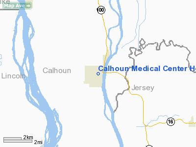
Calhoun Medical Center Heliport |
|
|
Location
& QuickFacts
|
FAA
Information Effective: |
2007-07-05 |
|
Airport
Identifier: |
36LL |
|
Airport
Status: |
Operational |
|
Longitude/Latitude: |
090-37-20.0000W/39-09-32.0000N
-90.622222/39.158889 (Estimated) |
|
Elevation: |
460 ft / 140.21 m (Estimated) |
|
Land: |
0 acres |
|
From
nearest city: |
0 nautical miles N of Hardin, IL |
|
Location: |
Calhoun County, IL |
|
Magnetic Variation: |
01E (2000) |
Owner
& Manager
|
Ownership: |
Privately
owned |
|
Owner: |
Calhoun Medical Center |
|
Address: |
2 Myrtle Lane
Hardin, IL 62047 |
|
Phone
number: |
618-576-2291 |
|
Manager: |
William Hurley |
|
Address: |
Po Box A
Hardin, IL 62047 |
|
Phone number: |
618-576-2225 |
Airport Operations and Facilities
|
Airport
Use: |
Private |
|
Wind
indicator: |
Yes |
|
Segmented Circle: |
No |
|
Control
Tower: |
No |
|
Lighting
Schedule: |
RDO-CTL
ACTVT PERIMETER LGTS, ROTG BCN & WIND SOCK - 123.05. |
|
Beacon
Color: |
Clear-Green-Yellow (heliport) |
|
Sectional chart: |
Kansas City |
|
Region: |
AGL - Great Lakes |
|
Boundary
ARTCC: |
ZKC - Kansas City |
|
Tie-in
FSS: |
STL - Saint Louis |
|
FSS
Phone: |
636-536-2980 |
|
FSS
Toll Free: |
1-800-WX-BRIEF |
|
Runway Information
Helipad HI
|
Dimension: |
40
x 40 ft / 12.2 x 12.2 m |
|
Surface: |
CONC, |
|
|
Runway HI |
Runway |
|
Traffic
Pattern: |
Left |
Left |
|
Radio Navigation
Aids
|
ID |
Type |
Name |
Ch |
Freq |
Var |
Dist |
|
LM |
NDB |
Oblio |
|
338.00 |
00E |
22.6 nm |
|
PPQ |
NDB |
Pittsfield |
|
344.00 |
02E |
29.9 nm |
|
CVM |
NDB |
Civic Memorial |
|
263.00 |
02E |
30.9 nm |
|
LTD |
NDB |
Litchfield |
|
371.00 |
01E |
44.1 nm |
|
CSX |
VOR/DME |
Cardinal |
111Y |
116.45 |
00E |
27.3 nm |
|
IJX |
VOR/DME |
Jacksonville |
023X |
108.60 |
02E |
41.2 nm |
|
STL |
VORTAC |
St Louis |
121X |
117.40 |
01E |
19.1 nm |
|
FTZ |
VORTAC |
Foristell |
045X |
110.80 |
05E |
32.3 nm |
|
TOY |
VORTAC |
Troy |
107X |
116.00 |
04E |
41.5 nm |
|
STL |
VOT |
St Louis Lambert |
|
111.00 |
|
27.5 nm |
|
SUS |
VOT |
Spirit Of St Louis |
|
112.20 |
|
29.9 nm |
Remarks
- PRVDD
DAY TIME USE ONLY, APCH FM 080-090 & FM 270, HELIPORT NOT SAFE FOR
NIGHT OPNS DUE TO STEEPLY RISING TERRAIN.
Calhoun Medical Center Heliport
Address:
Calhoun County, IL
Tel:
618-576-2291,
618-576-2225
Images
and information placed above are from
http://www.airport-data.com/airport/36LL/
We
thank them for the data!
| General
Info |
| Country |
United
States |
| State |
ILLINOIS
|
| FAA ID |
36LL |
| Latitude |
39-09-32.000N
|
| Longitude |
090-37-20.000W
|
| Elevation |
460 feet
|
| Near City |
HARDIN
|
We don't guarantee the information is fresh and accurate. The data may
be wrong or outdated.
For more up-to-date information please refer to other sources.
|
|


