 |
|
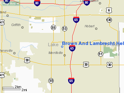
Brown And Lambrecht Heliport |
Location
& QuickFacts
|
FAA
Information Effective: |
2007-07-05 |
|
Airport
Identifier: |
LL12 |
|
Airport
Status: |
Operational |
|
Longitude/Latitude: |
087-20-29.1310W/41-30-01.1310N
-87.341425/41.500314 (Estimated) |
|
Elevation: |
600 ft / 182.88 m (Estimated) |
|
Land: |
0 acres |
|
From
nearest city: |
1 nautical miles W of New Lenox, IL |
|
Location: |
Will County, IL |
|
Magnetic Variation: |
01W (1985) |
Owner
& Manager
|
Ownership: |
Privately
owned |
|
Owner: |
Tom Lambrecht |
|
Address: |
Rt 30 & Gougar Road
Joliet, IL 60432 |
|
Phone
number: |
815-727-9211 |
|
Manager: |
Tom Lambrecht |
|
Address: |
Rt 30 & Gougar Road
Joliet, IL 60432 |
|
Phone number: |
815-727-9211 |
Airport Operations and Facilities
|
Airport Use: |
Private |
|
Wind indicator: |
Yes |
|
Segmented Circle: |
No |
|
Control Tower: |
No |
|
Landing fee charge: |
No |
|
Sectional chart: |
Chicago |
|
Region: |
AGL - Great Lakes |
|
Boundary ARTCC: |
ZAU - Chicago |
|
Tie-in FSS: |
IKK - Kankakee |
|
FSS on Airport: |
No |
|
FSS Toll Free: |
1-800-WX-BRIEF |
Airport Services
|
Airframe
Repair: |
NONE |
|
Power
Plant Repair: |
NONE |
|
Runway Information
Helipad H1
|
Dimension: |
75
x 75 ft / 22.9 x 22.9 m |
|
Surface: |
ASPH, |
|
|
Runway H1 |
Runway |
|
Traffic
Pattern: |
Left |
Left |
|
Radio Navigation
Aids
|
ID |
Type |
Name |
Ch |
Freq |
Var |
Dist |
|
VP |
NDB |
Sedly |
|
212.00 |
02W |
21.1 nm |
|
MX |
NDB |
Kedzi |
|
248.00 |
01W |
21.3 nm |
|
IUL |
NDB |
La Porte |
|
356.00 |
03W |
25.7 nm |
|
HK |
NDB |
Ermin |
|
332.00 |
01W |
25.8 nm |
|
MGC |
NDB |
Michigan City |
|
203.00 |
01W |
26.7 nm |
|
RZL |
NDB |
Rensselaer |
|
362.00 |
02W |
34.0 nm |
|
RWN |
NDB |
Winamac/dcmsnd |
|
335.00 |
00W |
41.3 nm |
|
ME |
NDB |
Deana |
|
350.00 |
00E |
41.6 nm |
|
CPB |
NDB |
Culver |
|
391.00 |
01W |
46.4 nm |
|
OXI |
VOR/DME |
Knox |
103X |
115.60 |
00E |
33.0 nm |
|
IKK |
VOR/DME |
Kankakee |
053X |
111.60 |
00E |
34.4 nm |
|
ORD |
VOR/DME |
Chicago O'hare |
086X |
113.90 |
02E |
38.7 nm |
|
CGT |
VORTAC |
Chicago Heights |
089X |
114.20 |
02E |
10.4 nm |
|
EON |
VORTAC |
Peotone |
079X |
113.20 |
02E |
24.6 nm |
|
JOT |
VORTAC |
Joliet |
070X |
112.30 |
02E |
44.1 nm |
|
GIJ |
VORTAC |
Gipper |
101X |
115.40 |
00E |
48.7 nm |
|
MDW |
VOT |
Chicago Midway |
|
111.00 |
|
25.2 nm |
|
ORD |
VOT |
Chicago O'hare Intl |
|
112.00 |
|
38.5 nm |
Based
Aircraft
|
Aircraft
based on field: |
1 |
|
Helicopters: |
1 |
Brown And Lambrecht Heliport
Address:
Will County, IL
Tel:
815-727-9211
Images
and information placed above are from
http://www.airport-data.com/airport/LL12/
We
thank them for the data!
| General
Info |
| Country |
United
States |
| State |
ILLINOIS
|
| FAA ID |
LL12 |
| Latitude |
41-30-01.131N
|
| Longitude |
087-20-29.131W
|
| Elevation |
600 feet
|
| Near City |
NEW LENOX
|
We don't guarantee the information is fresh and accurate. The data may
be wrong or outdated.
For more up-to-date information please refer to other sources.
|
|


