 |
|
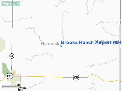
Location
& QuickFacts
|
FAA
Information Effective: |
2007-07-05 |
|
Airport
Identifier: |
IL46 |
|
Airport
Status: |
Operational |
|
Longitude/Latitude: |
091-02-00.5020W/40-28-00.1550N
-91.033473/40.466710 (Estimated) |
|
Elevation: |
700 ft / 213.36 m (Estimated) |
|
Land: |
0 acres |
|
From
nearest city: |
3 nautical miles SE of Burnside, IL |
|
Location: |
Hancock County, IL |
|
Magnetic Variation: |
02E (1985) |
Owner & Manager
|
Ownership: |
Privately owned |
|
Owner: |
John Brooks |
|
Address: |
Rr 3
Carthage, IL 62321 |
|
Phone number: |
217-357-2541 |
|
Address: |
|
Airport Operations and Facilities
|
Airport Use: |
Private |
|
Wind indicator: |
No |
|
Segmented Circle: |
No |
|
Control Tower: |
No |
|
Landing fee charge: |
No |
|
Sectional chart: |
Chicago |
|
Region: |
AGL - Great Lakes |
|
Boundary ARTCC: |
ZKC - Kansas City |
|
Tie-in FSS: |
STL - Saint Louis |
|
FSS on Airport: |
No |
|
FSS Phone: |
636-536-2980 |
|
FSS Toll Free: |
1-800-WX-BRIEF |
Airport Services
|
Airframe
Repair: |
NONE |
|
Power
Plant Repair: |
NONE |
|
Runway
Information
Runway N/S
|
Dimension: |
1800
x 100 ft / 548.6 x 30.5 m |
|
Surface: |
TURF, |
|
|
Runway N |
Runway S |
|
Traffic
Pattern: |
Left |
Left |
|
Radio Navigation
Aids
|
ID |
Type |
Name |
Ch |
Freq |
Var |
Dist |
|
EOK |
NDB |
Keokuk |
|
366.00 |
02E |
18.3 nm |
|
JZY |
NDB |
Macomb |
|
251.00 |
01E |
21.8 nm |
|
MPZ |
NDB |
Mount Pleasant |
|
212.00 |
02E |
35.9 nm |
|
UI |
NDB |
Quincy |
|
293.00 |
02E |
36.3 nm |
|
CTK |
NDB |
Canton |
|
236.00 |
02E |
44.1 nm |
|
HAE |
NDB |
Hannibal |
|
411.00 |
03E |
48.4 nm |
|
GBG |
VOR/DME |
Galesburg |
035X |
109.80 |
03E |
39.3 nm |
|
BRL |
VORTAC |
Burlington |
051X |
111.40 |
05E |
16.2 nm |
|
UIN |
VORTAC |
Quincy |
083X |
113.60 |
05E |
38.9 nm |
Remarks
- PROVIDED
ALL OPERATIONS ARE CONDUCTED IN ACCORDANCE WITH LETTER OF AGREEMENT
BETWEEN BROOKS RANCH AND MARTIN AIRPORTS.
Brooks Ranch Airport
Address:
Hancock County, IL
Tel:
217-357-2541
Images
and information placed above are from
http://www.airport-data.com/airport/IL46/
We
thank them for the data!
| General
Info |
| Country |
United
States |
| State |
ILLINOIS
|
| FAA ID |
IL46 |
| Latitude |
40-28-00.155N
|
| Longitude |
091-02-00.502W
|
| Elevation |
700 feet
|
| Near City |
BURNSIDE
|
We don't guarantee the information is fresh and accurate. The data may
be wrong or outdated.
For more up-to-date information please refer to other sources.
|
|


