 |
|
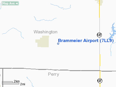
Location
& QuickFacts
|
FAA
Information Effective: |
2007-07-05 |
|
Airport
Identifier: |
7LL9 |
|
Airport
Status: |
Operational |
|
Longitude/Latitude: |
089-28-15.3200W/38-15-42.1820N
-89.470922/38.261717 (Estimated) |
|
Elevation: |
530 ft / 161.54 m (Estimated) |
|
Land: |
0 acres |
|
From
nearest city: |
1 nautical miles E of Oakdale, IL |
|
Location: |
Washington County, IL |
|
Magnetic Variation: |
01E (1985) |
Owner
& Manager
|
Ownership: |
Privately
owned |
|
Owner: |
Leslie Brammeier |
|
Address: |
12346 Oakdale Blacktop Road
Oakdale, IL 62268 |
|
Phone
number: |
618-329-5532 |
|
Manager: |
Leslie Brammeier |
|
Address: |
12346 Oakdale Blacktop Road
Oakdale, IL 62268 |
|
Phone number: |
618-329-5532 |
Airport Operations and Facilities
|
Airport
Use: |
Private |
|
Wind
indicator: |
No |
|
Segmented Circle: |
No |
|
Control
Tower: |
No |
|
Landing
fee charge: |
No |
|
Sectional chart: |
St Louis |
|
Region: |
AGL - Great Lakes |
|
Boundary
ARTCC: |
ZKC - Kansas City |
|
Tie-in
FSS: |
COU - Columbia |
|
FSS
on Airport: |
No |
|
FSS
Toll Free: |
1-800-WX-BRIEF |
|
Runway
Information
Runway N/S
|
Dimension: |
1912
x 70 ft / 582.8 x 21.3 m |
|
Surface: |
TURF, |
|
|
Runway N |
Runway S |
|
Traffic
Pattern: |
Left |
Left |
|
Obstruction: |
60 ft pline, 1320.0 ft from runway |
|
|
Radio Navigation
Aids
|
ID |
Type |
Name |
Ch |
Freq |
Var |
Dist |
|
SAR |
NDB |
Sparta |
|
239.00 |
01E |
13.0 nm |
|
PJY |
NDB |
Pinckneyville |
|
215.00 |
00E |
18.0 nm |
|
BL |
NDB |
Belleville |
|
362.00 |
02E |
18.2 nm |
|
SLO |
NDB |
Salem |
|
400.00 |
01W |
33.0 nm |
|
FES |
NDB |
Festus |
|
269.00 |
01E |
43.5 nm |
|
CVM |
NDB |
Civic Memorial |
|
263.00 |
02E |
46.8 nm |
|
SKE |
TACAN |
Scott |
059X |
|
02E |
24.7 nm |
|
VNN |
VOR/DME |
Mount Vernon |
085X |
113.80 |
02E |
31.9 nm |
|
MWA |
VOR/DME |
Marion |
041X |
110.40 |
04E |
37.5 nm |
|
ENL |
VORTAC |
Centralia |
097X |
115.00 |
04E |
17.5 nm |
|
TOY |
VORTAC |
Troy |
107X |
116.00 |
04E |
35.6 nm |
Based
Aircraft
|
Aircraft
based on field: |
1 |
|
Single
Engine Airplanes: |
1 |
Brammeier Airport
Address:
Washington County, IL
Tel:
618-329-5532
Images
and information placed above are from
http://www.airport-data.com/airport/7LL9/
We
thank them for the data!
| General
Info |
| Country |
United
States |
| State |
ILLINOIS
|
| FAA ID |
7LL9 |
| Latitude |
38-15-42.182N
|
| Longitude |
089-28-15.320W
|
| Elevation |
530 feet
|
| Near City |
OAKDALE
|
We don't guarantee the information is fresh and accurate. The data may
be wrong or outdated.
For more up-to-date information please refer to other sources.
|
|


