 |
|
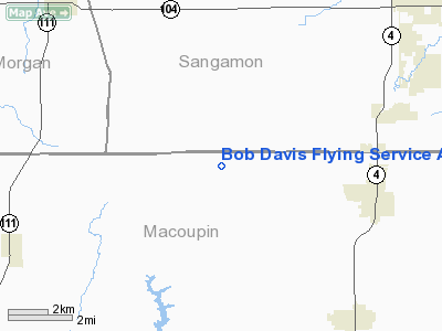
Bob Davis Flying Service Airport |
Location
& QuickFacts
|
FAA
Information Effective: |
2007-07-05 |
|
Airport
Identifier: |
25IL |
|
Airport
Status: |
Operational |
|
Longitude/Latitude: |
089-51-30.0000W/39-31-00.0000N
-89.858333/39.516667 (Estimated) |
|
Elevation: |
680 ft / 207.26 m (Estimated) |
|
Land: |
0 acres |
|
From
nearest city: |
5 nautical miles W of Virden, IL |
|
Location: |
Macoupin County, IL |
|
Magnetic Variation: |
01E (1990) |
Owner & Manager
|
Ownership: |
Privately owned |
|
Owner: |
Robert E. Davis |
|
Address: |
Rr 1 Box 52
Virden, IL 62690 |
|
Phone number: |
217-965-5268 |
|
Manager: |
Robert E. Davis |
|
Address: |
Rr 1 Box 52
Virden, IL 62690 |
|
Phone number: |
217-965-5268 |
Airport
Operations and Facilities
|
Airport
Use: |
Private |
|
Segmented Circle: |
No |
|
Control
Tower: |
No |
|
Sectional chart: |
Chicago |
|
Region: |
AGL - Great Lakes |
|
Boundary
ARTCC: |
ZKC - Kansas City |
|
Tie-in
FSS: |
STL - Saint Louis |
|
FSS
Phone: |
636-536-2980 |
|
FSS
Toll Free: |
1-800-WX-BRIEF |
|
Runway Information
Runway 09/27
|
Dimension: |
2640
x 100 ft / 804.7 x 30.5 m |
|
Surface: |
TURF, |
|
|
Runway 09 |
Runway 27 |
|
Traffic
Pattern: |
Left |
Left |
|
Radio Navigation
Aids
|
ID |
Type |
Name |
Ch |
Freq |
Var |
Dist |
|
SP |
NDB |
Huskk |
|
382.00 |
01W |
16.1 nm |
|
LTD |
NDB |
Litchfield |
|
371.00 |
01E |
22.8 nm |
|
TAZ |
NDB |
Taylorville |
|
395.00 |
00E |
24.8 nm |
|
LQ |
NDB |
Licol |
|
375.00 |
01W |
26.5 nm |
|
CVM |
NDB |
Civic Memorial |
|
263.00 |
02E |
38.6 nm |
|
PPQ |
NDB |
Pittsfield |
|
344.00 |
02E |
43.5 nm |
|
AAA |
NDB |
Abraham |
|
329.00 |
00E |
45.5 nm |
|
SYZ |
NDB |
Shelbyville |
|
365.00 |
01E |
47.5 nm |
|
IJX |
VOR/DME |
Jacksonville |
023X |
108.60 |
02E |
23.5 nm |
|
SPI |
VORTAC |
Spinner |
74X |
112.70 |
01W |
21.1 nm |
|
CAP |
VORTAC |
Capital |
074X |
112.70 |
04E |
25.0 nm |
|
VLA |
VORTAC |
Vandalia |
090X |
114.30 |
04E |
41.2 nm |
|
TOY |
VORTAC |
Troy |
107X |
116.00 |
04E |
46.8 nm |
|
DEC |
VORTAC |
Decatur |
119X |
117.20 |
03E |
48.2 nm |
|
STL |
VORTAC |
St Louis |
121X |
117.40 |
01E |
49.0 nm |
Remarks
- PRVDD
THE AREA 125 FT EITHER SIDE OF CNTRLN & 200 FT OFF EACH RY END BE
CLEAR OF OBSTN & ANY OBSTN IN RY APCH SLOPE ARE REMOVED/LOWERED
OR THE RY THR IS DSPLCD & MARKED TO PRVD A 20:1 APCH SLOPE.
Based
Aircraft
|
Aircraft
based on field: |
4 |
|
Single
Engine Airplanes: |
4 |
Bob Davis Flying Service Airport
Address:
Macoupin County, IL
Tel:
217-965-5268
Images
and information placed above are from
http://www.airport-data.com/airport/25IL/
We
thank them for the data!
| General
Info |
| Country |
United
States |
| State |
ILLINOIS
|
| FAA ID |
25IL |
| Latitude |
39-31-00.000N
|
| Longitude |
089-51-30.000W
|
| Elevation |
680 feet
|
| Near City |
VIRDEN
|
We don't guarantee the information is fresh and accurate. The data may
be wrong or outdated.
For more up-to-date information please refer to other sources.
|
|


